
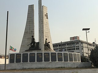
Owerri is the capital city of Imo State in Nigeria, set in the heart of Igboland. It is also the state's largest city, followed by Orlu, Okigwe and Ohaji/Egbema. Owerri consists of three Local Government Areas including Owerri Municipal, Owerri North and Owerri West, it has an estimated population of about 1,401,873 as of 2016 and is approximately 100 square kilometres (40 sq mi) in area. Owerri is bordered by the Otamiri River to the east and the Nworie River to the south.

Okigwe is the third largest city, after Owerri and Orlu, while Ohaji/Egbema is fourth in Imo state. Okigwe is located in the Okigwe Local Government Area of Nigeria. The city lies between the Port Harcourt-Enugu-Maiduguri rail line, being the nearest city to the biggest cattle market in Nigeria located in the Umu Nneochi Area of Abia state. Thus, the city has grown into a major cattle transit town for the southeast and south subregions of Nigeria. Okigwe has a population of 132,237. Most of the population is made up of immigrant workers from other states. Okigwe city was the primary host site of the old Imo State University. Okigwe has various tourist and historical sites. The Federal Government College in the city has remained one of the best unity schools in Nigeria. Okigwe remains one of the breadbaskets of Nigeria with terrace cultivation practised on its hilly farmlands. Okigwe also boasts many relaxation spots such as Alexandra Suites & Hotels Limited Okigwe Imo state which is situated at No 1 Alexandra Ave, Umuchima Road, Ubahu. St. Mary's Cathedral in Okigwe is the seat of the Roman Catholic Diocese of Okigwe. In 2016, the Imo state government recommissioned a new cattle market in the city in respect to the previous one that has been relocated to Abia.

Ogbaku is a town made up of eighteen (18) villages in Mbaitoli Local Government Area of Imo state, South Eastern Nigeria. It is situated along Onitsha-Owerri road. It is about 12 km to the capital city of Owerri.
Ubomiri is a town in Mbaitoli of Imo State located near Owerri, capital city of Imo State, in southeastern Nigeria.
Mbieri is a town in southeastern Nigeria. It is named after one of the indigenous Igbo clans that conquered parts of the old Owerri province. Mbieri is in Mbaitoli council of Imo State and it is the biggest of the original nine towns of Mbaitoli. The region surrounding Mbieri is rich in hydrocarbons.
Orodo is an Igbo community in Mbaitoli local government area of Imo State, Nigeria. It is situated between Owerri city and Orlu town. Orodo has borders with Ogwa, Mbieri, Afara, Ifakala, Umuaka, Amurie Omanze and Amandugba. Also, the current Mbaitoli Local Government Headquarters is significantly located at a part of Orodo called Ofekata. The community said to have seven road junction, in the center of the community called nkwo-orodo. The roads are: Ubaha-Eze road, Ahaba road, Amaukwu road, Umuonyahu road, Amaku road, Ofekata road and Eziama road.
Umunoha is a town in southeastern Nigeria near the city of Owerri. It is a typical Igbo town. It is bounded on the north by Eziama Obiato and Afara communities; on the south and southwest by Ogbaku, Azara Obiato and Ejemekwuru communities; and on the south and southeast by Ifakala and Afara communities. It is served by the great east-west road, the Port-Harcourt-Lagos Highway. Umunoha is about thirteen kilometers from Owerri, the Imo State capital. It is a small, compact but thickly populated community with a projected 1997 population of twenty-five thousand people.
Amaimo is an autonomous rural town located in Imo State, southeastern Nigeria. It is located near the city of Owerri. Amaimo is located in the North East of Ikeduru Local Government Area. It is bounded on the North by Ehime in Mbano LGA, on the South and East by Ugiri-Ike and Ahiazu in Mbaise; on the North-West by Inyishi and Eziama in Ikeduru LGA and on the South-West by Amakaohia Ikeduru. Amaimo was ruled by the great late Eze Apollos Anyaso
Ihuo is an autonomous community in southeastern Nigeria, in Ikeduru, Imo state. It is located near Owerri. The name may be written and pronounced as Iho. The majority of inhabitants of this community refer to it as Iho-Dimeze and are sometimes referred to as "Dimeze".
Imo State is a state in the South-East geopolitical zone of Nigeria, bordered to the north by Anambra State, Rivers State to the west and south, and Abia State to the east. It takes its name from the Imo River which flows along the state's eastern border. The state capital is Owerri and its state nickname is the "Eastern Heartland."
Ejemekwuru is an Igbo-speaking community that sits in the North-Western part of Imo State in the southeastern region of Nigeria.
Abba is a town in Nwangele Local Government Area (LGA) in Imo State, Nigeria. The first traditional ruler of Abba ancient kingdom was Eze Madukwem Emmanuel Unaka, succeeded by Eze Golden Maduabuchukwu. Abba consists of four communities. Listed in order of seniority they are Umuokpara, Umudurunna, Ekiti-Afor, and Ogwuaga, which all consist of twenty-eight villages.
Aba North is a Local Government Area in Aba, Abia State, Nigeria. In the year (1991) Aba North local government was created. The headquarters is at Eziama Uratta. It is amongst the local governments that made up Abia South senatorial zone. It is in South East geopolitical zone. The Igbo ethnic group is predominant in the area. The people of the area are mostly Christians and traditional worshippers with Igbo and English as the commonly spoken languages.

Mbaitoli is a Local Government Area of Imo State, Nigeria. Its headquarters are in the town of Nwaorieubi. It has an area of 204 km² and a population of 327,000. The postal code of the area is 461. Mbaitoli is divided into 9 autonomous communities with 12 INEC wards. The principal occupations of these communities are farming and handicrafts.
Ngor Okpala is a Local Government Area of Imo State, Nigeria. Its headquarters is in the town of Umuneke Ngor.

Njaba is a Local Government Area of Imo State, Nigeria. Its headquarters is located in the town of Nnenasa. It has an area of 84 km2 and a population of 143,485 at the 2006 census. The 2011 density projection is 2,004.5 inhabitants/km2. The postal code of the area is 474.

Oru-East is a Local Government Area of Imo State, Nigeria. Its headquarters is at Omuma. The following are towns that make up Oru East: Akatta, Akuma, Amagu, Amiri, Awo-Omamma, and Omuma.
Ibele is an autonomous community in the Njaba Local Government Area in Orlu Senatorial zone of Imo State, Nigeria. The town is located at the old Douglas road, running from Afor-Umuaka westward in Njaba Local Government Area to Ukworji in Eziama-Obiator of Mbaitoli local government area, then to Oguta.

Awo-Omamma, in the Northeast of Niger Delta basin is an oil-rich indigenous Igbo town on the banks of Njaba River. It is a potential tourism hub in the region due to its species of wildlife in Umuezukwe and green vegetation.
Abayi Okoroato is a city in Obingwa local government area of Abia State, Nigeria.