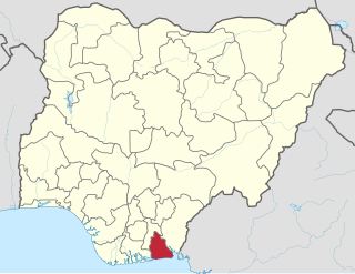
Akwa Ibom State is a state in the South-South geopolitical zone of Nigeria. It borders Cross River State to the east, Rivers State and Abia State to the west and north-west, and to the south by the Atlantic Ocean. The state takes its name from the Qua Iboe River which bisects the state before flowing into the Bight of Bonny. Akwa Ibom was split from Cross River State in 1987 with her capital Uyo and with 31 local government areas.

Anambra State is a Nigerian state located in the South-eastern region of the country. The state was created on 27 August 1991. Anambra state is bounded by Delta State to the west, Imo State and Rivers State to the south, Enugu State to the east and Kogi State to the north. The state's capital is Awka, while the state’s largest city is Onitsha which is regarded as one of the largest metropolis in Africa. Nnewi is the second largest commercial and industrial city in Anambra State, and also a known automobile hub within Nigeria and Africa.

Owerri is the capital city of Imo State in Nigeria, set in the heart of Igboland. It is also the state's largest city, followed by Orlu, Okigwe and Ohaji/Egbema. Owerri consists of three Local Government Areas including Owerri Municipal, Owerri North and Owerri West, it has an estimated population of 1,401,873 as of 2016 and is approximately 100 square kilometres (40 sq mi) in area. Owerri is bordered by the Otamiri River to the east and the Nworie River to the south. The Owerri Slogan is Heartland. It is also called the Las Vegas of Africa, due to the night life of the city and the numerous hotels, casino and leisure parks all over the city.
The Hong Kong Sheng Kung Hui (abbreviated SKH), also known as the Hong Kong Anglican Church (Episcopal), is the Anglican church in Hong Kong and Macao. It is the 38th Province of the Anglican Communion. It is also one of the major denominations in Hong Kong and the first in the Anglican Communion to ordain a female priest.

Nnewi is a commercial and industrial city in Anambra State, southeastern Nigeria. It is the second largest city in Anambra state after Onitsha. Nnewi as a metropolitan area has two local government area, which are Nnewi North and Nnewi South, all centred around the Nnewi town. Even Ekwusigo local government area is now part of Nnewi urban area, as urbanization continues to spread from Nnewi to neighbouring communities. The Nnewi town which is the only town in Nnewi North, comprises four villages: Otolo, Uruagu, Umudim, and Nnewichi. Nnewi had been the centre of economics and commerce, being at a time the fastest growing industrial city east of the Niger, being the home of many industries such as The Ibeto Group, the Chicason Group, Cutix Cables, amongst others. The first indigenous car manufacturing plant in Nigeria is located in the city while the first wholly Made-in-Nigeria motorcycle, the 'NASENI M1' was manufactured in Nnewi.
Arondizuogu (Aro-ndizuogu) is a town inhabited by the Aro people, an Igbo subgroup in Imo State of Nigeria. The Arondizuogu community is believed to have migrated from Arochukwu in the present Abia State to their current settlements in Imo State, which include the Okigwe, Ideato North and Onuimo local governments.

Orlu is the second-largest city in Imo State South East (Nigeria)|South East]], Nigeria, with a population of 420,600. It has a long history as the headquarters for the Organisation of African Unity (OAU) and humanitarian relief agencies during the Nigeria-Biafra Civil War. The city houses the Nigerian headquarters of the British Cheshire Home. It is the second most developed city after Owerri in Imo state.
Orogwe is a community in Owerri West local government of Imo state in Nigeria.
Orodo is an Igbo community in Mbaitoli local government area of Imo State, Nigeria. It is situated between Owerri city and Orlu town. Orodo has borders with Ogwa, Mbieri, Afara, Ifakala, Umuaka, Amurie Omanze and Amandugba. Also, the current Mbaitoli Local Government Headquarters is significantly located at a part of Orodo called Ofekata. The community said to have seven road junction, in the center of the community called nkwo-orodo. The roads are: Ubaha-Eze road, Ahaba road, Amaukwu road, Umuonyahu road, Amaku road, Ofekata road and Eziama road.
Imo State is a state in the South-East geopolitical zone of Nigeria, bordered to the north by Anambra State, Rivers State to the west and south, and Abia State to the east. It takes its name from the Imo River which flows along the state's eastern border. The state capital is Owerri and the State's slogan is the "Eastern Heartland."
Ejemekwuru is an Igbo-speaking community that sits in the North-Western part of Imo State in the southeastern region of Nigeria.
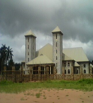
Okpofe is an autonomous community located in Ezinihitte Mbaise local government area (LGA), in Imo State, Nigeria with common boundaries with Itu, Ezeagbogu, Ihitte, Amumara and Oboama autonomous communities. Okpofe is the centre of the Ezinihitte Mbaise clan, and it is the only town in Ezinihitte Mbaise that does not share a boundary with another local government area in Imo State. It is quite a unique town in Ezinihitte. It is also on record that the Roman Catholic Church was first established in Okpofe town in the year 1918 when the first crop of missionaries brought to the town held the first Catholic mass at the shrine of Inyama Oguegbe Ajero, who himself was the Second Paramount King of the ancient town after Chief Mbagwu. Ezinihitte Mbaise The Anglican Juniorate in Mbaise is located in Okpofe too.
The Umuoji people are those whose roots can be traced to the town of Umuoji in Idemili North, a local government area in Anambra State, Nigeria. These people are from Igbo-speaking ethnic group whose early history is adversely affected by a lack of, or non-existent, written records. Umuoji is bounded by Ogidi, Ojoto, Uke, Abatete and Nkpor and has an estimated population of 80,000 people which includes local residents in its 23 villages and citizens in diaspora.

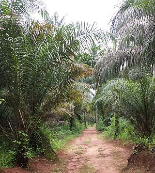
Awo-Omamma, in the northeast of the Niger Delta basin, is an oil-rich indigenous Igbo town on the banks of Njaba River. It is a potential tourism hub in the region due to its species of wildlife in Umuezukwe and green vegetation.
Osina is a town located in Ideato North Local Government Area of Imo State, Nigeria. And is falls under Orlu senatorial zone.
Umuezukwe is an ancient trade route, a river port, and a farming community in Awo-Omamma, northeast of the Niger Delta region, Nigeria's South East, Imo State. It is one of the densely populated Awo-Omamma rural settlements in the Njaba River basin.

Mazi Elechukwu Nnadibuagha Njaka was a Nigerian political scientist, known for the book Igbo Political Culture.

The 2023 Imo State gubernatorial election was held on 11 November 2023 due to the belated inauguration of incumbent Governor Hope Uzodinma, to elect the Governor of Imo State. Incumbent APC Governor Hope Uzodinma was re-elected, with him winning all the 27 local government areas. LP candidate Athan Achonu has filed a lawsuit against Uzodinma claiming that the election was "marred by irregularities, including vote buying and physical assaults of LP agents, and thus deserving of outright cancellation".
Chima Emmanuel Obieze is a Nigerian lawyer and politician. He is a member of the Enugu State House of Assembly representing Ezeagu Constituency under the Peoples' Democratic Party.
