
Odinani, also known as Odinala, Omenala, Odinana, and Omenana, is the traditional cultural belief and practice of the Igbo people of south east and Igbo people of south south Nigeria. These terms, as used here in the Igbo language, are synonymous with the traditional Igbo "religious system" which was not considered separate from the social norms of ancient or traditional Igbo societies. Theocratic in nature, spirituality played a huge role in their everyday lives. Although it has largely been syncretised with Catholicism, the indigenous belief system remains in strong effect among the rural, village and diaspora populations of the Igbo. Odinani can be found in Haitian Voodoo, Obeah, Santeria and even Candomblé. Odinani is a pantheistic and polytheistic faith, having a strong central deity at its head. All things spring from this deity. Although a pantheon of other gods and spirits, these being Ala, Amadiọha, Anyanwụ, Ekwensu, Ikenga, exists in the belief system, as it does in many other Traditional African religions, the lesser deities prevalent in Odinani serve as helpers or elements of Chukwu, the central deity.

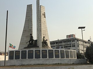
Owerri is the capital city of Imo State in Nigeria, set in the heart of Igboland. It is also the state's largest city, followed by Orlu, Okigwe and Ohaji/Egbema. Owerri consists of three Local Government Areas including Owerri Municipal, Owerri North and Owerri West, it has an estimated population of 1,401,873 as of 2016 and is approximately 100 square kilometres (40 sq mi) in area. Owerri is bordered by the Otamiri River to the east and the Nworie River to the south. The Owerri Slogan is Heartland. It is also called the Las Vegas of Africa, due to the night life of the city and the numerous hotels, casino and leisure parks all over the city.
The Anioma people are a subgroup of the Igbo people predominantly indigenous to present day Delta State, Nigeria, along with communities in Edo State. The Anioma people encompass and are native to the nine northeastern Local Government Areas of Delta State and the Ika-Igbo communities of Edo State. Politically, the Anioma occupy the Delta North Senatorial District where they are the majority group.
Nkpor is a town in Idemili North local government area of Anambra state. The town of Nkpor had an estimated population of 109,377 in 2007. It is attached to the much larger city of Onitsha to the west, Oze to the north, Ogidi and Umuoji to the east, and Obosi to the south. The name 'Nkpor' is derived from the adulteration of the Igbo word nkpogha meaning 'repositioning'.Nkpor is known for its farming prowess. There is a maize known as ‘akpu aka Nkpor’ because of its robust yield and is reminiscent of Nkpor men who are often muscular. In ancient times, a rich man is known in Nkpor for his rich yam barn and the number of animals in his pen. An average Nkpor indigene does not buy foodstuff in the market and does not deny his visitors food. Nkpor is a traditional Community that worshiped the God of their ancestors before the advent of Christianity.
Awaka is a relatively small town, situated on a small hill about four miles north-east of Owerri, capital city of Imo State, southeastern Nigeria. It is one of the towns that make host the Alaenyi clan, others include the surrounding Ihitta-Ogada, Egbu, Naze and Owere-Nchi-Ise.
Emekuku, is a town in Owerri North Local Government of Imo state in South-Eastern Nigeria.
Imo State is a state in the South-East geopolitical zone of Nigeria, bordered to the north by Anambra State, Rivers State to the west and south, and Abia State to the east. It takes its name from the Imo River which flows along the state's eastern border. The state capital is Owerri and the State's slogan is the "Eastern Heartland."
Umukabia[Ojim Ukwu Nnu Egbe] is a village in the Ohuhu community of Umuahia North Local Government Area, Abia State, Nigeria. There are also several other villages in Nigeria with the same name. Umukabia comprises 3 small villages namely; Okpuala being the eldest, followed by Umuagbom and Azummiri. Within these 3 small villages are 6 compounds-For Okpuala, they comprise-Agbom Na Omurumba and Umu Eze Aguma. Azumiri is regarded as a single compound. In the case of Umuagbom, there are three compounds, namely, Umuezeocha, Ibeneze also Uhu Ukwu Na Ezegiri and Ukwu Udara. Noteworthy is that each of these compounds finds further sub-divisions, comprising family units, each headed by a patriarch, usually the oldest male member of that family unit. This oldest male is also regarded as the ultimate repository of the knowledge, cultures and traditions of the family unit and sometimes Umukabia as a whole. He performs all the rituals and ceremonies regarding the compound and seeks reciprocals with the ancestors through oracles and ritualizations. These elders or patriarchs constitute Umukabia's democratic dispensation and policy making unit, in that they collectively make and take decisions on behalf of the entire Umukabia community. Whatever decisions they make is binding across the village and even beyond to Diasporic sons and daughters of Umukabia. Umukabia's renowned market day is known as Orie Umukabia Orie. Umukabia has a major river known as Ikwu, which traverses the villages in Umuire, Umuegwu Okpula Former Eastern Nigeria Premier, Dr. Michael Iheonukara Okpara's village and flows into the famous Imo River basin Imo/Abia States, Nigeria.Legend has it that Umukabia sits on a large rock which has made it impossible for bore holes to be successfully dug in any part of the village for the purposes of extracting water. The village holds annual ceremonies known as Iri Ji festival and Ekpe festival which is termed as the village Christmas and holds on an Orie market day after Christmas but never on a Sunday.
Ejemekwuru is an Igbo-speaking community that sits in the North-Western part of Imo State in the southeastern region of Nigeria.
Okpofe is an autonomous community located in Ezinihitte Mbaise local government area (LGA), in Imo State, Nigeria with common boundaries with Itu, Ezeagbogu, Ihitte, Amumara and Oboama autonomous communities. Okpofe is the centre of the Ezinihitte Mbaise clan, and it is the only town in Ezinihitte Mbaise that does not share a boundary with another local government area in Imo State. It is quite a unique town in Ezinihitte. It is also on record that the Roman Catholic Church was first established in Okpofe town in the year 1918 when the first crop of missionaries brought to the town held the first Catholic mass at the shrine of Inyama Oguegbe Ajero, who himself was the Second Paramount King of the ancient town after Chief Mbagwu. Ezinihitte Mbaise The Anglican Juniorate in Mbaise is located in Okpofe too.
Ihiagwa is a town in Owerri West Local Government Area of Imo State, Nigeria. It is located 12 km (7.5 mi) south of the capital city of Owerri. The township is composed of eight villages: Umuelem, Umuchima, Mboke, Nnkaramochie, Iriamogu, Aku/Umuokwo, Ibuzo and Umuezeawula. Ihiagwa has been divided into two autonomous communities, namely Ihiagwa Ancient Kingdom (Chimelem), comprising two villages: Umuelem and Umuchima;and Dindi-Ihiagwa, comprising the remaining six villages, all divisions done for administrative and developmental reasons. Each autonomous community is a monarchy ruled by an Eze.
Owerri Municipal is a Local Government Area in Imo State, Nigeria. Its headquarters is in the city of Owerri. It has an area of 58 km² and a population of 127,213 according to the 2006 census. The postal code of the area is 460. Owerri city sits at the intersection of roads from Port Harcourt, Onitsha, Aba, Orlu, Okigwe and Umuahia. It is also the trade center for palm products, corn [maize], yams and cassava [manioc]. Eke Ukwu Owere market is the main market in Owerri Municipal.
The Umuoji people are those whose roots can be traced to the town of Umuoji in Idemili North, a local government area in Anambra State, Nigeria. These people are from Igbo-speaking ethnic group whose early history is adversely affected by a lack of, or non-existent, written records. Umuoji is bounded by Ogidi, Ojoto, Uke, Abatete and Nkpor and has an estimated population of 80,000 people which includes local residents in its 23 villages and citizens in diaspora.

Orlu Ishiobiukwu Gedegwum is the ancient palace and nerve centre of the Orlu people. This is the residence of the traditional monarchy of Orlu, known as the Igwe of Orlu in Nigeria. Located in Imo state, the palace is often at the centre of state occasions and royal hospitality. It has always been a focal point for traditional festivals, ceremonies and dispute resolution.

Inyi is a town in Oji River Local Government Area of Enugu State, Nigeria, approximately 60 kilometers from Enugu City and 35 kilometers from Nnewi. The name "Inyi" refers to a metaphor, which is an essential component in the creation of proverbs. It is the Igbo name for the red water tree. Due to historical events connecting the tree and the town's founder, he was given the name, which subsequently became the town's name. Inyi has several tourist attractions, including the Nwachighi stream, Ajala Inyi shrine, Okpu-ogho spring, Oji Alum Rapids, and the Sacred Heart Church. The town is also known for its pottery and traditional crafts. Visitors can also enjoy the hospitality of the Inyi people, who are known for their love of traditional music and dance. They also have a rich tradition of pottery and traditional crafts. The people of Inyi are primarily farmers, wine tappers, and petty traders. Women are skilled in pottery and the making of abacha varieties. Inyi people believe in God, the other gods, ancestors, and reincarnation. A popular festival in Inyi is the Ajala Inyi festival, which is held every year in October. Christmas and Easter are also celebrated in Inyi.
Anaku is one of the administrative divisions of Anambra State, South-Eastern Nigeria. The town lies 6°15' North of the Equator and 6°44' East of the Greenwich Meridian. It is bordered by "Omabala," the native name of the Anambra River, which is a tributary of the River Niger (North), Aguleri, Ezu River (South), Omor and Umuerum communities (East).

Otulu is a town in Oru West local government area of Imo State, Nigeria. It is located along the Owerri-Onitsha Federal Highway in Imo State. Approaching from Owerri to Onitsha one will get to Awo-Omanma, Amiri and then Otulu after which one has Mgbidi; while from Onitsha to Owerri one has Otulu after Mgbidi.

Neke is a town located in Isi-Uzo Local Government Area of Enugu State in South Eastern Nigeria. Bordered by towns such as Nike, Ikem, Mbu, Eha Amufu, Obollo and UmuAlor, Neke is a small town with a strong backbone. In the pre-colonial era, the people of Neke were known as fearsome warriors who had an economic stronghold on neighboring areas. In the present day, there are 5 main districts located in Neke namely; Ishienu, Akpani, ObeguAba, Umugwu and Umuegwu. These districts represent villages made up of clans and kindred prominent to the town's social structure.
Okolochi is an ancient community in today's Owerri West Local Government Area of Imo State, Nigeria, it borders Emeabiam, Eziobodo, Ihiagwa and Obibiezena communities. It is one of the host communities of Federal University of Technology, Owerri, FUTO.
Oboro is the largest of four clans in Ikwuano Local Government Area of Abia State, Nigeria. It is bounded to the north by Ibeku and Bende clans, west by the Olokoro and Ngwa, east by Ibere and south by the Isuogu. Oboro was classified in the Ohuhu-Ngwa cluster of the Southern Igbo area by British anthropologists Forde and Jones. It is also one of 18 Igbo clans in the Old Bende Division of the defunct Owerri Province. The Oboro speak a common language with the other 17 clans of the Bende Division though dialectal variations exist. These clans share a history of inter-ethnic relations.
