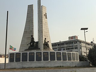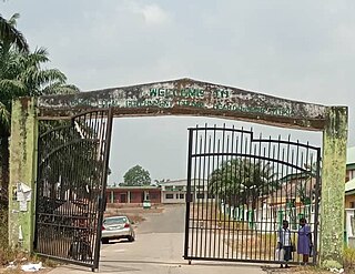
Owerri is the capital city of Imo State in Nigeria, set in the heart of Igboland. It is also the state's largest city, followed by Orlu, Okigwe and Ohaji/Egbema. Owerri consists of three Local Government Areas including Owerri Municipal, Owerri North and Owerri West, it has an estimated population of 1,401,873 as of 2016 and is approximately 100 square kilometres (40 sq mi) in area. Owerri is bordered by the Otamiri River to the east and the Nworie River to the south. The Owerri Slogan is Heartland. It is also called the Las Vegas of Africa, due to the night life of the city and the numerous hotels, casino and leisure parks all over the city.

Orlu is the second-largest city in South East, Imo State, Nigeria, with a population of 420,600. It has a long history as the headquarters for the Organisation of African Unity (OAU) and humanitarian relief agencies during the Nigeria-Biafra Civil War. The city houses the Nigerian headquarters of the British Cheshire Home. It is the second most developed city after Owerri in Imo state.
Orodo is an Igbo community in Mbaitoli local government area of Imo State, Nigeria. It is situated between Owerri city and Orlu town. Orodo has borders with Ogwa, Mbieri, Afara, Ifakala, Umuaka, Amurie Omanze and Amandugba. Also, the current Mbaitoli Local Government Headquarters is significantly located at a part of Orodo called Ofekata. The community said to have seven road junction, in the center of the community called nkwo-orodo. The roads are: Ubaha-Eze road, Ahaba road, Amaukwu road, Umuonyahu road, Amaku road, Ofekata road and Eziama road.

Imo State is a state in the South-East geopolitical zone of Nigeria, bordered to the north by Anambra State, Rivers State to the west and south, and Abia State to the east. It takes its name from the Imo River which flows along the state's eastern border. The state capital is Owerri and the State's slogan is the "Eastern Heartland."
Ejemekwuru is an Igbo-speaking community that sits in the North-Western part of Imo State in the southeastern region of Nigeria.

Obowo, also spelled Obowu is a Local Government Area in Imo State, Nigeria formed during the Ibrahim Babangida administration in May 1989. It was carved out of Etiti Local Government Area with its headquarters at Isi Nweke. There are twenty-two autonomous communities in Obowo Local Government Area. Achara, Amanze, Umuariam, Umunachi, Umuagu, Ehume, Umungwa, Umulogho, Odenkwume, Okwuohia, Amuzi, Alike, Avutu, Umuosochie and Umuoke are towns in the L.G.A. Obowo is located about 45 minutes from Owerri, across the Imo River and is less than 30 minutes from the Umuahia and Ahiara in opposite directions with the Amanze seven and a half (71/2) junction and landmark in-between. It is surrounded by Ahiazu and Aboh Mbaise Local Government Areas to the north and Umuahia Abia State to the East.
Dunukofia is a Local Government Area in Anambra State, South-East Nigeria. Towns that make up the local government are Ukpo, the headquarters; Ifitedunu, Dunukofia Umunnachi, Umudioka, Ukwulu and Nawgu. It shares boundaries with Awka North, Idemili North, Njikoka and Oyi Local Governments.
The Ohuhu clan of Umuahia north in Abia State Nigeria Igbo people, also referred to as Ohonhaw, form a unique community of people in Umuahia, Abia state, Nigeria, consisting of several Autonomous Communities including Umukabia, Ohiya, Isingwu, Ofeme, Afugiri, Nkwoegwu, Umuawa, Umudiawa, Akpahia, Umuagu, Amaogugu, Umule-Eke-Okwuru, Umuhu-Okigha, Amaogwugwu called Eziama/ Amaudo in Ohuhu etc. Ohuhu was formerly known as Umuhu-na-Okaiuga, or better-known as Ohu-ahia-na-otu. Until 1949, the Umuopara clan used to be part of Ohuhu before they were carved out politically.
Ihiagwa is a town in Owerri West Local Government Area of Imo State, Nigeria. It is located 12 km (7.5 mi) south of the capital city of Owerri. The township is composed of eight villages: Umuelem, Umuchima, Mboke, Nnkaramochie, Iriamogu, Aku/Umuokwo, Ibuzo and Umuezeawula. Ihiagwa has been divided into two autonomous communities, namely Ihiagwa Ancient Kingdom (Chimelem), comprising two villages: Umuelem and Umuchima;and Dindi-Ihiagwa, comprising the remaining six villages, all divisions done for administrative and developmental reasons. Each autonomous community is a monarchy ruled by an Eze.
Ikwuano is a Local Government Area of Abia State, Nigeria. Its headquarters is in Isiala Oboro. The name 'Ikwuano' etymologically indicates that there are four different ancient kingdoms that make up the community called Ikwuano. These include Oboro, Ibere, Ariam/Usaka and Oloko.

Ukwa East is a Local Government Area located in Abia State, Nigeria. Its headquarters is in the town of Akwete. Ukwa East is bordered by Akwa Ibom State and Rivers States.

Ideato South is a Local Government Area in Imo State, South-eastern Nigeria. Ideato South, with a total of 23 autonomous communities has its headquarters in the town of Dikenafai, the source of Orashi River. Ideato South has an area of 88 km² and a population of 159,879 at the 2006 census. The postal code of the area is 475.

Isiala Mbano is a Local Government Area in Imo State, Nigeria. Its headquarters is in the town of Umuelemai. It has an area of 166 square km and a population of 198,736 at the 2006 census. The postal code of the area is 471. Isiala Mbano presently has 39 autonomous communities spread across 12 Political Wards with 196 polling stations. Isiala Mbano has the longest ruling Monarch in Okigwe Senatorial District in the person of His Royal Majest, Eze Kingsley Leweanya Duru, Ezejiofo Achara III of Osuachara Ancient Kingdom and Ezejiudo I of Umuduru Autonomous community.

Njaba is a Local Government Area of Imo State, Nigeria. Its headquarters is located in the town of Nnenasa. It has an area of 84 km2 and a population of 143,485 at the 2006 census. The 2011 density projection is 2,004.5 inhabitants/km2. The postal code of the area is 474.

Nwangele is a Local Government Area of Imo State, Nigeria. The name was derived from the popular Nwangele river which marks the boundary between Amaigbo and Umuozu Isu. The river which is believed to have originated from Isiekenesi town passes through several villages in Amaigbo and empties into Oramiriukwa a tributary of Imo river. Its headquarter is in Amaigbo.

Oru-East is a Local Government Area of Imo State, Nigeria. Its headquarters is at Omuma. The following are towns that make up Oru East: Akatta, Akuma, Amagu, Amiri, Awo-Omamma, and Omuma.
Owerri Municipal is a Local Government Area in Imo State, Nigeria. Its headquarters is in the city of Owerri. It has an area of 58 km² and a population of 127,213 according to the 2006 census. The postal code of the area is 460. Owerri city sits at the intersection of roads from Port Harcourt, Onitsha, Aba, Orlu, Okigwe and Umuahia. It is also the trade center for palm products, corn [maize], yams and cassava [manioc]. Eke Ukwu Owere market is the main market in Owerri Municipal.

Orlu Ishiobiukwu Gedegwum is the ancient palace and nerve centre of the Orlu people. This is the residence of the traditional monarchy of Orlu, known as the Igwe of Orlu in Nigeria. Located in Imo state, the palace is often at the centre of state occasions and royal hospitality. It has always been a focal point for traditional festivals, ceremonies and dispute resolution.
Amaifeke is an urban town in Orlu Local Government Area LGA of Imo State in the Niger Delta region of South Eastern Nigeria. The town shares the Orlu Urban metropolis area with Umuna and part of Orlu village. The indigenous population of Amaifeke belong to the Igbo ethnic group and the town is situated within the Igbo cultural area. Amaifeke shares boundaries with the following towns; Ihioma, Okporo, Okwuabala, Umuna, Orlu and Owere Ebeiri. The main language spoken in Amaifeke is the Orsu variant of the Igbo language.

Otulu is a town in Oru West local government area of Imo State, Nigeria. It is located along the Owerri-Onitsha Federal Highway in Imo State. Approaching from Owerri to Onitsha one will get to Awo-Omanma, Amiri and then Otulu after which one has Mgbidi; while from Onitsha to Owerri one has Otulu after Mgbidi.


