
Owerri is the capital city of Imo State in Nigeria, set in the heart of Igboland. It is also the state's largest city, followed by Orlu, Okigwe and Ohaji/Egbema. Owerri consists of three Local Government Areas including Owerri Municipal, Owerri North and Owerri West, it has an estimated population of 1,401,873 as of 2016 and is approximately 100 square kilometres (40 sq mi) in area. Owerri is bordered by the Otamiri River to the east and the Nworie River to the south. The Owerri Slogan is Heartland. It is also called the Las Vegas of Africa, due to the night life of the city and the numerous hotels, casino and leisure parks all over the city.
Awaka is a relatively small town, situated on a small hill about four miles north-east of Owerri, capital city of Imo State, southeastern Nigeria. It is one of the towns that make host the Alaenyi clan, others include the surrounding Ihitta-Ogada, Egbu, Naze and Owere-Nchi-Ise.
Emekuku, is a town in Owerri North Local Government of Imo state in South-Eastern Nigeria.
Naze is a town in southeastern Nigeria, 408 km south of Abuja, the country's capital. It is located in the Owerri North local government area of Imo State.
Nekede is a town in southeastern Nigeria. It is located near the city of Owerri. This is an Igbo speaking town that is made up of three distinct towns, viz Umualum, Umudibia, and Umuoma. Nekede also hosts the Imo State new Owerri capital territory popularly known as new Owerri. Federal University of Technology Owerri is 20 minutes drive from Nekede. It lies on the junction of the Nworie River and the Otamiri River. The population of Nekede is fast developing into a city with increasing population due to the citing of the Federal Polytechnic, Nekede, a federal government-owned higher institution.
Orogwe is a community in Owerri West local government of Imo state in Nigeria.
Mbieri is a town in southeastern Nigeria. It is named after one of the indigenous Igbo clans that conquered parts of the old Owerri province. Mbieri is in Mbaitoli council of Imo State and it is the biggest of the original nine towns of Mbaitoli. The region surrounding Mbieri is rich in hydrocarbons.
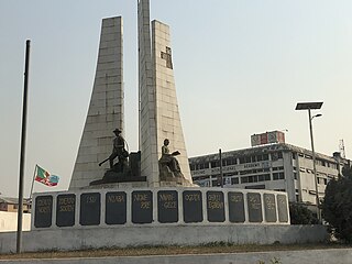
Imo State is a state in the South-East geopolitical zone of Nigeria, bordered to the north by Anambra State, Rivers State to the west and south, and Abia State to the east. It takes its name from the Imo River which flows along the state's eastern border. The state capital is Owerri and the State's slogan is the "Eastern Heartland."
Ihiagwa is a town in Owerri West Local Government Area of Imo State, Nigeria. It is located 12 km (7.5 mi) south of the capital city of Owerri. The township is composed of eight villages: Umuelem, Umuchima, Mboke, Nnkaramochie, Iriamogu, Aku/Umuokwo, Ibuzo and Umuezeawula. Ihiagwa has been divided into two autonomous communities, namely Ihiagwa Ancient Kingdom (Chimelem), comprising two villages: Umuelem and Umuchima;and Dindi-Ihiagwa, comprising the remaining six villages, all divisions done for administrative and developmental reasons. Each autonomous community is a monarchy ruled by an Eze.

The Otamiri River is one of the main rivers in Imo State, Nigeria. The river takes its name from Ota Miri, a deity who owns all the waters that are called by his name, and who is often the dominating god of Mbari houses. The river runs south from Egbu past Owerri and through Nekede, Ihiagwa, Eziobodo, Olokwu Umuisi, Mgbirichi and Umuagwo to Ozuzu in Etche, in the Rivers State, from where it flows to the Atlantic Ocean. The length of the river from its source to its confluence at Emeabiam with the Uramiriukwa River is 30 kilometres (19 mi).
Owerri Municipal is a Local Government Area in Imo State, Nigeria. Its headquarters is in the city of Owerri. It has an area of 58 km² and a population of 127,213 according to the 2006 census. The postal code of the area is 460. Owerri city sits at the intersection of roads from Port Harcourt, Onitsha, Aba, Orlu, Okigwe and Umuahia. It is also the trade center for palm products, corn [maize], yams and cassava [manioc]. Eke Ukwu Owere market is the main market in Owerri Municipal.
Owerri North is a Local Government Area of Imo State, Nigeria. Its headquarters are in the town of Orie Uratta. It has an area of 198 square km and a population of 175,395 at the 2006 census. The postal code of the area is 460. Owerri North is semi-urban government area. It encircles Owerri Municipal like a peninsula. Six major roads that lead out of the municipal cuts across Owerri North Communities. In the North, Orlu road leads to Amakaohia and Akwakuma communities. In the East, Okigwe road leads to Orji Community. In the West, MCC road off Wetheral to Obibi Uratta and Ihitaoha communities. In the South, Mbaise road leads to Egbu and Emekuku communities, while Aba road leads to Naze, Agbala and Ulakwo communities.

The Imo River (Igbo:Imo) is located in southeastern Nigeria and flows 240 kilometres (150 mi) into the Atlantic Ocean. In Akwa Ibom State, the river is known as Imoh River, that is, Inyang Imoh, which translates to River of Wealth. Its estuary is around 40 kilometres (25 mi) wide, and the river has an annual discharge of 4 cubic kilometres (1.0 cu mi) with 26,000 hectares of wetland. The Imo's tributary rivers are the Otamiri and Oramirukwa. The Imo was cleared under the British colonial administration of Nigeria in 1907–1908 and 1911; first to Aba and then to Udo near Umuahia.
Oramiriukwa River is a stream in Imo State, Nigeria that runs a 14-kilometre (9 mi) course to drain into the Otamiri River. Oramiriukwa one of the Rivers found in Imo Riverdrainage runs roughly a 14.0km course from its headwaters in Abba Isu and releases into Otamiri Waterway. In view of the fish gets of neighborhood anglers involving an assortment of fishing gear in an examining station in Emekuku, a sum of 17 groups of fish comprising 27 species were distinguished in the waterway.
Amakọhia-Ubi is an autonomous community in the Owerri West Local Government area of Imo State (1), Nigeria. The community is divided into four villages: Umunjam, Obiọkwu, Umuike, and Umuọka. Each of these villages, which later became towns, has between four and eight kindreds. Amakọhia-Ubi, originally, Amakọhia-Ubi was a village in the Umunwọha Ọfọ Ise community comprising Ohii, Amakohia-Ubi, Ndegwu, Orogwe, and Irete in order of seniority, until each of them was recognized as autonomous by the Peoples Democratic Party-led government. Each of these officially known as an autonomous community was granted the right to choose a traditional ruler according to government procedures establishing the autonomous community status.

Otulu is a town in Oru West local government area of Imo State, Nigeria. It is located along the Owerri-Onitsha Federal Highway in Imo State. Approaching from Owerri to Onitsha one will get to Awo-Omanma, Amiri and then Otulu after which one has Mgbidi; while from Onitsha to Owerri one has Otulu after Mgbidi.

Awo-Omamma, in the bortheast of the Niger Delta basin, is an oil-rich indigenous Igbo town on the banks of Njaba River. It is a potential tourism hub in the region due to its species of wildlife in Umuezukwe and green vegetation.
Umuguma Town is Owerri West Local Government Area's headquarters. It is in Imo State, Nigeria. It evolved out of the old Owerri Local Government Area in 1996. Umuguma—a descendant of Arugo—is one of the 774 communities in the constitution of the Federal Republic of Nigeria as Local Government administrative
Eziobodo is an ancient kingdom located in today's Owerri-West local government, Owerri - Imo State Nigeria. Eziobodo is an igbo-speaking community with a population of over 15,000 locals.

The Nworie River is a river in Nigeria that passes through Owerri and drains into the Otamiri River at Nekede. The length of the river from its source to its confluence is 9.2 km. The river is heavily polluted; in 2017 the local government issues warnings against using water from the river. In order to increase the state's supply of electricity, the formal President of Nigeria, Muhammadu Buhari approved the conceptual design of a proposed power producing facility near the Nworie River in Owerri, the capital of Imo.