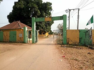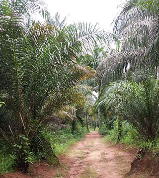
Owerri is the capital city of Imo State in Nigeria, set in the heart of Igboland. It is also the state's largest city, followed by Orlu, Okigwe and Ohaji/Egbema. Owerri consists of three Local Government Areas including Owerri Municipal, Owerri North and Owerri West, it has an estimated population of 1,401,873 as of 2016 and is approximately 100 square kilometres (40 sq mi) in area. Owerri is bordered by the Otamiri River to the east and the Nworie River to the south. The Owerri Slogan is Heartland. It is also called the Las Vegas of Africa, due to the night life of the city and the numerous hotels, casino and leisure parks all over the city.

Oguta is a town on the east bank of Oguta Lake in Imo State of southeastern Nigeria.
Ihite is a town in Orumba South Local Government Area in Anambra State, Nigeria. It is located south-east of the local government area on the Nnobi-Ekwulobia-Ufuma-Umunze-Ibinta-Okigwe federal trunk road. Ihite shares boundaries with Umunze in Anambra State, Aondizuogu, Ndiochi and Okannachi in Imo state, and Nneato in Abia State.
Ekwerazu Ogwa is a village in southeastern Nigeria. Also, it is located near the city of Owerri.
Ihitte Ogwa is a village in southeastern Nigeria located near the city of Owerri, Imo State.
Mbieri is a town in southeastern Nigeria. It is named after one of the indigenous Igbo clans that conquered parts of the old Owerri province. Mbieri is in Mbaitoli council of Imo State and it is the biggest of the original nine towns of Mbaitoli. The region surrounding Mbieri is rich in hydrocarbons.
Eziama Obiato is a town in Mbaitoli Local Government Area of Imo State, southeastern Nigeria. It is about 18 kilometers to the city of Owerri. The town is strategically located as it shares common boundaries with four other Local Government Areas in Imo State. It is bordered by Awo-Omamma, Umu-ofor/Akabo, Amazano/Umuaka, Afara and Umunoha. Eziama Obiato is home to the popular "Ukwuorji" Bus Stop on the Owerri/Onitsha Road.
Iho is an autonomous community in southeastern Nigeria, in Ikeduru, Imo state. It is located near Owerri. The name may be written and pronounced as Iho. The majority of inhabitants of this community refer to it as Iho-Dimeze and are sometimes referred to as "Dimeze"
Ejemekwuru is an Igbo-speaking community that sits in the North-Western part of Imo State in the southeastern region of Nigeria.
Bane is a town in Ogoni territory of Rivers State, Nigeria. Located within the Ken-Khana kingdom, Bane was the birthplace of chief Jim Wiwa and forms the immediate eastern coastal boundaries between Rivers State and Akwa Ibom State. The main boundary that demarcates these two States is the Imo River on whose coastlines the town is conspicuously located. Bane's immediate neighbours on the other side of the Imo River are the Opobo and the Nkoro and the Anaang.
Ihiagwa is a town in Owerri West Local Government Area of Imo State, Nigeria. It is located 12 km (7.5 mi) south of the capital city of Owerri. The township is composed of eight villages: Umuelem, Umuchima, Mboke, Nnkaramochie, Iriamogu, Aku/Umuokwo, Ibuzo and Umuezeawula. Ihiagwa has been divided into two autonomous communities, namely Ihiagwa Ancient Kingdom (Chimelem), comprising two villages: Umuelem and Umuchima;and Dindi-Ihiagwa, comprising the remaining six villages, all divisions done for administrative and developmental reasons. Each autonomous community is a monarchy ruled by an Eze.

Ideato South is a Local Government Area in Imo State, South-eastern Nigeria. Ideato South, with a total of 23 autonomous communities has its headquarters in the town of Dikenafai, the source of Orashi River. Ideato South has an area of 88 km² and a population of 159,879 at the 2006 census. The postal code of the area is 475.

Mbaitoli is a Local Government Area of Imo State, Nigeria. Its headquarters are in the town of Nwaorieubi. It has an area of 204 km² and a population of 327,000. The postal code of the area is 461. Mbaitoli is divided into 9 autonomous communities with 12 INEC wards. The principal occupations of these communities are farming and handicrafts.
Owerri Municipal is a Local Government Area in Imo State, Nigeria. Its headquarters is in the city of Owerri. It has an area of 58 km² and a population of 127,213 according to the 2006 census. The postal code of the area is 460. Owerri city sits at the intersection of roads from Port Harcourt, Onitsha, Aba, Orlu, Okigwe and Umuahia. It is also the trade center for palm products, corn [maize], yams and cassava [manioc]. Eke Ukwu Owere market is the main market in Owerri Municipal.
Umuopara is a clan of the Igbo people of Umuahia, Abia State, Nigeria. it's one of the five clans that make up Umuahia. Umuopara lies on the western border of Abia with Imo State. The natural boundaries between the Umuopara of Umuahia, Abia State and its Umungwa and Udo-Mbaise neighbours both in Imo state is the Imo River.

Otulu is a town in Oru West local government area of Imo State, Nigeria. It is located along the Owerri-Onitsha Federal Highway in Imo State. Approaching from Owerri to Onitsha one will get to Awo-Omanma, Amiri and then Otulu after which one has Mgbidi; while from Onitsha to Owerri one has Otulu after Mgbidi.
Omuma town is the headquarters of Oru East Local Government Area of Imo State in the Southeastern part of Nigeria. It is one of the oldest towns in Imo State. Omuma is located at latitude 5.560° N and longitude 6.972° E. Its boundary to the west is Mgbidi, to the east by Akatta and Attah, to the north by Eleh and Nempi and to the south by Amiri and Otulu. Omuma has four communities: Abia-Omuma, Ozuh-Omuma, Umuhu-Omuma, and Etiti-Omuma. The current Imo state governor, Hope Uzodinma, is from Omuma.

Osina is a town located in Ideato North Local Government Area of Imo State, Nigeria. And is falls under Orlu senatorial zone.

The Ikeji festival is an annual four-day festival held by the Igbo people of Arondizuogu, in Imo state, Nigeria, between the months of March and April to celebrate the harvest of new yams and the Igbo culture. It is arguably the largest masquerade parade in West Africa. The inception of the Ikeji festival dates back five centuries and is an Igbo festival which unites all Igbo race across the globe as they return to the south-eastern regions of Nigeria to witness and partake in the festival. The festival is marked with the display of numerous masquerades dancing around the villages, music, and practice of the Igbo traditional religion.


