The Catholic Church in Nigeria is part of the worldwide Catholic Church, under the spiritual leadership of the Pope, the curia in Rome, and the Catholic Bishops' Conference of Nigeria (CBCN).

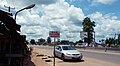
Owerri is the capital city of Imo State in Nigeria, set in the heart of Igboland. It is also the state's largest city, followed by Orlu, Okigwe and Ohaji/Egbema. Owerri consists of three Local Government Areas including Owerri Municipal, Owerri North and Owerri West, it has an estimated population of 1,401,873 as of 2016 and is approximately 100 square kilometres (40 sq mi) in area. Owerri is bordered by the Otamiri River to the east and the Nworie River to the south. The Owerri Slogan is Heartland. It is also called the Las Vegas of Africa, due to the night life of the city and the numerous hotels, casino and leisure parks all over the city.

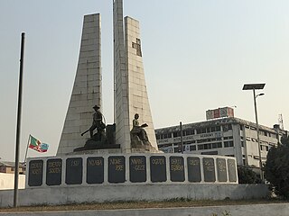
Enugu State verbally pronounced as "Enụgwụ" by the igbo indigenes is a state in the South-East geopolitical zone of Nigeria, bordered to the north by the states of Benue and Kogi, Ebonyi State to the east and southeast, Abia State to the south, and Anambra State to the west. The state takes its name from its capital and largest city, Enugu. The city acquired township status in 1917 and was called Enugwu-Ngwo. Due to the rapid expansion towards areas owned by other indigenous communities, it was renamed Enugu in 1928.

Orlu is the second-largest city in Imo State South East (Nigeria)|South East]], Nigeria, with a population of 420,600. It has a long history as the headquarters for the Organisation of African Unity (OAU) and humanitarian relief agencies during the Nigeria-Biafra Civil War. The city houses the Nigerian headquarters of the British Cheshire Home. It is the second most developed city after Owerri in Imo state.
Awaka is a relatively small town, situated on a small hill about four miles north-east of Owerri, capital city of Imo State, southeastern Nigeria. It is one of the towns that make host the Alaenyi clan, others include the surrounding Ihitta-Ogada, Egbu, Naze and Owere-Nchi-Ise.
Naze is a town in southeastern Nigeria, 408 km south of Abuja, the country's capital. It is located in the Owerri North local government area of Imo State.
Umunoha is a town in southeastern Nigeria near the city of Owerri. It is an Igbo town. Umunoha is south of Eziama Obiato and Afara communities; and is North and Northeast of Ogbaku, Azara Obiato and Ejemekwuru communities; and is north and northwest of Ifakala and Afara communities. It is served by the great east-west road, the Port-Harcourt-Lagos Highway. Umunoha is about thirteen kilometers from Owerri, the Imo State capital. It is a small, compact but thickly populated community with a projected 1997 population of twenty-five thousand people.
Amatta is an autonomous community in Imo State south eastern Nigeria. It is located about 4 km northeast of Owerri.
Imo State is a state in the South-East geopolitical zone of Nigeria, bordered to the north by Anambra State, Rivers State to the west and south, and Abia State to the east. It takes its name from the Imo River which flows along the state's eastern border. The state capital is Owerri and the State's slogan is the "Eastern Heartland."
Ejemekwuru is an Igbo-speaking community that sits in the North-Western part of Imo State in the southeastern region of Nigeria.
Nnarambia is a town in Ahiara, Imo state, Nigeria. It is made up of seven hamlets: Amaobu, Amaokwe, Amakpaka, Umuofo, Obia, Umunnachi and Umuezereugwu.
Okpofe is an autonomous community located in Ezinihitte Mbaise local government area (LGA), in Imo State, Nigeria with common boundaries with Itu, Ezeagbogu, Ihitte, Amumara and Oboama autonomous communities. Okpofe is the centre of the Ezinihitte Mbaise clan, and it is the only town in Ezinihitte Mbaise that does not share a boundary with another local government area in Imo State. It is quite a unique town in Ezinihitte. It is also on record that the Roman Catholic Church was first established in Okpofe town in the year 1918 when the first crop of missionaries brought to the town held the first Catholic mass at the shrine of Inyama Oguegbe Ajero, who himself was the Second Paramount King of the ancient town after Chief Mbagwu. Ezinihitte Mbaise The Anglican Juniorate in Mbaise is located in Okpofe too.
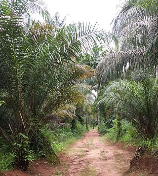
Owerri Municipal is a Local Government Area in Imo State, Nigeria. Its headquarters is in the city of Owerri. It has an area of 58 km² and a population of 127,213 according to the 2006 census. The postal code of the area is 460. Owerri city sits at the intersection of roads from Port Harcourt, Onitsha, Aba, Orlu, Okigwe and Umuahia. It is also the trade center for palm products, corn [maize], yams and cassava [manioc]. Eke Ukwu Owere market is the main market in Owerri Municipal.

Awgbu is a town in Orumba South Local Government Area of Anambra State, South East of Nigeria. The town of Awgbu had an estimated population of 120,000 as at 2006. Awgbu town shares boundaries in the west with Agulu and Mbaukwu; in the east with Ndikelionwu, Omogho, and Awa; in the north with Umuawulu and Amaetiti; while in the south with Amaokpala and Nanka. The indigenes of Awgbu are the descendant of Ezekanunu. Ezekanunu has six sons from five wives: They include Ugwu, Abor, Osikwu, Ohzu and Amaugo, and Mbulukor. The practice then being that inheritance are shared according to wives. There are five villages in Awgbu.

Otulu is a town in Oru West local government area of Imo State, Nigeria. It is located along the Owerri-Onitsha Federal Highway in Imo State. Approaching from Owerri to Onitsha one will get to Awo-Omanma, Amiri and then Otulu after which one has Mgbidi; while from Onitsha to Owerri one has Otulu after Mgbidi.

Awo-Omamma, in the northeast of the Niger Delta basin, is an oil-rich indigenous Igbo town on the banks of Njaba River. It is a potential tourism hub in the region due to its species of wildlife in Umuezukwe and green vegetation.
The Waawa clan of Northern Igboland, also referred to as Ndi Waawa, Wawa People, are a unique sub-group of the Igbo people in Enugu and Ebonyi State, Nigeria, consisting of several communities, who all speak a unique dialect of Igbo called Waawa. The most notable among these are the Agbaja and Ngwo which consist of peoples between the wooded lands of Awka to the rocky valleys of Enugu. The Agbaja are made up of communities in present-day Ngwo clan, Udi, Ezeagu, Umulokpa, Igbo-Etiti, Oji River, greater Awgu, Aninri and Enugu East Local Government Areas. Other notable parts of the Waawa clan include Nkanu, Nsukka, Abia, Nike, Agbani, Owo, and other communities in Enugu State. The Waawa are most notably associated with Chief Onyeama's people from Eke, who was the paramount ruler of Agbaja in the early 20th century.
Osina is a town in Ideato North Local Government of Imo State, Nigeria and is under Orlu senatorial zone. Osina has four villages: Eluama, Uhualla, Ofeke, Umuduru/Umuogbu (Durunogbu). The Nnewi – Okigwe road passes through Osina. The Awka – Umuahia road also passes through Osina.
Eziobodo is an ancient kingdom located in today's Owerri-West local government, Owerri - Imo State Nigeria. Eziobodo is an igbo-speaking community with a population of over 15,000 locals.
Umuezukwe is an ancient trade route, a river port, and a farming community in Awo-Omamma, northeast of the Niger Delta region, Nigeria's South East, Imo State. It is one of the densely populated Awo-Omamma rural settlements in the Njaba River basin.