Aboh Mbaise

Last updated

Aboh Mbaise
LGA and town
Aboh Mbaise Local Government Area in Imo State.jpg
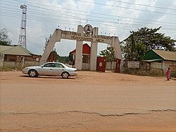
Entrance to the Headquarters of Aboh Mbaise Local Government Area
Nigeria location map.svg
Red pog.svg
Aboh Mbaise
Location in Nigeria
Coordinates: 5°27′N7°14′E / 5.450°N 7.233°E / 5.450; 7.233
CountryFlag of Nigeria.svg  Nigeria
State Imo State
Local Government HeadquarterAboh
Town & VillagesNguru, (Nguru-Ahiato, Nguru-Nweke, Nguru-Nwankwo,) Okwuato, Enyiogugu, Lorji, Amuzu, Mbutu, Uvuru.
Area
  Total184 km2 (71 sq mi)
Population
 (2006)
  Total195,652
Languages
   National language Igbo
Time zone UTC+1 (WAT)
Area codes 462106, 462107, 462105, 462103, 462104, 462101, 462102, 462109, 462108
Aboh Mbaise

Aboh Mbaise is a Local Government Area of Imo State, Nigeria. Its headquarters is in the town of Aboh. [1]

It has an area of 184 km2 and a population of 194,779 at the 2006 census. [2] There are different towns in Aboh-Mbaise such as Nguru, Uvuru, Mbutu, okwuato, Lorji, Amuzu, Enyiogugu. [3]

Aboh Mbaise Headquarters building Aboh Mbaise Headquarters Building.jpg
Aboh Mbaise Headquarters building

Aboh-Mbaise has rich cultural value. Nguru, in particular, celebrates its Itu aka Nguru Uboma ahia ise cultural festival every year in February. ITU AKA Nguru Uboma Ahia Ise holds at Nguru Centre mostly last Saturday of February each year. The ceremonies start with the Ike Aka and continue with the Egwu Onwa. ITU AKA Ngwuru Uboma Ahia Ise is a celebration that dates back in history. Itu Aka literally means "pointing out" or showing. In the days when Nguru and his children settled in Nguru Land, farming was the main occupation of the people and was done by shifting cultivation, whereby the people will farm in one area in one year and move to another area another year. The ceremony used to be a religious and traditional ceremony by which the elders and priests of Nguru will kick start the planting season by offering sacrifices and "pointing out" or “showing” to the people, which part of the forest they will farm that year. The ceremonies start with the Ike Aka Ceremony, followed by the Igwo Onwa which comes up one week later and finally the ITU AKA Ceremony which is the grand finale.

The postal code of the area is 462001. [4]

History

Related Research Articles

Mbaise is a region in Imo State in southeastern Nigeria. In the heart of Igboland, the region includes several towns and cities. The population is composed of indigenous clans, connected by intermarriage. With a population density of over 1,000 people per square kilometer, Mbaise is West Africa's most densely-populated area; its 2006 population was 611,204.

<span class="mw-page-title-main">Local government areas of Nigeria</span> Third-level administrative division of Nigeria

Nigeria has 774 local government areas (LGAs), each administered by a local government council consisting of a chairman, who is the chief executive, and other elected members, who are referred to as councillors. Each LGA is further subdivided into a minimum of ten and a maximum of twenty wards. A ward is administered by a councillor, who reports directly to the LGA chairman. The councillors fall under the legislative arm of the Local Government, the third tier of government in Nigeria, below the state governments and the federal government.

Orogwe is a community in Owerri West local government of Imo state in Nigeria.

Amaimo is an autonomous rural town located in Imo State, southeastern Nigeria. It is located near the city of Owerri. Amaimo is located in the North East of Ikeduru Local Government Area. It is bounded on the North by Ehime in Mbano LGA, on the South and East by Ugiri-Ike and Ahiazu in Mbaise; on the North-West by Inyishi and Eziama in Ikeduru Local Government Area, and on the South-West by Amakaohia Ikeduru. Amaimo was ruled by the great late Eze Apollos Anyaso

<span class="mw-page-title-main">Imo State</span> State of Nigeria

Imo State is a state in the South-East geopolitical zone of Nigeria, bordered to the north by Anambra State, Rivers State to the west and south, and Abia State to the east. It takes its name from the Imo River which flows along the state's eastern border. The state capital is Owerri and the State's slogan is the "Eastern Heartland."

<span class="mw-page-title-main">Obowo</span> Local Government Area in Imo State

Obowo, also spelled Obowu is a Local Government Area in Imo State, Nigeria formed during the Ibrahim Babangida administration in May 1989. It was carved out of Etiti Local Government Area with its headquarters at Isi Nweke. There are twenty-two autonomous communities in Obowo Local Government Area. Achara, Amanze, Umuariam, Umunachi, Umuagu, Ehume, Umungwa, Umulogho, Odenkwume, Okwuohia, Amuzi, Alike, Avutu, Umuosochie and Umuoke are towns in the L.G.A. Obowo is located about 45 minutes from Owerri, across the Imo River and is less than 30 minutes from the Umuahia and Ahiara in opposite directions with the Amanze seven and a half (71/2) junction and landmark in-between. It is surrounded by Ahiazu and Aboh Mbaise Local Government Areas to the north and Umuahia Abia State to the East.

Nnarambia is a town in Ahiara, Imo state, Nigeria. It is made up of five hamlets: Ama-obu, Amakpaka, Umuezereugwu, Umunnachi, and Ofor na Obia.

Okpofe is an autonomous community located in Ezinihitte Mbaise local government area (LGA), in Imo State, Nigeria with common boundaries with Itu, Ezeagbogu, Ihitte, Amumara and Oboama autonomous communities. Okpofe is the centre of the Ezinihitte Mbaise clan, and it is the only town in Ezinihitte Mbaise that does not share a boundary with another local government area in Imo State. It is quite a unique town in Ezinihitte. It is also on record that the Roman Catholic Church was first established in Okpofe town in the year 1918 when the first crop of missionaries brought to the town held the first Catholic mass at the shrine of Inyama Oguegbe Ajero, who himself was the Second Paramount King of the ancient town after Chief Mbagwu. Ezinihitte Mbaise The Anglican Juniorate in Mbaise is located in Okpofe too.

<span class="mw-page-title-main">Ahiazu Mbaise</span> Town and Local Government Area in Imo State, Nigeria

Ahiazu Mbaise is a Local Government Area of Imo State, Nigeria. It is as a result of a merger between Ahiara and Ekwerazu. Its headquarters are in the town of Afo oru. There are fourteen (14) towns that make up Ahiazu Mbaise. They include; Mpam, Ihitte Afor, Opara-Nadim, Akabor, Ogwuama/Amuzi, Obodo-Ujichi, Otulu/Aguneze, Umu-OKrika, Obohia, Ekwereazu, Obodo-Ahiara, Lude/Nnara-Mbia, Ogbe, Oru - Ahiara. The 12 wards in Ahiazu Mbaise local government area are: Amuzi/Ihenworie, Mpam, Nnarambia, Obohia/Ekwereazu, Ogbe, Ogbor/Umueze, Okrika Nweke, Okrika Nwenkwo, Oparanadim, Oru-na-Lude, Otulu/Aguneze, Umunumo/Umuchieze.

<span class="mw-page-title-main">Ihitte/Uboma</span> Local Government Area in Imo State, Nigeria

Ihitte/Uboma is a Local Government Area of Imo State, Nigeria. Its headquarters are in the town of Isinweke.

Ngor Okpala is a Local Government Area of Imo State, Nigeria. Its headquarters is in the town of Umuneke Ngor.

Owerri North is a Local Government Area of Imo State, Nigeria. Its headquarters are in the town of Orie Uratta. It has an area of 198 square km and a population of 175,395 at the 2006 census. The postal code of the area is 460. Owerri North is semi-urban government area. It encircles Owerri Municipal like a peninsula. Six major roads that lead out of the municipal cuts across Owerri North Communities. In the North, Orlu road leads to Amakaohia and Akwakuma communities. In the East, Okigwe road leads to Orji Community. In the West, MCC road off Wetheral to Obibi Uratta and Ihitaoha communities. In the South, Mbaise road leads to Egbu and Emekuku communities, while Aba road leads to Naze, Agbala and Ulakwo communities.

<span class="mw-page-title-main">Umuaka</span> Community in Imo state, Nigeria

The Umuaka Autonomous Community is a city in Njaba Local Government Area of Imo State, Nigeria. Umuaka is situated almost mid way between Orlu and Owerri. The Orlu/Owerri Road passes almost through the center of Umuaka crossing the Ukwuorji-Nkwerre/Amaigbo Road at Afor Umuaka Market.

Amakohia-Ubi is an autonomous community in the Owerri West Local Government area of Imo State (1), Nigeria. The community is divided into four villages: Umunjam, Obiọkwu, Umuike, and Umuọka. Each of these villages, which later became towns, has between four and eight kindreds. Amakọhia-Ubi, originally, Amakọhia-Ubi was a village in the Umunwọha Ọfọ Ise community comprising Ohii, Amakohia-Ubi, Ndegwu, Orogwe, and Irete in order of seniority, until each of them was recognized as autonomous by the Peoples Democratic Party-led government. Each of these officially known as an autonomous community was granted the right to choose a traditional ruler according to government procedures establishing the autonomous community status.

Umuguma Town is Owerri West Local Government Area's headquarters. It is in Imo State, Nigeria. It evolved out of the old Owerri Local Government Area in 1996. Umuguma—a descendant of Arugo—is one of the 774 communities in the constitution of the Federal Republic of Nigeria as Local Government administrative

Bede Uchenna Eke is a politician and lawmaker in the House of Representatives at the National Assembly, representing Aboh Mbaise/Ngor Okpala Federal Constituency.

<span class="mw-page-title-main">Ikechukwu Dozie</span> Nigerian academician

Professor Ikechukwu Nosike Simplicius Dozie is a professor of Microbiology, a public health scientist, teacher and community health specialist currently serving at the Department of Public Health, Federal University of Technology Owerri, Nigeria. He is a member of American Society of Tropical Medicine & Hygiene (ASTMH). Dozie was a consultant to the World Health Organization’s African programme for Onchocerciasis. He is the Director, Linkages and Advancement, Federal University of Technology Owerri.

<span class="mw-page-title-main">2023 Imo State gubernatorial election</span> 2023 gubernatorial election in Imo State, Nigeria

The 2023 Imo State gubernatorial election was held on 11 November 2023 due to the belated inauguration of incumbent Governor Hope Uzodinma, to elect the Governor of Imo State. Incumbent APC Governor Hope Uzodinma was re-elected, with him winning all the 27 local government areas. LP candidate Athan Achonu has filed a lawsuit against Uzodinma claiming that the election was "marred by irregularities, including vote buying and physical assaults of LP agents, and thus deserving of outright cancellation".

<span class="mw-page-title-main">2023 Nigerian Senate elections in Imo State</span> 2023 Senate elections in Imo

The 2023 Nigerian Senate elections in Imo State will be held on 25 February 2023, to elect the 3 federal Senators from Imo State, one from each of the state's three senatorial districts. The elections will coincide with the 2023 presidential election, as well as other elections to the Senate and elections to the House of Representatives; with state elections being held two weeks later. Primaries were held between 4 April and 9 June 2022.

<span class="mw-page-title-main">2023 Nigerian presidential election in Imo State</span>

The 2023 Nigerian presidential election in Imo State will be held on 25 February 2023 as part of the nationwide 2023 Nigerian presidential election to elect the president and vice president of Nigeria. Other federal elections, including elections to the House of Representatives and the Senate, will also be held on the same date while state elections will be held two weeks afterward on 11 March.

References

Agulanna, E.C. (2008). The Mbaiseness of Mbaise, 2nd. ed. Owerri: Career Publishers.|Agulanna, E.C. (2008). The Mbaiseness of Mbaise, 2nd. ed. Owerri: Career Publishers.

  1. "Mbaise Local Government Areas". MBAISEONLINE.COM. 2020-05-25. Retrieved 2021-02-20.
  2. Federal Republic of Nigeria (2010). Federal Republic of Nigeria 2006 Population and Housing Census. Abuja: National Population Commission. p. 54.
  3. Nigeria, Media (2018-04-19). "List Of Towns And Villages In Aboh Mbaise L.G.A, Imo State". Media Nigeria. Retrieved 2023-05-11.
  4. "Post Offices- with map of LGA". NIPOST. Archived from the original on 7 October 2009. Retrieved 2009-10-20.