U.S. Highway 26 is an east–west United States Numbered Highway that runs from Seaside, Oregon, to Ogallala, Nebraska. When the U.S. Numbered Highway System was first defined, it was limited to Nebraska and Wyoming; by the 1950s, it continued into Idaho and Oregon. The highway's eastern terminus is in Ogallala at an intersection with Interstate 80 (I-80). Its western terminus is south of Seaside at an intersection with US 101. Prior to 2004, the route's last 20 miles (32 km) were cosigned with US 101 from the highways' junction south of Seaside north to Astoria where its intersection with US 30 was also US 30's western terminus. Long segments of the highway follow the historic Oregon Trail. At its peak, immediately before the establishment of the Interstate Highway System, US 26 was 1,557 miles (2,506 km) in length and terminated in Astoria.

U.S. Route 97 (US 97) is a major north–south route of the United States Numbered Highway System in the Pacific Northwest region. It runs for approximately 670 miles (1,078 km) through the states of California, Oregon, and Washington, primarily serving interior areas on the east side of the Cascade Mountains. The highway terminates to the south at a junction with Interstate 5 (I-5) in Weed, California, and to the north at the Canadian border near Osoyoos, British Columbia, where it becomes British Columbia Highway 97. Major cities on the US 97 corridor include Klamath Falls, Bend, and Redmond in Oregon; and Yakima, Ellensburg, and Wenatchee in Washington. A portion of the highway in California and Oregon is part of the Volcanic Legacy Scenic Byway.

U.S. Route 197 (US 197) is a north–south United States Highway, of which all but 2.76 miles of its 69.93 miles are within the state of Oregon. The highway starts in rural Wasco County in Central Oregon at an intersection with US 97. US 197 travels north as a continuation of The Dalles-California Highway No. 4 through the cities of Maupin, Tygh Valley, and Dufur to The Dalles. Within The Dalles, the highway becomes concurrent with US 30 and intersects Interstate 84 (I-84) before it crosses over the Columbia River on The Dalles Bridge into Washington. The highway continues through the neighboring city of Dallesport in Klickitat County and terminates at a junction with State Route 14 (SR 14).

Oregon Route 8, also known as Oregon Highway 8, is an Oregon state highway which serves the western suburbs of Portland. The road is locally known as Canyon Road and Tualatin Valley Highway, and travels through the center of the Tualatin Valley. Oregon 8 is located entirely within Washington County. The portion of the route from US 26 to Oregon Route 47 is part of the National Highway System, listed as a principal arterial.

Interstate 84 (I-84) is an Interstate Highway in the northwestern United States. The highway runs almost 770 miles from Portland, Oregon, to a junction with I-80 near Echo, Utah. The highway serves and connects Portland, Boise, and Ogden, Utah. With connections to other highways, I-84 connects these cities to points east and also serves as part of a corridor between Seattle and Salt Lake City. The sections running through Oregon and Idaho are also known as the Vietnam Veterans Memorial Highway.

U.S. Route 730 (US 730) is an east–west United States Numbered Highway, of which all but 6.08 miles of its 41.78 miles are within the state of Oregon. The highway starts in rural Morrow County in Eastern Oregon at an interchange with Interstate 84 (I-84) and US 30, located east of the city of Boardman. US 730 travels east along the Columbia River as a continuation of Columbia River Highway No. 2 into Umatilla County, intersecting I-82 and US 395 in the city of Umatilla. US 730 and US 395 form a short concurrency within the city before the highways part, and US 730 continues northeast into Washington. The highway travels through rural Walla Walla County and ends at an intersection with US 12 south of Wallula.
U.S. Route 97 in the U.S. state of Oregon is a major north–south United States highway which runs from the California border, south of Klamath Falls, to the Washington border on the Columbia River, between Biggs Junction, Oregon and Maryhill, Washington. Other than the northernmost stretch, US 97 is known as The Dalles-California Highway. In May 2009, Oregon Senate passed a bill to rename US 97 as "World War II Veterans Historic Highway".

Oregon Route 47 is an Oregon state highway that runs between the Willamette Valley, near McMinnville, and the city of Clatskanie, along the Columbia River in the northwest part of the state. OR 47 traverses several highways of the Oregon state highway system: part of the Tualatin Valley Highway No. 29, part of the Nehalem Highway No. 102, part of the Sunset Highway No. 47, and the Mist–Clatskanie Highway No. 110.
The Nehalem Highway No. 102 is a state highway in the U.S. state of Oregon that passes through the Nehalem River valley. It runs from U.S. Route 101 (US 101) in Astoria southeast to Oregon Route 8 (OR 8) in Forest Grove. Between Astoria and the Mist–Clatskanie Highway No. 110 in Mist, it is signed as Oregon Route 202 while the rest is signed as OR 47. A piece of the highway in Astoria, north of the Warrenton–Astoria Highway No. 105, is also US 101 Business.

Oregon Route 6 is a state highway in the U.S. state of Oregon that runs between the city of Tillamook on the Oregon Coast, to the Willamette Valley, near Banks. OR 6 traverses the Wilson River Highway No. 37 of the Oregon state highway system, named after the river paralleling the highway's western segment.

U.S. Route 101 (US 101), is a major north–south U.S. Highway in Oregon that runs through the state along the western Oregon coastline near the Pacific Ocean. It runs from the California border, south of Brookings, to the Washington state line on the Columbia River, between Astoria, Oregon, and Megler, Washington.

Oregon Route 7 is an Oregon state highway which runs from Interstate 84 at Baker City to U.S. Route 26 at Austin Junction. OR 7 traverses several highways of the Oregon state highway system: Whitney Highway No. 71, part of the La Grande–Baker Highway No. 66, and part of the Baker–Copperfield Highway No 12. A short spur, Oregon Route 410, serves the city of Sumpter.

Oregon Route 27 is an Oregon state highway located in Deschutes County and Crook County. OR 27 traverses the Crooked River Highway No. 14 of the Oregon state highway system. Known as the Lower Crooked River Back Country Byway, OR 27 has the distinction of being one of the only state highways in Oregon which is partially paved: out of its 44.79-mile (72.08 km) total length, an 18.5-mile (29.8 km) stretch of the highway is gravel.

Oregon Route 53 is an Oregon state highway that runs through a pair of river valleys in the Oregon Coast range; those of the Necanicum River and the Nehalem River. OR 53 traverses the Necanicum Highway No. 46 of the Oregon state highway system.

Oregon Route 104 is a state highway in Clatsop County, Oregon, United States. It is 6.03 miles (9.70 km) long and connects US Route 101 south of Warrenton with Fort Stevens State Park in Warrenton. OR 104 is known as the Fort Stevens Highway No. 104.

Illinois Route 103 is a 9.18-mile-long (14.77 km) state route in west-central Illinois, United States. The route, entirely in Schuyler County, runs from U.S. Route 24 near Ripley east to the intersection of US 67 and IL 100 across the Illinois River from Beardstown. In addition to connecting Ripley and Beardstown, IL 103 serves the community of Sugar Grove. The highway is part of both the National Highway System and the Lincoln Heritage Trail. It is maintained by the Illinois Department of Transportation. The route was established in 1924 between Ripley and its current eastern terminus; its western terminus was moved north to its current location in 1932.
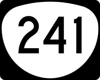
Oregon Route 241 is an Oregon state highway running from U.S. Route 101 in Coos Bay to Nesika County Park in Coos County. OR 241 is known as the Coos River Highway No. 241. It is 18.94 miles (30.48 km) long and runs east–west, entirely within Coos County.
U.S. Route 26 (US 26) is a major cross-state United States Numbered Highway with its western terminus in the U.S. state of Oregon, connecting US 101 on the Oregon Coast near Seaside with the Idaho state line east of Nyssa. Local highway names include the Sunset Highway No. 47, Mount Hood Highway No. 26, and John Day Highway No. 5 before continuing into Idaho and beyond.

K-128 is a 36.9-mile-long (59.4 km) north–south state highway in the U.S. state of Kansas. K-128's southern terminus is at U.S. Route 24 (US-24) and K-9 northwest of Glen Elder, and the northern terminus continues as Nebraska Highway 78 (N-78) at the Nebraska border north of Burr Oak. West of Mankato, a small section of K-128 is co-designated as US-36.