
Beaverton is a city in Washington County, in the U.S. state of Oregon with a small portion bordering Portland in the Tualatin Valley. The city is among the main cities that make up the Portland metropolitan area. Its population was 97,494 at the 2020 census, making it the second-largest city in the county and the seventh-largest city in Oregon. Beaverton is an economic center for Washington County along with neighboring Hillsboro. It is home to the world headquarters of Nike, Inc., although it sits outside of city limits on unincorporated county land.

Tigard is a city in Washington County, Oregon, United States. The population was 54,539 at the 2020 census. As of 2007, Tigard was the state's 12th largest city. Incorporated in 1961, the city is located south of Beaverton and north of Tualatin, and is part of the Portland metropolitan area. Interstate 5 and Oregon Route 217 are the main freeways in the city, with Oregon Route 99W and Oregon Route 210 serving as other major highways. Public transit service is provided by TriMet, via several bus routes and the WES Commuter Rail line.

The Tualatin River is a tributary of the Willamette River in Oregon in the United States. The river is about 83 miles (134 km) long, and it drains a fertile farming region called the Tualatin Valley southwest and west of Portland at the northwest corner of the Willamette Valley. There are approximately 500,000 people residing on 15 percent of the land in the river's watershed.

The Tualatin Valley is a farming and suburban region southwest of Portland, Oregon. The valley is formed by the meandering Tualatin River, a tributary of the Willamette River at the northwest corner of the Willamette Valley, east of the Northern Oregon Coast Range. Most of the valley is located within Washington County, separated from Portland by the Tualatin Mountains. Communities in the Tualatin Valley include Banks, Forest Grove, Cornelius, Hillsboro, Aloha, Beaverton, Sherwood, Tigard, and Tualatin.

The Portland metropolitan area is a metro area in the U.S. states of Oregon and Washington centered on the principal city of Portland, Oregon. The U.S. Office of Management and Budget (OMB) identifies it as the Portland–Vancouver–Hillsboro, OR–WA Metropolitan Statistical Area, a metropolitan statistical area used by the United States Census Bureau (USCB) and other entities. The OMB defines the area as comprising Clackamas, Columbia, Multnomah, Washington, and Yamhill Counties in Oregon, and Clark and Skamania Counties in Washington. The area had a population of 2,512,859 at the 2020 census.

Oregon Route 10 is an Oregon state highway which serves Portland and some of its western suburbs.

Oregon Route 8, also known as Oregon Highway 8, is an Oregon state highway which serves the western suburbs of Portland. The road is locally known as Canyon Road and Tualatin Valley Highway, and travels through the center of the Tualatin Valley. Oregon 8 is located entirely within Washington County. The portion of the route from US 26 to Oregon Route 47 is part of the National Highway System, listed as a principal arterial.

Oregon Route 217 is an Oregon state highway which serves the western suburbs of Portland. OR 217 is a controlled-access highway which connects U.S. Route 26 with Interstate 5.

Oregon Route 219 is an Oregon state highway which runs between the cities of Hillsboro and Woodburn, Oregon, in the United States. The Hillsboro-Silverton Highway continues further south to Silverton, signed as OR 214. The highway mainly serves local residents and agricultural traffic; despite its proximity to the Portland area it lies outside the Portland Urban Growth Boundary and so maintains its character as a country road.

Oregon Route 99W is a state-numbered route in Oregon, United States, that runs from OR 99 and OR 99E in Junction City north to I-5 in southwestern Portland. Some signage continues it north to US 26 near downtown, but most signage agrees with the Oregon Department of Transportation's (ODOT) description, ending it at I-5. OR 99W is known by ODOT as the Pacific Highway West No. 1W ; that highway continues north through downtown to the Pacific Highway No. 1 (I-5) in northern Portland, as well as south on OR 99 to the Pacific Highway (I-5) in Eugene.

Oregon Route 141, known as the Beaverton–Tualatin Highway No. 141, is an Oregon state highway which runs from the city of Wilsonville to the southern edge of Beaverton. The highway is 10.46 miles (16.83 km) long.

The Westside Express Service (WES) is a commuter rail line serving part of the Portland metropolitan area's Washington County and a small portion of Clackamas County in the U.S. state of Oregon. Owned by TriMet and operated by Portland & Western Railroad (P&W), the line is 14.7 miles (23.7 km) long and travels north–south from Beaverton to Wilsonville via Tigard and Tualatin, along a route just west of Oregon Highway 217 and Interstate 5 (I-5). It consists of five stations and connects with MAX Light Rail at Beaverton Transit Center. Service operates on a 45-minute headway on weekdays during the morning and evening rush hours. In Spring 2022, the service saw daily ridership of 420 passengers, about 109,000 rides annually.

Scholls, Oregon is an unincorporated community in Washington County, Oregon, United States. It is located along the southern shore of the Tualatin River, near the intersection of Oregon Routes 210 and 219. Scholls is located approximately seven miles north of Newberg, seven miles west of Tigard and eight miles south of Hillsboro. The area around Scholls is primarily agricultural.

Kinton is an unincorporated community in Washington County, Oregon, United States. It is located near the northern shore of the Tualatin River, near the intersection of Oregon Route 210 and River Road, a major county arterial that runs northwest towards Hillsboro. Kinton is located approximately eight miles north of Newberg, six miles southwest of Beaverton, and seven miles southeast of Hillsboro. The community was once the site of a ferry crossing the Tualatin River between Kinton and nearby Scholls. While the ferry has long since been replaced with a bridge, OR 210 is still known locally as Scholls Ferry Road. Kinton is in Oregon's wine country, with several notable wineries in the area.
Progress, Oregon is a neighborhood in Washington County, Oregon, United States. Originally an unincorporated community that stood apart from any city, most of Progress now lies within the city limits of either Tigard or Beaverton. Other nearby communities include Garden Home and Metzger.
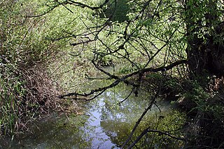
Fanno Creek is a 15-mile (24 km) tributary of the Tualatin River in the U.S. state of Oregon. Part of the drainage basin of the Columbia River, its watershed covers about 32 square miles (83 km2) in Multnomah, Washington, and Clackamas counties, including about 7 square miles (18 km2) within the Portland city limits.

Tualatin is a train station in Tualatin, Oregon, United States, served by TriMet as part of WES Commuter Rail. Situated next to Hedges Green Shopping Center on Southwest Boones Ferry Road, it is the fourth station southbound on the commuter rail line, which operates between Beaverton and Wilsonville in the Portland metropolitan area's Washington County. The station was approved in 2004 as part of the Washington County Commuter Rail Project, but construction was delayed following a dispute with its location and the amount of available parking. A compromise was eventually reached, and it was completed in time for the line's opening in 2009. The station includes a 129-space park and ride and connections to the Tualatin Shuttle and TriMet bus routes 76–Hall/Greenburg and 97–Tualatin–Sherwood Rd. WES connects with the Blue and Red lines of MAX Light Rail at Beaverton Transit Center.

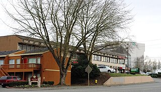
The Washington Square Transit Center is a TriMet transit center located at the Washington Square shopping center in Tigard, Oregon, in the mall's parking lot north of J. C. Penney.

Tualatin Valley Fire & Rescue (TVF&R) is a special-purpose government fire fighting and emergency services district in the Portland metropolitan area of Oregon. Established in 1989 with a merger between Washington County Fire District 1 and the Tualatin Rural Fire Protection District, it primarily provides fire and emergency medical services in eastern Washington County, but also provides services in neighboring Multnomah, Clackamas, and Yamhill counties. It serves unincorporated areas along with the cities of Beaverton, Tigard, Tualatin, West Linn, Wilsonville, and Sherwood, among others. With over 400 firefighters and 27 fire stations, the district is the second largest fire department in the state and has an annual budget of $197 million.

Cornell Road is an east–west street and traffic corridor in the Portland metropolitan area, in Multnomah and Washington counties in the U.S. state of Oregon. It crosses the Tualatin Mountains between the Willamette Valley and the city of Portland on the east and the Tualatin Valley and the city of Hillsboro on the west.


