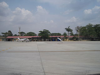
El Edén International Airport is an international airport serving Armenia, the capital of the Quindío Department of Colombia. The airport is 13 kilometres (8.1 mi) southwest of Armenia, near the town of La Tebaida. It handles domestic flights to Bogotá and Medellín and international flights to Panama City and Fort Lauderdale, Florida.

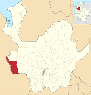
Vigía del Fuerte is a town and municipality in the Colombian department of Antioquia. The town is on the eastern bank of the Atrato River, which is locally the boundary between the Antioquia and Chocó Departments of Colombia.

Alcides Fernández Airport is a commercial airport on the Caribbean coast serving to town of Acandí in the Choco Department of Colombia. The airport is considered by residents of the town of Acandí to be an important link between that community and the rest of Colombia as well as neighboring Panama.

Guaymaral Airport is a high-elevation airport in the north of Bogotá, Colombia, also serving the towns of Cota and Chía. The runway is 15 kilometres (9.3 mi) northeast of Bogota's El Dorado International Airport.

Antonio Nariño Airport is located in the town of Chachagüí and serves the city of Pasto in the Nariño Department of Colombia. The airport is 35 kilometres (22 mi) north of Pasto. It handles only domestic flights in addition to military operations and private charters. A new terminal, administrative and tower control are being built, also new navigation equipment is being set up due to the increasing number of passengers and cargo flights.

Alfonso López Pumarejo Airport serves as air terminal for the city of Valledupar, Colombia and as a small Colombian Air Force and Colombian Police air base. The airport is operated by Aerocivil and three commercial airlines serve the airport: LAN Colombia, EasyFly and Avianca.

Antonio Roldán Betancourt Airport is an airport serving Apartadó, a town in the Antioquia Department of Colombia. The airport is in the countryside 12 kilometres (7.5 mi) southwest of Apartadó.

The Las Brujas Airport is a domestic airport located in the town of Corozal, Sucre in Colombia. The airport is located 10 minutes from the capital of the department, the city of Sincelejo. In emergency situations, it serves as the alternate airport of the city of Montería. It has regional and national operations. Las Brujas operates regional and domestic flights to Barranquilla, Bogota and Medellin.

Villa Garzón Airport is an airport serving Villa Garzón, a town in the Putumayo Department of Colombia, also serving the town of Mocoa. The airport is 5 kilometres (3 mi) south of Villa Garzón.

Reyes Murillo Airport is an airport serving Nuquí, a Pacific coast town in the Chocó Department of Colombia.

Tres de Mayo Airport is an airport serving the town of Puerto Asís in the Putumayo District of Colombia.

César Gaviria Trujillo Airport is an airport serving the town of Inírida in the Guainía Department of Colombia. The airport is named in honor of César Gaviria Trujillo, a former President of Colombia and Secretary General of the Organization of American States.

Caucayá Airport is an airport serving the river town of Puerto Leguízamo in the Putumayo Department of Colombia. Puerto Leguízamo is on the Putumayo River, locally the border with Peru.

Jorge Enrique González Torres Airport is an airport serving San José del Guaviare, the capital of the Guaviare Department of Colombia. The runway is just north of the town and parallels the Guaviare River.

Medicinal Plants Orito Ingi-Ande Flora Sanctuary is the newest protected area in Colombia. The sanctuary is localized in Southern Colombia, Departments of Putumayo and Nariño in the municipalities of Orito (Putumayo) and Funes & Pasto in (Nariño) south side of Cerro Patascoy. In this area they keep medical plants from harm and destruction.

Orocue Airport is an airport serving Orocué, a town and municipality in the Casanare Department of Colombia. The runway is adjacent to the western edge of the town, north of the Meta River.

Furatena Airport is an airport serving the emerald region of the western emerald belt and town of Quípama in the Boyacá Department of Colombia. The airport is four nautical miles west of Muzo Airport.

Miraflores Airport is an airport serving the town of Miraflores, in the Guaviare Department of Colombia. The runway and town are on the east bank of the Vaupés River, a tributary of the Rio Negro River.

Las Ánimas is a volcano of the Central Ranges of the Colombian Andes at the border of the departments of Cauca and Nariño. The volcano is 4,175 metres (13,698 ft) high.


