Osgodby, coastal North Yorkshire

Last updated

Osgodby
St Michael and All Angels - geograph.org.uk - 1193272.jpg
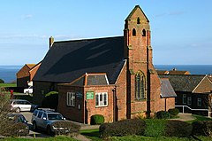
St Michael & All Angels Church
North Yorkshire UK location map (2023).svg
Red pog.svg
Osgodby
Location within North Yorkshire
Population1,248 (2011 census) [1]
OS grid reference TA055846
Civil parish
  • Osgodby
Unitary authority
Ceremonial county
Region
Country England
Sovereign state United Kingdom
Post town SCARBOROUGH
Postcode district YO11
Police North Yorkshire
Fire North Yorkshire
Ambulance Yorkshire
UK Parliament
List of places
UK
England
Yorkshire
54°14′49″N0°22′48″W / 54.246900°N 0.380000°W / 54.246900; -0.380000

Osgodby is a village and civil parish in the district and county of North Yorkshire, England. Until 2023, it was in the borough of Scarborough.

Approximately 3 miles (4.8 km) south of Scarborough off the coastal road, Osgodby was a medieval village with a manor house mentioned in the Domesday Book as Asgozbi ('Asgaut's farm or estate'). It appears to have grown until the 13th or 14th century and then declined to a sparsely populated farming area by the 19th century. Housing was developed east of the medieval site in the 1930s and again from the 1960s, with buildings of farms on the site of the manor house being converted into a pub and a restaurant. The oldest surviving building is Stuart House, dated 1615. Remnants of a 13th-century chantry chapel of St Leonard have been incorporated into a barn. [2] [3]

According to the 2011 UK census, Osgodby parish had a population of 1,248, [1] an increase on the 2001 UK census figure of 1,186. [4]

Osgodby Point Osgodby Point, Osgodby.jpg
Osgodby Point

Related Research Articles

<span class="mw-page-title-main">Fylingdales</span> Civil parish in North Yorkshire, England

Fylingdales is a civil parish in North Yorkshire, England situated south of Whitby, within the North York Moors National Park. It contains the villages of Robin Hood's Bay and Fylingthorpe and Fyling Hall School.

<span class="mw-page-title-main">Folkton</span> Village in England

Folkton is a small village and civil parish at the foot of the Yorkshire Wolds and on the edge of the Vale of Pickering on an area known as Folkton Carr in North Yorkshire, England.

<span class="mw-page-title-main">Ormesby</span> Area of Middlesbrough and Redcar and Cleveland, North Yorkshire, England

Ormesby is a village and area split between the unitary authority areas of Middlesbrough and Redcar and Cleveland in North Yorkshire, England.

<span class="mw-page-title-main">Aislaby, Scarborough</span> Village and civil parish in North Yorkshire, England

Aislaby is a village and civil parish in North Yorkshire, England. It is situated near the town of Whitby on the northern slopes of Eskdale just off the A171.

<span class="mw-page-title-main">Barlby</span> Village in North Yorkshire, England

Barlby is a linear village in the civil parish of Barlby with Osgodby, in North Yorkshire, England. It is situated 2 miles (3 km) to the north-east of the market town of Selby, and is bordered to the west by the River Ouse and to the east by the A19 Barlby bypass. Across the bypass is Barlby's smaller sister village, Osgodby.

<span class="mw-page-title-main">Barton, North Yorkshire</span> Village and civil parish in North Yorkshire, England

Barton is a village and civil parish in North Yorkshire, England. According to the 2011 census it had a population of 837. It is situated near the border with the ceremonial county of County Durham, and is 6 miles south-west of Darlington.

<span class="mw-page-title-main">Brompton by Sawdon</span> Civil parish in North Yorkshire, England

Brompton-by-Sawdon is a village in the Brompton civil parish of North Yorkshire district and county, England. The civil parish includes the village and the village of Sawdon.

<span class="mw-page-title-main">Cayton</span> Village and civil parish in North Yorkshire, England

Cayton is a village and civil parish in North Yorkshire, England, 4 miles (6 km) south of Scarborough.

<span class="mw-page-title-main">Brough with St Giles</span> Village and civil parish in North Yorkshire, England

Brough with St Giles is a village and a civil parish in North Yorkshire, England. The civil parish also includes the settlements of Catterick Bridge and Walkerville, and Catterick Racecourse and the site of the Roman town of Cataractonium. According to the 2001 Census the parish had a population of 338, increasing to 801 at the 2011 census.

<span class="mw-page-title-main">Topcliffe, North Yorkshire</span> Village and civil parish in North Yorkshire, England

Topcliffe is a village and civil parish in North Yorkshire, England. The village is situated on the River Swale, on the A167 road and close to the A168. It is about 5 miles (8 km) south-west of Thirsk and 11 miles (18 km) south of the county town of Northallerton. It has a population of 1,489. An army barracks, with a Royal Air Force airfield enclosed within, is located to the north of the village.

<span class="mw-page-title-main">Wilton, Ryedale</span> Village and civil parish in North Yorkshire, England

Wilton is a small village and civil parish near Pickering in North Yorkshire, England. The village is 4 miles (6.4 km) east of Pickering, 12 miles (19 km) west of Scarborough, and 10 miles (16 km) north-east of Malton.

<span class="mw-page-title-main">Pickhill</span> Village in North Yorkshire, England

Pickhill is a village in North Yorkshire, England, 6 miles (10 km) west of Thirsk. It is a part of the civil parish of Pickhill with Roxby.

<span class="mw-page-title-main">Danby Wiske</span> Village in North Yorkshire, England

Danby Wiske is a village and the main settlement in the civil parish of Danby Wiske with Lazenby, in North Yorkshire, England. The village lies 3.7 miles (6 km) north north-west of the county town of Northallerton.

<span class="mw-page-title-main">West Tanfield</span> Village and civil parish in North Yorkshire, England

West Tanfield is a village and civil parish in the former Hambleton District of North Yorkshire, England. The village is situated approximately six miles north of Ripon on the A6108, which goes from Ripon to Masham and Wensleydale. The parish includes the hamlets of Nosterfield, Thornborough and Binsoe.

Lebberston is a rural village and civil parish in North Yorkshire on the east coast of England. The village is situated 4 miles (6 km) south-east from Scarborough, and between the villages of Cayton and Gristhorpe.

<span class="mw-page-title-main">Flaxton, North Yorkshire</span> Village and civil parish in North Yorkshire, England

Flaxton is a small village and civil parish in North Yorkshire, England. It is close to the A64 between York and Malton. The village lies entirely within a Conservation Area as defined by Planning 1990.

<span class="mw-page-title-main">Sherburn, North Yorkshire</span> Village and civil parish in North Yorkshire, England

Sherburn is a village and civil parish in North Yorkshire, England. It is situated on the south side of the Vale of Pickering, immediately north of the Yorkshire Wolds. Sherburn lies 4 miles (6.4 km) north of Weaverthorpe, 3 miles (4.8 km) south of Brompton, 2 miles (3.2 km) east of East Heslerton and 2 miles (3.2 km) west of Ganton.

<span class="mw-page-title-main">Cliffe, Selby</span> Village and civil parish in North Yorkshire, England

Cliffe is a small village and civil parish in North Yorkshire, England. It was historically part of the East Riding of Yorkshire until 1974, but from 1974 to 2023 was in the Selby District of the shire county of North Yorkshire. In 2023 the district was abolished and North Yorkshire became a unitary authority.

<span class="mw-page-title-main">Thirkleby High and Low with Osgodby</span> Civil parish in North Yorkshire, England

Thirkleby High and Low with Osgodby is a civil parish in North Yorkshire, England. The parish includes the villages of Great Thirkleby and Little Thirkleby and the scattered hamlet of Osgodby. The similarly named medieval settlement of Thirkleby Manor is around 30 miles north, in the parish of Kirby Grindalythe, Ryedale District. The population of the civil parish taken at the 2011 Census was 266.

<span class="mw-page-title-main">Huttons Ambo</span> Civil parish in North Yorkshire, England

Huttons Ambo is a civil parish in the former Ryedale district of North Yorkshire, England. It is about 14 miles (22.5 km) north-east of York and 3 miles (4.8 km) south-west of Malton. The civil parish of Huttons Ambo consists of the villages of High Hutton and Low Hutton.

References

  1. 1 2 UK Census (2011). "Local Area Report – Osgodby Parish (1170217358)". Nomis. Office for National Statistics . Retrieved 4 March 2018.
  2. "Scarborough, North Yorkshire: Osgodby". Visitor UK. Retrieved 16 June 2023.
  3. Philip Nicholas Wood (27 October 2010). "Excavation at the Medieval Village of Osgodby, near Scarborough, North Yorkshire. Analysis Report prepared for North Yorkshire County Council". Northern Archaeological Associates Ltd. Retrieved 16 June 2023 via academia.edu.
  4. "2001 Census: Key Statistics: Parish Headcounts: Area: Osgodby CP (Parish)". Neighbourhood Statistics. Office for National Statistics . Retrieved 7 July 2008.