
Broome County in the U.S. state of New York, as of the 2010 United States Census, had a population of 200,600. Its county seat is Binghamton. The county was named for John Broome, the state's lieutenant governor when Broome County was created.

Otsego is a town in the north-central part of Otsego County, New York, United States. The population was 3,900 at the 2010 census. The town is named after Lake Otsego, which forms part of the town's eastern border.

Otsego Lake is a 4,046-acre (16.37 km2) lake located in Otsego County in the U.S. State of New York. It is the source of the Susquehanna River and largest lake in Otsego County. The Village of Cooperstown is located at the lake's southern end. Glimmerglass State Park is located on the lake's northeastern shore, and includes Hyde Hall, a large mansion constructed in 1817 that overlooks the lake. Glimmerglass Opera is located on the western shore.

The West Branch Delaware River is one of two branches that form the Delaware River. It is approximately 90 mi (144 km) long, and flows through the U.S. states of New York and Pennsylvania. It winds through a mountainous area of New York in the western Catskill Mountains for most of its course, before joining the East Branch along the northeast border of Pennsylvania with New York. Midway or so it is empounded by the Cannonsville Dam to form the Cannonsville Reservoir, both part of the New York City water supply system for delivering drinking water to the City.

Canadarago Lake is a 1,917-acre (7.76 km2) lake located in Otsego County, New York and is the source of Oaks Creek. The Village of Richfield Springs is located at the lake's northern end. It is the second largest lake in Otsego County, lying to the west of and parallel to the larger Otsego Lake. The lake's name is also spelled "Candajarago Lake" or "Caniadaraga Lake".

Hempstead Lake State Park is a 737-acre (2.98 km2) state park located in Nassau County, New York in the United States. The park is located in West Hempstead and is one of three state parks within the Town of Hempstead. There is a quick-access entrance at exit 18 from the Southern State Parkway. The park contains the largest freshwater lake in Nassau County.

The Wallkill River, a tributary of the Hudson, drains Lake Mohawk in Sparta, New Jersey, flowing from there generally northeasterly 88.3 miles (142.1 km) to Rondout Creek in New York, just downstream of Sturgeon Pool, near Rosendale, with the combined flows reaching the Hudson at Kingston.

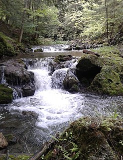
Oaks Creek is a river that drains Canadarago Lake, which is situated in the north central region of Otsego County, New York. The creek begins by the Hamlet of Schuyler Lake and flows southeast approximately 9.32 miles (15.00 km), dropping only 105 feet (32 m) in elevation, before converging with the Susquehanna River south of the Village of Cooperstown, by the Hamlet of Index. From the source to Oaksville the creek flows along Panther Mountain. Fly Creek is a main tributary, that converges with Oaks Creek south of the Hamlet of Fly Creek.

Hayden Creek is a river in Otsego County, in the U.S. State of New York. It begins northeast of the Hamlet of Springfield Center and flows generally southward before flowing into Otsego Lake south of the Hamlet of Springfield Center.
Cripple Creek is a river in southern Herkimer County and northern Otsego County in the state of New York. It begins at the outlet of Weaver Lake near Warren and flows through Young Lake before flowing into Otsego Lake south of Springfield, New York. Was formally called Lawyers Creek.
Shadow Brook, also known as East Springfield Brook, is a river in northern Otsego County in the U.S. State of New York. It begins north-northeast of the Hamlet of East Springfield, and flows into Otsego Lake south-southeast of the Hamlet of Springfield Center, near Glimmerglass State Park. It is the largest watershed in the Otsego Lake basin.
Otsquago Creek is a river that enters the Mohawk River in Fort Plain, New York. Otsquago is a Mohawk Indian word meaning "under the bridge," probably referring to an early bridge of felled trees along the creek, a way of making small bridges. It is also referred to as Otsquage on old maps, which is an Indian word for "healing waters".

The Canajoharie Creek is a river that flows into the Mohawk River in the Village of Canajoharie in the U.S. State of New York. The name "Canajoharie" is a Mohawk language term meaning "the pot that washes itself", referring to the "Canajoharie Boiling Pot", a 20-foot (6.1 m) wide and 10-foot (3.0 m) deep pothole in the Canajoharie Creek, just south of the village of Canajoharie. Bowmans Creek is one main tributary that enters the creek east of the Hamlet of Sprout Brook. The other main tributary is Brimstone Creek which enters the creek north-northwest of the Village of Ames.

West Branch Sacandaga River converges with the Sacandaga River in Blackbridge, New York.
Kayuta Lake is located northwest of Bardwell Mill, New York. Kayuta Lake Campground is located by the Black River inlet. Fish species present in the lake are smallmouth bass, pickerel, white sucker, rock bass, yellow perch, bluegill, and black bullhead. There is a carry down access on the north shore located on State Dam Road.

Lily Lake is a lake in Fulton County in the U.S. State of New York. It is located southwest of the Hamlet of Canada Lake. Fish species present in the lake are northern pike, largemouth bass, black bullhead, rock bass, yellow perch, and pumpkinseed sunfish. There is access via Sprite Creek from Canada Lake.

Valley Brook is a hamlet located west of Fort Plain, on NY 80 in Montgomery County, New York. Otsquene Creek enters Otsquago Creek just west of Valley Brook and the Otsquago Creek flows east through the hamlet.
Basswood Pond is a small lake in Otsego County, New York. It is located north of Burlington within Basswood Pond State Forest. Basswood Pond drains south via an unnamed creek which flows into Butternut Creek.

Bowmans Creek is a river in Montgomery County, New York. It begins west of the hamlet of Hessville and just south of the hamlet of Ripple Corners. It then flows in a mostly southeast direction for a few miles passing through the hamlet of Sprout Brook before flowing into the Canajoharie Creek just east of the hamlet of Sprout Brook.
Kane Mountain is a mountain in the Adirondack Mountains region of New York. It is located north of the Hamlet of Canada Lake. The Kane Mountain Fire Observation Station is located on top of the mountain. Sheeley Mountain is located south-southwest, Canada Lake is located south, Camelhump is located east and Pine Lake is located north of Kane Mountain.

