
Francois Peron National Park is a national park on the Peron Peninsula in Western Australia, 726 km north of Perth, and located within the boundary of the Shark Bay World Heritage area. The nearest towns to the park are Denham, which is found on the southern edge of the park and Carnarvon which is found about 80 kilometres (50 mi) to the north.
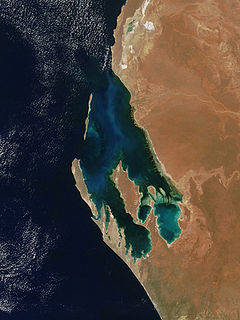
Shark Bay is a World Heritage Site in the Gascoyne region of Western Australia. The 23,000-square-kilometre (8,900 sq mi) area is located approximately 800 kilometres (500 mi) north of Perth, on the westernmost point of the Australian continent. UNESCO's official listing of Shark Bay as a World Heritage Site reads:

North West Coastal Highway is a generally north-south Western Australian highway which links the coastal city of Geraldton with the town of Port Hedland. The 1,300-kilometre-long (808 mi) road, constructed as a sealed two-lane single carriageway, travels through remote and largely arid landscapes. Carnarvon is the only large settlement on the highway, and is an oasis within the harsh surrounding environment. The entire highway is allocated National Route 1, part of Australia's Highway 1, and parts of the highway are included in tourist routes Batavia Coast Tourist Way and Cossack Tourist Way. Economically, North West Coastal Highway is an important link to the Mid West, Gascoyne and Pilbara regions, supporting the agricultural, pastoral, fishing, and tourism industries, as well as mining and offshore oil and gas production.

Clarkson is an outer northern suburb of Perth, Western Australia, located 34 kilometres north of Perth's central business district in the City of Wanneroo.

Balladonia is a small roadhouse community located on the Eyre Highway in Western Australia. It is the first stop east of Norseman on the journey east across the Nullarbor Plain. Between Balladonia and Caiguna is a 146.6-kilometre (91.1 mi) stretch of the highway which is one of the longest straight stretches of road in the world.

In Australia and New Zealand, a cattle station is a large farm, the main activity of which is the rearing of cattle. The owner of a cattle station is called a grazier. The largest cattle station in the world is Anna Creek Station in South Australia, which covers an area of 23,677 square kilometres.
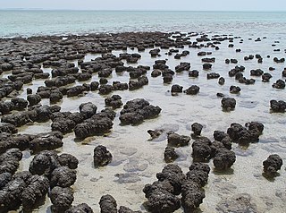
The Hamelin Pool Marine Nature Reserve is a protected marine nature reserve located in the UNESCO World Heritage–listed Shark Bay in the Gascoyne region of Western Australia. The 127,000-hectare (310,000-acre) nature reserve boasts the most diverse and abundant examples of living marine stromatolites in the world, monuments to life on Earth over 3,500 million years BP.

Edward Timothy Hooley, usually known as E. T. Hooley or Tim Hooley, was an explorer in Western Australia, who in 1866 pioneered an overland stock route from Geraldton to the Ashburton River. He entered politics in later life, serving nearly three years as a Member of the Western Australian Legislative Council, then nearly six years in the Western Australian Legislative Assembly.

The Shire of Murchison covers a large area of the Murchison sub-region of the central part of Western Australia, 300 kilometres (186 mi) northeast of Geraldton. The shire and the older 'Murchison' region and goldfield are now part of the designated Mid West region. It is Australia's second least populated local government area and the only one without a town.

The Shire of Shark Bay is a local government area of Western Australia in the Gascoyne region. It has an area of 25,423 km² and a population of about 950. It is made up of two peninsulas, located at the westernmost point of Australia. There is one town in the Shire of Shark Bay, Denham, which is the administrative centre for the Shire. There are also a number of small communities; they are Useless Loop, Monkey Mia, Nanga and Hamelin Pool. The Overlander and The Billabong are roadhouses.
Boolardy Station is a remote former sheep and cattle station in the Mid West (Murchison) region of Western Australia, about 194 km (121 mi) north-north-east of Pindar and 200 km (120 mi) west-south-west of Meekatharra. It is within the Shire of Murchison and situated on pastoral lease no. 3114/406. The area of the lease is 3,467.48 square kilometres (1,338.80 sq mi).
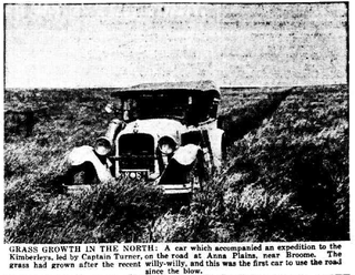
Anna Plains Station is a cattle station in the Kimberley region of Western Australia.

Wave Hill Station, most commonly referred to as Wave Hill, is a pastoral lease in the Northern Territory operating as a cattle station. The property is best known as the scene of the Wave Hill walk-off, a strike by Indigenous Australian workers for better pay and conditions, which in turn was an important influence on Aboriginal land rights in Australia.

Madura Station also known as Madura Plains is a pastoral lease and sheep station located about 700 kilometres (435 mi) east south east of Kalgoorlie in the Goldfields-Esperance region of Western Australia. It is within the locality of Madura and the Eyre Highway runs along the boundary of the station.
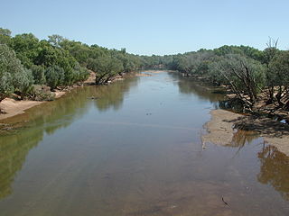
Yeeda Station is a pastoral lease that operates as a cattle station in the Kimberley region of Western Australia.
Boolathana Station is a pastoral lease currently operating as a cattle station that once operated as a sheep station in Western Australia.
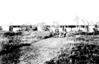
Nanutarra Station, commonly referred to as Nanutarra, is a pastoral lease that operates as a cattle station, and previously operated as a sheep station, in Western Australia.

Moola Bulla Station is a pastoral lease that operates as a cattle station in the Kimberley region of Western Australia. It is approximately 20 kilometres (12 mi) west of Halls Creek and 150 kilometres (93 mi) south of Warmun, and occupies an area of 6,600 square kilometres (2,548 sq mi). It bisects the watershed of the Fitzroy River and Ord Rivers.
Mount Barnett Station is a pastoral lease that operates as a cattle station in Western Australia.


