Oyster Bed Bridge

Last updated
Oyster Bed Bridge
Unincorporated Rural Area
Canada Prince Edward Island location map 2.svg
Red pog.svg
Oyster Bed Bridge
Location within Prince Edward Island
Coordinates: 46°23′18″N63°14′13″W / 46.388345°N 63.237005°W / 46.388345; -63.237005
Country Flag of Canada (Pantone).svg  Canada
Province Flag of Prince Edward Island.svg  Prince Edward Island
County Queens County
Parish Greensville
Lot Lot 24
Time zone Atlantic (AST)
Canadian Postal code
C0A 1N0
Area code(s) 902
NTS Map011L06
GNBC CodeBABZD

Oyster Bed Bridge is an unincorporated rural community in the township of Lot 24, Queens County, Prince Edward Island, Canada.

Lot 24, Prince Edward Island Township in Prince Edward Island, Canada

Lot 24 is a township in Queens County, Prince Edward Island, Canada. It is part of Charlotte Parish. Lot 24 was awarded to Charles Lee and Francis MacLeane in the 1767 land lottery. It was sold in arrears for quitrent in 1781 and a portion was granted to Loyalists in 1783.

Queens County, Prince Edward Island Place

Queens County is a county in the province of Prince Edward Island, Canada. It is the largest county in the province by population with 82,017 (2016), land area, and highest average income. Charlottetown is the county seat of Queens County, and is the largest city and the capital of Prince Edward Island.

Prince Edward Island Province of Canada

Prince Edward Island is a province of Canada and one of the three Maritime Provinces. It is the smallest province of Canada in both land area and population, but it is the most densely populated. Part of the traditional lands of the Mi'kmaq, it became a British colony in the 1700s and was federated into Canada as a province in 1873. Its capital is Charlottetown. According to Statistics Canada, the province of PEI has 155,318 residents.

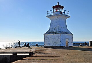
Oyster Bed Bridge is located at the intersections of Route 6 and Route 7, 12 kilometres (7 mi) south of North Rustico and 20 kilometres (12 mi) north of Charlottetown in the central part of the province on the north shore. [1] [2]

Prince Edward Island Route 6 is a secondary highway in central Prince Edward Island.

Prince Edward Island Route 7

Prince Edward Island Route 7 is a secondary highway in central Prince Edward Island. The short connecting route begins at an intersection with Route 2 west of Charlottetown, and runs north to Oyster Bed Bridge, where the road continues as Route 6. It is an uncontrolled, paved two-lane road for its entire length.

Charlottetown Provincial capital city in Prince Edward Island, Canada

Charlottetown is the capital and largest city of the Canadian province of Prince Edward Island, and the county seat of Queens County. Named after Charlotte of Mecklenburg-Strelitz, queen consort of King George III of the United Kingdom, Charlottetown was originally an unincorporated town that incorporated as a city in 1855.

Related Research Articles

Northumberland Strait strait

The Northumberland Strait is a strait in the southern part of the Gulf of Saint Lawrence in eastern Canada. The strait is formed by Prince Edward Island and the gulf's eastern, southern, and western shores.

Confederation Bridge fixed link connecting Canadian province of Prince Edward Island with the mainland, at New Brunswick

The Confederation Bridge spans the Abegweit Passage of the Northumberland Strait. Opened in 1997, it links Prince Edward Island with mainland New Brunswick, Canada. The 12.9-kilometre (8 mi) bridge is Canda's longest bridge and the world's longest bridge over ice-covered water.

Abegweit Passage is the narrowest part of the Northumberland Strait, comprising the 13-kilometre-wide portion between Cape Traverse, Prince Edward Island, and Cape Tormentine, New Brunswick. Tidal currents in this area can reach up to 4 knots. This portion of the strait is now spanned by the Confederation Bridge.

Bonshaw is a municipality that holds community status in Prince Edward Island, Canada. It is located near the province's south shore on the Northumberland Strait.

Cape Tormentine, New Brunswick village in New Brunswick Canada

Cape Tormentine is a village in southeastern New Brunswick, Canada. It is located on the Northumberland Strait at the Abegweit Passage, the shortest crossing between Prince Edward Island and the mainland. It once flourished as a transportation hub between New Brunswick and Prince Edward Island but has been in decline since 1997 when the ferry service was closed due to the opening of the Confederation Bridge. At the Canada 2011 Census the population was 108, three quarters what it was at the 2006 census.

Cavendish, Prince Edward Island unincorporated rural area in Prince Edward Island, Canada

Cavendish is an unincorporated rural community in the township of Lot 23, Queens County, Prince Edward Island, Canada.

Route 1 is a 120-kilometre (75 mi) long provincial highway that serves as the Prince Edward Island section of the Trans-Canada Highway. Route 1 traverses the southern shores of Prince Edward Island, from the Confederation Bridge in Borden-Carleton to the Wood Islands ferry dock. It is an uncontrolled access 2-lane highway with a maximum speed limit of 90 km/h (55 mph), except within some towns and the city of Charlottetown.

Miscouche Place in Prince Edward Island, Canada

Miscouche is a municipality that holds community status in Prince Edward Island, Canada. It is located in Prince County.

Prince Edward Island Route 2 highway in Prince Edward Island

Route 2, also known as Veterans Memorial Highway and the All Weather Highway, is a 216-kilometre (134 mi) two-lane uncontrolled access highway traversing Prince Edward Island, Canada from Tignish to Souris. Route 2 was recognized as the first numbered highway in the province in 1890, when it opened between Charlottetown and Summerside.

Prince Edward Island Route 4 highway in Prince Edward Island

Route 4 is a 63 km (39 mi) long, two-lane uncontrolled access secondary highway in eastern Prince Edward Island, Canada. In runs east from the Trans-Canada Highway (Route 1) at Wood Islands along the Northumberland Straight to Route 18 the settlement of High Bank, where it turns north and passes through Murray River and Montague before ending at Route 2 at Dingwells Mills. Its maximum speed limit is 90 km/h (56 mph).

Route 1A is a 20-kilometre (12 mi) long provincial highway in central Prince Edward Island. The route is a spur route of the Route 1 which connects the Trans-Canada Highway near Borden-Carleton and the Confederation Bridge with the city of Summerside. It is an uncontrolled access 2-lane highway with a maximum speed limit of 90 km/h (55 mph) and is considered a "Core route" of Canada's National Highway System. Route 1A is unnamed except for the portion within Summerside city limits, where it is known as Read Drive.

Ascension Road, labelled Route 160, is a 2-lane collector highway in western Prince County, Prince Edward Island, Canada. It is located 2 miles (3.2 km) NW of the community of Tignish. Its maximum speed limit is 80 kilometres per hour (50 mph).

Hillsborough River (Prince Edward Island) river in Canada

The Hillsborough River, also known as the East River, is a Canadian river in northeastern Queens County, Prince Edward Island.

Bluffton, Alberta

Bluffton is a hamlet in central Alberta, Canada within Ponoka County. It is located 1 kilometre (0.62 mi) northeast of Highway 20, approximately 97 kilometres (60 mi) northwest of Red Deer.

Resort Municipality, Prince Edward Island Resort municipality in Prince Edward Island, Canada

Resort Municipality, officially named the Resort Municipality of Stanley Bridge, Hope River, Bayview, Cavendish and North Rustico, is the lone municipality in Prince Edward Island, Canada that holds resort municipality status. It was established in 1990.

Rusticoville, Prince Edward Island Unincorporated Rural Area in Prince Edward Island, Canada

Rusticoville is an unincorporated rural community in the township of Lot 23, Queens County, Prince Edward Island, Canada.

South Rustico, Prince Edward Island Unincorporated Rural Area in Prince Edward Island, Canada

South Rustico, formerly called Rustico, is an unincorporated rural community in the township of Lot 24, Queens County, Prince Edward Island, Canada.

References

  1. "Oyster Bed Bridge". Place Finder. Government of Prince Edward Island. Retrieved November 19, 2019.
  2. "Place names - Oyster Bed Bridge". Natural Resources Canada. Government of Canada. October 6, 2016. Retrieved November 19, 2019.

Coordinates: 46°24′57″N63°17′30″W / 46.41583°N 63.29167°W / 46.41583; -63.29167

Geographic coordinate system Coordinate system

A geographic coordinate system is a coordinate system that enables every location on Earth to be specified by a set of numbers, letters or symbols. The coordinates are often chosen such that one of the numbers represents a vertical position and two or three of the numbers represent a horizontal position; alternatively, a geographic position may be expressed in a combined three-dimensional Cartesian vector. A common choice of coordinates is latitude, longitude and elevation. To specify a location on a plane requires a map projection.