
The 1989 Loma Prieta earthquake occurred on California's Central Coast on October 17 at local time. The shock was centered in The Forest of Nisene Marks State Park in Santa Cruz County, approximately 10 mi (16 km) northeast of Santa Cruz on a section of the San Andreas Fault System and was named for the nearby Loma Prieta Peak in the Santa Cruz Mountains. With an magnitude of 6.9 and a maximum Modified Mercalli intensity of IX (Violent), the shock was responsible for 63 deaths and 3,757 injuries. The Loma Prieta segment of the San Andreas Fault System had been relatively inactive since the 1906 San Francisco earthquake until two moderate foreshocks occurred in June 1988 and again in August 1989.

The Hayward Fault Zone is a geologic fault zone capable of generating destructive earthquakes. This fault is about 74 mi (119 km) long, situated mainly along the western base of the hills on the east side of San Francisco Bay. It runs through densely populated areas, including Richmond, El Cerrito, Berkeley, Oakland, San Leandro, Castro Valley, Hayward, Union City, Fremont, and San Jose.

Seismic retrofitting is the modification of existing structures to make them more resistant to seismic activity, ground motion, or soil failure due to earthquakes. With better understanding of seismic demand on structures and with our recent experiences with large earthquakes near urban centers, the need of seismic retrofitting is well acknowledged. Prior to the introduction of modern seismic codes in the late 1960s for developed countries and late 1970s for many other parts of the world, many structures were designed without adequate detailing and reinforcement for seismic protection. In view of the imminent problem, various research work has been carried out. State-of-the-art technical guidelines for seismic assessment, retrofit and rehabilitation have been published around the world – such as the ASCE-SEI 41 and the New Zealand Society for Earthquake Engineering (NZSEE)'s guidelines. These codes must be regularly updated; the 1994 Northridge earthquake brought to light the brittleness of welded steel frames, for example.

The MacArthur Maze is a large freeway interchange near the east end of the San Francisco–Oakland Bay Bridge in Oakland, California. It splits Bay Bridge traffic into three freeways—the Eastshore (I-80/I-580), MacArthur (I-580) and Nimitz (I-880).

State Route 480 was a state highway in San Francisco, California, United States, consisting of the elevated double-decker Embarcadero Freeway, the partly elevated Doyle Drive approach to the Golden Gate Bridge and the proposed and unbuilt section in between. The unbuilt section from Doyle Drive to Van Ness Avenue was to have been called the Golden Gate Freeway and the Embarcadero Freeway as originally planned would have extended from Van Ness along the north side of Bay Street and then along the Embarcadero to the San Francisco-Oakland Bay Bridge.

West Oakland is a neighborhood situated in the northwestern corner of Oakland, California, United States, situated west of Downtown Oakland, south of Emeryville, and north of Alameda. The neighborhood is located along the waterfront at the Port of Oakland and at the eastern end of the San Francisco–Oakland Bay Bridge. It lies at an elevation of 13 feet.

Emeryville is an Amtrak station in Emeryville, California, United States. The station is served by the California Zephyr, Capitol Corridor, Coast Starlight, and San Joaquins.

16th Street station is an abandoned Southern Pacific Railroad station in the Prescott neighborhood of Oakland, California, United States. The Beaux-Arts building was designed by architect Jarvis Hunt, a preeminent railroad station architect, and opened in 1912. The station has not been served by trains since 1994.

Oakland – Jack London Square is a train station in Jack London Square of Oakland, California, United States. It is officially named after C. L. Dellums, co-founder of the Brotherhood of Sleeping Car Porters. The station is served by Amtrak's Capitol Corridor, Coast Starlight, and San Joaquins trains. Through Thruway buses, this station is one of two that serves San Francisco, the other being Emeryville.

The City Center Building, known briefly as Centennial Tower, was the tallest building in Hayward, California. It was previously the second tallest, until the 2013 razing of Warren Hall on the Cal State East Bay campus. It was for many years an abandoned building, located between Foothill Boulevard and City Center Drive, in the City Center section of Downtown Hayward, adjacent to the PlazaCenter mall. It was formerly used as Hayward City Hall.

The Robert B. Atwood Building is an office building located at 550 West 7th Avenue in Downtown Anchorage, Alaska. The building houses government offices for the State of Alaska. Standing at 20 stories and 81 m (265 ft), it is the second-tallest building in Alaska. The building was formerly known as the Bank of America Center. Together with the slightly taller Conoco-Phillips Building, this high-rise helps define the Anchorage skyline.
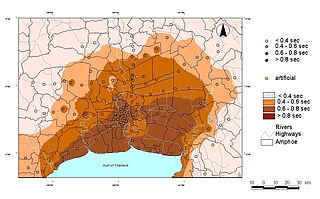
Seismic microzonation is defined as the process of subdividing a potential seismic or earthquake prone area into zones with respect to some geological and geophysical characteristics of the sites such as ground shaking, liquefaction susceptibility, landslide and rock fall hazard, earthquake-related flooding, so that seismic hazards at different locations within the area can correctly be identified. Microzonation provides the basis for site-specific risk analysis, which can assist in the mitigation of earthquake damage. In most general terms, seismic microzonation is the process of estimating the response of soil layers under earthquake excitations and thus the variation of earthquake characteristics on the ground surface.
Ground–structure interaction (SSI) consists of the interaction between soil (ground) and a structure built upon it. It is primarily an exchange of mutual stress, whereby the movement of the ground-structure system is influenced by both the type of ground and the type of structure. This is especially applicable to areas of seismic activity. Various combinations of soil and structure can either amplify or diminish movement and subsequent damage. A building on stiff ground rather than deformable ground will tend to suffer greater damage. A second interaction effect, tied to mechanical properties of soil, is the sinking of foundations, worsened by a seismic event. This phenomenon is called soil liquefaction.

Oakland City Hall is the seat of government for the city of Oakland, California. The current building was completed in 1914, and replaced a prior building that stood on what is now Frank H. Ogawa Plaza. Standing at the height of 320 feet (98 m), it was the first high-rise government building in the United States. At the time it was built, it was also the tallest building west of the Mississippi River. The City Hall is depicted on the city seal of Oakland.
The East Bay Vivarium is a shop located in Berkeley, California in the United States. The store is more than forty years old, the oldest and largest store of its kind in the United States. It sells snakes, lizards, various other reptiles and amphibians, as well as the supplies to maintain and care for them. The store is open to reptile enthusiasts, hobbyists, and the general public. The store has been deemed a "must-see" by Disney family and the "strangest attraction" in Berkeley by The New York Times.

Michael John Nigel Priestley was a New Zealand earthquake engineer. He made significant contributions to the design and retrofit of concrete structures, and developed the first displacement-based method of seismic design.

Ahsan Kareem is the Robert M. Moran Professor of Engineering in the Department of Civil & Environmental Engineering and Earth Sciences (CEEES) at the University of Notre Dame. He is Director of the Nathaz Modeling Laboratory and served as the past Chair at the Department of CEEES at the University of Notre Dame.

Michael C. Constantinou is an American structural engineer who is a Samuel P. Capen Professor and State University of New York Distinguished Professor in the Department of Civil, Structural and Environmental Engineering at the University at Buffalo. He also serves an editor of the Journal of Earthquake Engineering and Structural Dynamics
Andrew Stuart Whittaker is an American structural engineer who is currently a SUNY Distinguished Professor in the Department of Civil, Structural and Environmental Engineering at the University at Buffalo, State University of New York.


