The term "United States," when used in the geographical sense, refers to the contiguous United States, Alaska, Hawaii, the five insular territories of Puerto Rico, Northern Mariana Islands, U.S. Virgin Islands, Guam, American Samoa, and minor outlying possessions. The United States shares land borders with Canada and Mexico and maritime borders with Russia, Cuba, The Bahamas, and many other countries, mainly in the Caribbeanin addition to Canada and Mexico. The northern border of the United States with Canada is the world's longest bi-national land border.

Whitewash, calcimine, kalsomine, calsomine, or lime paint is a type of paint made from slaked lime (calcium hydroxide, Ca(OH)2) or chalk (calcium carbonate, CaCO3), sometimes known as "whiting". Various other additives are sometimes used.

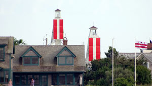
Leading lights, also known as range lights in the United States, are a pair of light beacons used in navigation to indicate a safe passage for vessels entering a shallow or dangerous channel; they may also be used for position fixing. At night, the lights are a form of leading line that can be used for safe navigation. The beacons consist of two lights that are separated in distance and elevation, so that when they are aligned, with one above the other, they provide a bearing. Range lights are often illuminated day and night.

The Sierra Madre is a mountain range in southwestern California. It forms the southernmost part of the California Coast Ranges and lies mostly in Santa Barbara County, with a small portion extending into Ventura County. The Sierra Madre has a northwest-to-southeast orientation, bordered on the north and northeast by the Cuyama River and Cuyama Valley, and on the south and east by the drainage of the Sisquoc River.

The painted turtle is the most widespread native turtle of North America. It lives in relatively slow-moving fresh waters, from southern Canada to northern Mexico, and from the Atlantic to the Pacific. They have been shown to prefer large wetlands with long periods of inundation and emergent vegetation. This species is one of the few that is specially adapted to tolerate freezing temperatures for extended periods of time due to an antifreeze-like substance in their blood that keeps their cells from freezing. This turtle is a member of the genus Chrysemys, which is part of the pond turtle family Emydidae. Fossils show that the painted turtle existed 15 million years ago. Three regionally based subspecies evolved during the last ice age. The southern painted turtle is alternately considered the only other species in Chrysemys, or another subspecies of C. picta.

Dazzle camouflage, also known as razzle dazzle or dazzle painting, is a family of ship camouflage that was used extensively in World War I, and to a lesser extent in World War II and afterwards. Credited to the British marine artist Norman Wilkinson, though with a rejected prior claim by the zoologist John Graham Kerr, it consisted of complex patterns of geometric shapes in contrasting colours interrupting and intersecting each other.

The Radium Girls were female factory workers who contracted radiation poisoning from painting radium dials – watch dials and hands with self-luminous paint. The incidents occurred at three factories in the United States: one in Orange, New Jersey, beginning around 1917; one in Ottawa, Illinois, beginning in the early 1920s; and one in Waterbury, Connecticut, also in the 1920s.

In basketball, there are five players on court per team, each assigned to positions. Historically, these players have been assigned to positions defined by the role they play on the court, from a strategic point of view. The three main positions are guard, forward, and center, with the standard team featuring two guards, two forwards, and a center. Over time, as more specialized roles developed, each of the guards and forwards came to be differentiated, and today each of the five positions is known by a unique name and number: point guard (PG) or 1, the shooting guard (SG) or 2, the small forward (SF) or 3, the power forward (PF) or 4, and the center (C) or 5.

Harveys Creek is a tributary of the Susquehanna River in Luzerne County, Pennsylvania, in the United States. It is approximately 14.5 miles (23.3 km) long and flows through Harveys Lake, Lake Township, Lehman Township, Jackson Township, and Plymouth Township. The creek's watershed has an area of 46.3 square miles (120 km2). The creek has four named tributaries, which are known as Bear Hollow Creek, Paint Spring Run, Pikes Creek, and East Fork Harveys Creek. The watershed is designated as a High-Quality Coldwater Fishery and a Migratory Fishery above Pikes Creek and as a Coldwater Fishery and a Migratory Fishery below it. The creek's source is Harveys Lake, the largest natural lake in Pennsylvania.

Range Township is one of the fourteen townships of Madison County, Ohio, United States. The 2020 census found 981 people in the township

Arizona is a landlocked state situated in the southwestern region of the United States of America. It has a vast and diverse geography famous for its deep canyons, high- and low-elevation deserts, numerous natural rock formations, and volcanic mountain ranges. Arizona shares land borders with Utah to the north, the Mexican state of Sonora to the south, New Mexico to the east, and Nevada to the northwest, as well as water borders with California and the Mexican state of Baja California to the southwest along the Colorado River. Arizona is also one of the Four Corners states and is diagonally adjacent to Colorado.

Hospital Point Range Front Light is a historic lighthouse at the end of Bayview Avenue in Beverly, Massachusetts. It forms the front half of a range which guides vessels toward Salem Harbor. The tower was added to the National Register of Historic Places as Hospital Point Light Station on September 28, 1987.

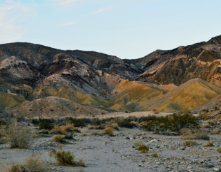
The Coyote Mountains are a small mountain range in San Diego and Imperial Counties in southern California. The Coyotes form a narrow ESE trending 2 mi (3.2 km) wide range with a length of about 12 mi (19 km). The southeast end turns and forms a 2 mi (3.2 km) north trending "hook". The highest point is Carrizo Mountain on the northeast end with an elevation of 2,408 feet (734 m). Mine Peak at the northwest end of the range has an elevation of 1,850 ft (560 m). Coyote Wash along I-8 along the southeast margin of the range is 100 to 300 feet in elevation. Plaster City lies in the Yuha Desert about 5.5 mi (8.9 km) east of the east end of the range.

Lead-based paint was widely used in the United States because of its durability. The United States banned the manufacture of lead-based house paint in 1978 due to health concerns.

Air Test and Evaluation Squadron 30, nicknamed The Bloodhounds) is a United States Navy air test and evaluation squadron based at Naval Air Station Point Mugu, California. Using the tail code BH, the squadron flies the E-2D Hawkeye, Lockheed P-3 Orion, Gulfstream NC-20G, and the Lockheed C-130 Hercules aircraft. The VX-30 Bloodhounds provide support to the United States Navy's Sea Test Range off the shores of central California.

The decline in painted turtle populations is not a simple story of dramatic range reduction, such as the American bison. Instead, the turtle remains numerous and occupies its original range—it is classified as G5 in its Natural Heritage Global Rank—however, the settlement of North America has undoubtedly reduced its population density. Since at least 1952, scientists have noted human impact on the painted turtle. Ernst and Lovich, in their 2009 turtle almanac, acknowledge that estimates of species-specific population changes are lacking, but say that it is useful to discuss general factors affecting all turtles. However, these pressures are generally more pressing on turtles of the sea, estuary or land, or already rare turtles. The painted turtle's high reproduction rates and its ability to survive in habitats affected by humans, such as polluted wetlands and artificially made ponds, have allowed it to maintain its range. In New England, the Turtle Conservation Project notes: "Ironically, prime habitat has been created by fertilizer runoff, creating vegetation-clogged lakes; just what Painted Turtles like."

The Mountain states form one of the nine geographic divisions of the United States that are officially recognized by the United States Census Bureau. It is a subregion of the Western United States.

Gadao's Cave, also known as Liyang Gadao, is a rock art site on the United States island of Guam. Located near the village of Inarajan, the cave is the site of a panel of approximately 50 Chamorro pictographs, painted with a mixture of coral lime and tree sap. The most unusual images are of two human stick figures that appear to be carrying things. It is not known who painted them or when, and what their significance is. The legendary chief of Inarajan Gadao is believed to be the creator of the cave's images.

The Painted Rock Mountains are a short 15-mile (24 km) long mountain range of the north-central Sonoran Desert southwest of Phoenix, Arizona and in southwest Maricopa County. The Gila River flows through the central-north end of the range.


