
Croatia, officially the Republic of Croatia, is a country located at the crossroads of Central and Southeast Europe. Its coast lies entirely on the Adriatic Sea. Croatia borders Slovenia to the northwest, Hungary to the northeast, Serbia to the east, Bosnia and Herzegovina and Montenegro to the southeast, and shares a maritime border with Italy to the west. Its capital and largest city, Zagreb, forms one of the country's primary subdivisions, with twenty counties. Other major urban centers include Split, Rijeka and Osijek. The country spans 56,594 square kilometres, and has a population of nearly 3.9 million.

Split-Dalmatia County is a central-southern Dalmatian county in Croatia. The administrative center is Split. The population of the county is 455,242 (2011). The land area is 14.106,40 km2. Split-Dalmatia County is Croatia's most rapidly urbanising and developing region, as economic opportunities and living standards are among the highest alongside capital Zagreb and Istria County.

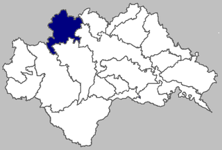
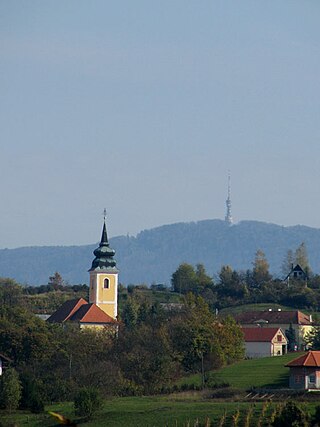
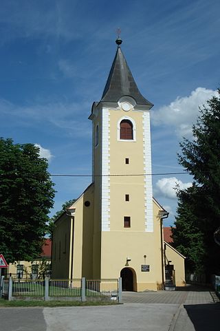
Štrigova is a village and municipality in Međimurje County, in northern Croatia.

Pirovac is a coastal municipality and village in Croatia, 26 km away from the city of Šibenik.
Lekenik is a village and a municipality in central Croatia, located between Sisak and Velika Gorica in the lowland region of Turopolje.

Dugopolje is a village and a municipality in Croatia in the Split-Dalmatia County.
Marija Gorica is a municipality in western Zagreb County of Croatia on the border with Slovenia.
Gornji Mihaljevec is a village and municipality in Međimurje County, in northern Croatia.

Sveti Martin na Muri is a village and municipality in Međimurje County, in northern Croatia.
Parliamentary elections were held in the Kingdom of Croatia-Slavonia from 19 to 22 May 1897. The People's Party emerged as the victor.
Baljci is a village in the Municipality of Tomislavgrad in Canton 10 of the Federation of Bosnia and Herzegovina, an entity of Bosnia and Herzegovina. The village belongs to the local community of Šujica. Until 1945, the village was administratively part of the Srez of Livno.
Kazaginac is a village in the Municipality of Tomislavgrad in Canton 10 of the Federation of Bosnia and Herzegovina, an entity of Bosnia and Herzegovina. The village is also part of the smaller Buško Blato micro-region, consisting of those villages and settlements surrounding the lake known as Buško Lake. According to the 2013 census, there were 277 inhabitants.
Mokronoge is a village in the Municipality of Tomislavgrad in Canton 10 of the Federation of Bosnia and Herzegovina, an entity of Bosnia and Herzegovina.

Bijelo Brdo is a village in the Erdut municipality in eastern Croatia. It is connected by the D213 road and by R202 railway. It has a total of 1,961 inhabitants (2011).

Bjelina is a village westwards from the town of Knin in the Benkovac municipality of southern Croatia.
Vidonje is a village located in the municipality of Zažablje, in Dubrovnik-Neretva County, Croatia.
Crkveni Bok is a village in central Croatia, in the municipality of Sunja, Sisak-Moslavina County. It is located in the Banija region, in the fertile plains on the right bank of the Sava river, to the east of the town of Sunja and some 20 km north-west of village of Jasenovac.
Ivanjski Bok is a village in central Croatia, in the municipality of Sunja, Sisak-Moslavina County. It is located in the Banija region, in the fertile plains on the right bank of the Sava river, to the east of the town of Sunja and some 20 km north-west of village of Jasenovac.
Strmen is a village in central Croatia, in the municipality of Sunja, Sisak-Moslavina County. It is located in the Banija region.

Banfi is a village in northern Croatia, part of the Štrigova municipality within Međimurje County. The village is located at the border with Slovenia.
