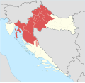
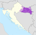
Though the Republic of Croatia administratively consists of twenty counties, it is traditionally divided into four historical and cultural regions: Croatia proper, Dalmatia, Istria, and Slavonia. [1] These are further divided into other, smaller regions.
Coat of arms | Name | Location | Description |
---|---|---|---|
![]() | Croatia proper | ![]() | The central part of the Republic of Croatia that also holds the capital Zagreb. |
![]() | Dalmatia | ![]() | Dalmatia consists of much of the coastline of the Republic of Croatia, and stretches from the island of Rab in the north of the country to the Bay of Kotor in the south. Dubrovnik, one of Croatia's most important tourist cities, is in Dalmatia. The largest city is Split. |
![]() | Slavonia | ![]() | This region comprises the majority of inland eastern Croatia, and was also once its own kingdom. |
![]() | Istria | ![]() | Istria consists mainly of the Croatian part of the peninsula of Istria. Pula is the largest city in Croatian Istria, and sits at the peninsula's southern tip. |
The geography of Croatia is defined by its location—it is described as located at the crossroads of Central Europe and Southeast Europe, or within the wider region of Southern Europe. Croatia's territory covers 56,594 km2 (21,851 sq mi), making it the 127th largest country in the world. Bordered by Slovenia in the northwest, Hungary in the northeast, Bosnia and Herzegovina and Serbia in the east, Montenegro in the southeast and the Adriatic Sea in the south, it lies mostly between latitudes 42° and 47° N and longitudes 13° and 20° E. Croatia's territorial waters encompass 18,981 square kilometres (7,329 sq mi) in a 12 nautical miles wide zone, and its internal waters located within the baseline cover an additional 12,498 square kilometres (4,826 sq mi).
Unique Master Citizen Number is an identification number that was assigned to every citizen of former Yugoslav republics of the SFR Yugoslavia. It continues to be used in almost all of the countries that were created after the dissolution of Yugoslavia – Bosnia and Herzegovina, Montenegro, North Macedonia, Serbia and Slovenia use it in its original form, while Croatia has switched to a new identification number called the Personal Identification Number.
Croatian cuisine is heterogeneous and is known as a cuisine of the regions, since every region of Croatia has its own distinct culinary tradition. Its roots date back to ancient times. The differences in the selection of foodstuffs and forms of cooking are most notable between those in mainland and those in coastal regions. Mainland cuisine is more characterized by Slavic features and influences from the more recent contacts with Turkish, Hungarian and Austrian cuisine, using lard for cooking, and spices such as black pepper, paprika, and garlic. The coastal region bears the influences of Greek and Roman cuisine, as well as of the later Mediterranean cuisine, in particular Italian. Coastal cuisines use olive oil, herbs and spices such as rosemary, sage, bay leaf, oregano, marjoram, cinnamon, clove, nutmeg, and lemon and orange rind. Peasant cooking traditions are based on imaginative variations of several basic ingredients and cooking procedures, while bourgeois cuisine involves more complicated procedures and use of selected herbs and spices. Charcuterie is part of the Croatian culinary tradition in all regions. Food and recipes from other former Yugoslav countries are also popular in Croatia.
Banovina or Banija is a geographical region in central Croatia, between the Sava, Una, Kupa and Glina rivers. The main towns in the region include Petrinja, Glina, Kostajnica, and Dvor. There is no clear geographical border of the region towards the west and the neighboring region of Kordun. The area of Banovina is today administratively almost entirely located within the Sisak-Moslavina County.
In contemporary geography, the terms Central Croatia and Mountainous Croatia are used to describe most of the area sometimes historically known as Croatia or Croatia proper, one of the four historical regions of the Republic of Croatia, together with Dalmatia, Istria, and Slavonia. It is located between Slavonia in the east, the Adriatic Sea in the west, and Dalmatia to the south. The region is not officially defined, and its borders and extent are described differently by various sources. The term Central Croatia refers to the northeastern part, and the term Mountainous Croatia refers to the southwestern part of the territory; the far western part is known as the Croatian Littoral; likewise the terms 'Zagreb macroregion' and 'Rijeka macroregion' can be used instead. Central Croatia is the most significant economic area of the country, contributing well over 50% of Croatia's gross domestic product. The capital of the Republic of Croatia, Zagreb, is the largest city and most important economic centre in Central Croatia.
The subdivisions of Croatia on the first level are the 20 counties and one city-county.
Ban of Croatia was the title of local rulers or office holders and after 1102, viceroys of Croatia. From the earliest periods of the Croatian state, some provinces were ruled by bans as a ruler's representative (viceroy) and supreme military commander. In the 18th century, Croatian bans eventually became the chief government officials in Croatia.
The following outline is provided as an overview of and topical guide to Croatia:
The Croatian Parliament electoral districts are the special territorial subdivision of Croatia used for the country's parliamentary elections.
Croatian dance traditionally refers to a category of folk-dances, the most common being the kolo.
Croatian national costume, also called as Croatian traditional clothing or Croatian dress, refers to the traditional clothing worn by Croats living in Croatia, Bosnia and Herzegovina, Serbia, with smaller communities in Hungary, Austria, Montenegro, and Romania. Since today Croats wear Western-style clothing on a daily basis, the national costumes are most often worn with connection to special events and celebrations, mostly at ethnic festivals, religious holidays, weddings, and by dancing groups who dance the traditional Croatian kolo, or circle dance.
Younger Ikavian, also called Western Ikavian/Western Neoshtokavian Ikavian, or Bosnian–Dalmatian dialect, is a subdialect of Shtokavian Serbo-Croatian spoken primarily by Croats in Croatia, Bosnia and Herzegovina, Serbia, and Italy. It is spoken to a lesser extent by Bosniaks and rarely by Serbs in Bosnia and Herzegovina. Most speakers use the Latin alphabet.
Topography of Croatia is defined through three major geomorphological parts of the country. Those are the Pannonian Basin, the Dinaric Alps, and the Adriatic Basin. The largest part of Croatia consists of lowlands, with elevations of less than 200 metres above sea level recorded in 53.42% of the country. Bulk of the lowlands are found in the northern regions of the country, especially in Slavonia, itself a part of the Pannonian Basin plain. The plains are interspersed by the horst and graben structures, believed to break the Pannonian Sea surface as islands. The greatest concentration of ground at relatively high elevations is found in Lika and Gorski Kotar areas in the Dinaric Alps, but such areas are found in all regions of Croatia to some extent. The Dinaric Alps contain the highest mountain in Croatia—1,831-metre (6,007 ft) Dinara, as well as all other mountains in Croatia higher than 1,500 metres. Croatia's Adriatic Sea mainland coast is 1,777.3 kilometres long, while its 1,246 islands and islets encompass further 4,058 kilometres of coastline—the most indented coastline in the Mediterranean. Karst topography makes up about half of Croatia and is especially prominent in the Dinaric Alps, as well as throughout the coastal areas and the islands.
Local elections were held in Croatia on 15 May 2005. This were the fourth local elections in Croatia since independence.
The 4th Corps was a Yugoslav Partisan corps that fought against the Germans, Independent State of Croatia (NDH) and Chetniks in occupied Democratic Federal Yugoslavia during World War II.
This article documents the timeline of the COVID-19 pandemic in Croatia.
Local elections were held in Croatia on 13 April 1997. This was first local elections in Croatia after the end of war and unification of the territory. In the area of Eastern Slavonia, Baranja and Western Syrmia the elections were conducted with the support and supervision of the United Nations Transitional Administration for Eastern Slavonia, Baranja and Western Sirmium.
Local elections were held in Croatia on 25 May 2001. This was third local elections in Croatian since independence and for the first time since democratization.
The Treća nogometna liga, commonly Treća NL or 3. NL, is the fourth tier of the Croatian football league system. The league was reestablished in 2022 following the reconstruction of league system in Croatia. It is operated by the Croatian Football Federation.