
Tiberias is an Israeli city on the western shore of the Sea of Galilee. A major Jewish center during Late Antiquity, it has been considered since the 16th century one of Judaism's Four Holy Cities, along with Jerusalem, Hebron, and Safed. In 2022, it had a population of 48,472.
This is a partial timeline of Zionism since the start of the 16th century.

Magdala was an ancient Jewish city on the shore of the Sea of Galilee, 5 km north of Tiberias. In the Babylonian Talmud it is known as Magdala Nunayya, and which some historical geographers think may refer to Tarichaea. It is believed to be the birthplace of Mary Magdalene. Until the 1948 Arab–Israeli War, the Arab village of al-Majdal stood at the site of ancient Magdala. The Israeli municipality of Migdal now extends into the area.

Ulrich Jasper Seetzen also known as Musa Al-Hakim was a German explorer of Arabia and Palestine from Jever, German Frisia. An alternative spelling of his name, Ulrich Iospar Sentzen, is sometimes seen in scientific publications.

Jerusalem's population size and composition has shifted many times over its 5,000 year history.

The Palestine Exploration Fund is a British society based in London. It was founded in 1865, shortly after the completion of the Ordnance Survey of Jerusalem by Royal Engineers of the War Department. The Fund is the oldest known organization in the world created specifically for the study of the Levant region, also known as Palestine. Often simply known as the PEF, its initial objective was to carry out surveys of the topography and ethnography of Ottoman Palestine – producing the PEF Survey of Palestine. Its remit was considered to fall between an expeditionary survey and military intelligence gathering. There was also strong religious interest from Christians; William Thomson, Archbishop of York, was the first president of the PEF.

Edward Robinson was an American biblical scholar known for his magnum opus, Biblical Researches in Palestine, the first major work in biblical geography and biblical archaeology, which earned him the epithets "Father of Biblical Geography" and "Founder of Modern Palestinology."

Samakh was a Palestinian Arab village at the south end of Lake Tiberias in Ottoman Galilee and later Mandatory Palestine. It was the site of battle in 1918 during World War I.

Haim Farhi, was a Jewish adviser to the governors of the Galilee in the days of the Ottoman Empire, until his assassination in 1820.

Abu Tor, also Abu Thor or ath-Thori, is a mixed Jewish and Arab neighborhood in East Jerusalem, built on a prominence south of the Old City.
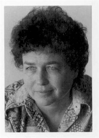
Ruth Kark is an Israeli historical geographer and professor of geography at the Hebrew University of Jerusalem. Professor Kark is a well-known researcher and expert in the field of the historical geography of Palestine and Israel.
Benjamin of Tiberias was a man of immense wealth, who enlisted and armed many soldiers during the Jewish revolt against Heraclius in the 7th century Palaestina province of the Byzantine Empire. The Persian force was joined by Benjamin of Tiberias, who enlisted and armed Jewish soldiers from Tiberias, Nazareth and the mountain cities of Galilee. Together they marched on Jerusalem. Later, they were joined by the Jews of the southern parts of the country; and supported by a band of Arabs, the united forces took Jerusalem in 614 CE. Benjamin was one of the leaders of the revolt, actively participating in the Persian siege and capture of Jerusalem in 614. It is thought that the second leader Nehemiah ben Hushiel was appointed as ruler of Jerusalem.

Khirbet Ghazaleh is a town in the Daraa Governorate, roughly 17 kilometers northeast of Daraa adjacent to Da'el in the west and near Izra' to the north. It is situated on the main highway between Damascus and Amman. In the 2004 census by the Central Bureau of Statistics Khirbet Ghazaleh had a population of 16,240. Its inhabitants are predominantly Muslims.

Travelogues of Palestine are the written descriptions of the region of Palestine by travellers, particularly prior to the 20th century. The works are important sources in the study of the history of Palestine and of Israel. Surveys of the geographical literature on Palestine were published by Edward Robinson in 1841, Titus Tobler in 1867 and subsequently by Reinhold Röhricht in 1890. Röhricht catalogued 177 works between 333 – 1300 CE, 19 works in the 14th century, 279 works in the 15th century, 333 works in the 16th century, 390 works in the 17th century, 318 works in the 18th century and 1,915 works in the 19th century.
Tarichaea is the Greek place name for a historic site of disputed location. It was situated along the shore of the Sea of Galilee, and mentioned in the writings of Josephus. Tarichaea was one of the first villages in Galilee to have sustained an attack by Rome, during the First Jewish-Roman War. The village (κώμη) attracted to it the seditious from the outlying regions east of Galilee, who mixed with the local townsfolk and who relied upon some 230 boats on the Sea of Galilee for protection in the event of an assault upon the village. When the village was eventually overrun by the Roman army, the population surrendered.
The cartography of the region of Palestine, also known as cartography of the Holy Land and cartography of the Land of Israel, is the creation, editing, processing and printing of maps of the region of Palestine from ancient times until the rise of modern surveying techniques. For several centuries during the Middle Ages it was the most prominent subject in all of cartography, and it has been described as an "obsessive subject of map art".

The Van de Velde maps of Palestine and Jerusalem were an important scientific mapping of the region of Palestine and mapping of Jerusalem, published in 1858 by Dutch cartographer Charles William Meredith van de Velde.

The PEF Survey of Palestine was a series of surveys carried out by the Palestine Exploration Fund (PEF) between 1872 and 1877 for the completed Survey of Western Palestine and in 1880 for the soon abandoned Survey of Eastern Palestine. The survey was carried out after the success of the Ordnance Survey of Jerusalem by the newly-founded PEF, with support from the War Office. Twenty-six sheets were produced for "Western Palestine" and one sheet for "Eastern Palestine". It was the first fully scientific mapping of Palestine.

The 1840–41 Royal Engineers maps of Palestine, Lebanon and Syria was an early scientific mapping of Palestine, Lebanon and Syria.

The Kiepert maps of Palestine and Jerusalem were important scientific mappings of the region of Palestine and mappings of Jerusalem, initially published in 1841 by German cartographer Heinrich Kiepert as the maps accompanying Biblical Researches in Palestine, the magnum opus of the "Father of Biblical Geography", Edward Robinson.

