
Mundakayam, is a town in Kanjirappally Taluk in the Kottayam District of Kerala. It is the doorway to the high ranges of southern Kerala, and is at the border of Kottayam and Idukki districts. The next nearest town, Kanjirappally, is 14 km (8.7 mi) & Erumely is 12 km from Mundakayam. Mundakayam has rubber plantations, and greenery. The Manimala River runs through Mundakayam. It is located 48 km east of the district headquarters at Kottayam and 148 km from the state capital, Thiruvananthapuram. The name Mundakayam is said to be derived from the Mundi cranes that used to be seen along the Manimala River banks.
Perumbavoor, IPA: [peɾumbɐːʋuːr], is a historic place located at Bank of Periyar in Ernakulam District in the Indian state of Kerala. It lies in the north-eastern tip of the Greater Cochin area and is also the headquarters of Kunnathunad Taluk. Perumbavoor is famed in the state for wood industries and small-scale industries. Ernakulam lies 30 km southwest of Perumbavoor. The town lies between Angamaly and Muvattupuzha on the Main Central Road (MC), which connects Thiruvananthapuram to Angamaly through the old Travancore part of Kerala. Perumbavoor lies in the banks of river Periyar.

Pampady is a fastest growing town in Kottayam district of Kerala, Southern India. It lies midway between the backwaters of Western Kerala and the mountains of the Western Ghats.
Kottuvally is a census town in Paravoor.It is also a village in Paravur Taluk, Ernakulam district in the Indian state of Kerala. The village is situated in the south of the taluk. The nearest town is North Paravur, 4 km away. The Kottuvally panchayath is spread out on both sides of NH-66 road.

Peralasseri is a Panchayath and a census town in Kannur district in the Indian state of Kerala, situated on the Kannur-Kuthuparamba high road 12 km from Kannur town, on the bank of Anjarakandy river.
Kunnukara is a census town and panchayat in Paravur Taluk of Ernakulam district, Kerala, India. The village is situated on the Airport road connecting North Paravur (NH66) and Nedumbassery (NH544). North Paravur is the nearest town, 7 km from this village. Aluva (10 km) and Angamaly (12 km) are also near to Kunnukara. Its administrative headquarters is in Kunnukara Town itself. The Mini Civil Station has four hospitals, all the Govt. offices, a Khadi Unit Supermarkets etc.
Meppayur is a town in Kozhikode district of Kerala state, South India.
Thirumarady is situated in the eastern part of Ernakulam District in Kerala, South India. Thirumarady is the headquarters of Thirumarady Grama Panchayath which won an award for the "Best Panchayat in the State" two times for its commendable achievements in the rural area.

Erumely, also spelt "Erumeli" is a panchayat in the southeast part of Kottayam district in Kerala state, India. Erumely is situated 49 km east of Kottayam town and 133 km North of capital city Trivandrum. It is situated on the way to Sabarimala and also an important halting place (idathavalam) for the Sabarimala pilgrims. Erumely is famed for its religious harmony and prosperity between Hindus and Muslims which existed from the early periods. It is a place which have strong roots in legends and myths associated with lord Ayyappa. A new airport has been proposed in Erumeli. The village is nourished by Manimala River.
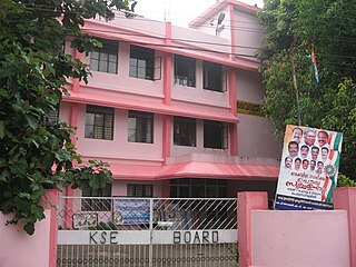
Kodungoor is a town in Kottayam district of Kerala state in India and is popularly known as "Vazhoor". Kodungoor is 25 km from the district headquarters, Kottayam, 28 km from Changanassery, 22 km from Pala,27 km from Ettumanoor,26 km from Mundakayam,26 km from Ranni, 7 km from Ponkunnam,4 km from Pallickathode, 9 km from Pampady and 13 km from Kanjirappally. The Kollam-Theni road passes through the town. SH 13 branches out at Kodungoor junction leading to Pala and Manimala, after the junction a little further KK road also branches out towards Changanassery. Thus Kodungoor town plays a vital role in connecting some major towns in Kottayam through roads averaging at 25 km distances.
Perunad (Ranni-Perunad) is a scenic hilly village in Pathanamthitta district, Kerala state, India It's located on the banks of Pamba River and Kakkadu River.
Kallorkkad is a village in Ernakulam district in Kerala, India. Most of its people are either farmers or engaged in small-scale business.
Rajakkad is a town in the Idukki district in the Indian state of Kerala situated in the Western Ghats.
Panathady is a village in Kasaragod district in the state of Kerala, India. Panathady Panchayat is in Vellarikundu taluk. It is 36 kilometers away from the nearest municipality, Kanhangad, and it is 8 kilometers away from the Kerala-Karnataka border, Panathur.
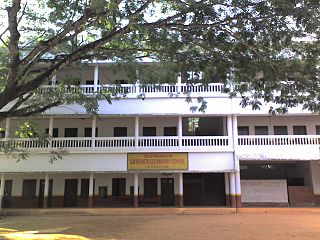
Njeezhoor is a village in Kottayam district in the state of Kerala, India. Njeezhoor is also spelled Neezhoor. Njeezhoor is situated at the northern end of Kottayam (30 km).Distance to Cochin is only 45 km. The nearest railhead is piravom road Railway Station (12 km). Even though it’s a remote village in Kerala, the population has 98% Literacy, Good Educational institutions, cellular phone coverage, Telephone exchange, internet facilities, good transportation systems, irrigation systems etc. Njeezhoor grama panchyat has been awarded two time "The best panchyat in Kottayam district".

Thamarassery, formerly known as Thazhmalachery, is a major town in the Kozhikode district of Kerala, India, 30 km north-east of Kozhikode (Calicut) City and 29 km east of Koyilandy. It lies on the Calicut - Wayanad - Mysore route.
Karavaloor is a village situated in Kollam district in the Indian state of Kerala.
Ayavana is a panchayath in Eranakulam district in the Indian state of Kerala. It is situated 8 km away from Muvattupuzha on the banks of river Kaliyar. Ayavana panchayath includes Anchelpetty, Kakkattoor, Kalampoor, Enanalloor, Kavakkad, Karimattom etc.

Muttom is a rural area in Idukki district in the Indian state of Kerala. This place is 66 km away from Cochin. Geographically this place is part of Midland or Idanad region of Kerala. Hindus, Christians and Muslims are living peacefully in the area.
Kakkoor is a village situated in the eastern part of Ernakulam district in Kerala, south of India. Kakkoor is famously known for Kakkoor Kalavayal the agricultural fest conducted every year in the month of Kumbham in the Malayalam calendar.

