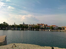
Souli is a village and a community in the municipality of Megalopoli in southwestern Arcadia, Greece. The community consists of the mountain villages Souli and Derveni. Both villages are located in the mountains on the border with Messenia, at about 500 m elevation. Derveni is on the old road from Megalopoli to Kalamata, and Souli is 1 km southeast of it. Souli is 2 km west of Chirades, 4 km southwest of Paradeisia, 15 km southwest of Megalopoli and 30 km north of Kalamata. Souli suffered damage from the 2007 Greek forest fires.
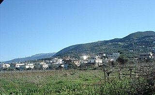
Kallithea is a community in the suburbs of Patras in Achaea, Greece. It is located 9 km south of downtown Patras, on the Greek National Road 33 to Tripoli. The community consists of the villages Kallithea and Ano Kallithea, and is part of the municipal unit Messatida within the municipality of Patras. The nearest villages are Ovrya to the north and Thea to the west. To the east lies the mountain Omplos.
Perivolia is a village and a community in the southwestern part of Arcadia, Greece. It is part of the municipality of Megalopoli, located in a rural area 3 km (2 mi) south-east of downtown Megalopoli. The Greek National Road 7/E55 (Corinth - Tripoli - Kalamata passes southeast of the village. The community consists of the villages Perivolia and Vrysoules.
Varvasaina is a village and a community in the eastern part of the municipality of Pyrgos, Elis, Greece. The community consists of the villages Varvasaina and Kato Varvasaina. It is situated in a valley between low hills, 3 km southeast of Koliri, 3 km northwest of Salmoni, 5 km north of Epitalio and 5 km east of Pyrgos town centre. The Greek National Road 74 passes south of the village. The railway from Pyrgos to Kalamata and Olympia passes through Kato Varvasaina.
Karyochori is a village in the municipal unit of Agia Paraskevi in the Kozani regional unit, northern Greece. Karyochori is built in a valley at the elevation of 710 m above sea level. It is located 2 km southeast of Agios Christoforos, 8 km east of Ptolemaida and 22 km north of Kozani. There are large open-pit lignite mines to the south and west of Karyochori, and farmlands to the north.
Elatochori is a village and a community of the Katerini municipality. Before the 2011 local government reform it was part of the municipality of Pierioi, of which it was a municipal district. The 2021 census recorded 447 inhabitants in the village. The community of Elatochori covers an area of 38.872 km2.
Tsagkarada is a village and a community in the municipal unit of Mouresi in the eastern part of Magnesia, Greece.
Kala Nera is a village in the municipal unit of Milies, Magnesia, Greece. It is situated in the western part of the mountainous Pelion peninsula, on the Pagasetic Gulf coast. It is 3 km southwest of Milies, 5 km southeast of Agios Georgios Nileias and 17 km southeast of Volos.
Flampouro is a village and a community of the Elassona municipality. Before the 2011 local government reform it was a part of the municipality of Olympos. The community of Flampouro covers an area of 58.72 km2.
Chalkiades is a village in the south of the Larissa regional unit, Greece. It is part of the municipal unit of Polydamantas. Chalkiades is located in the Thessalian Plain, 12 km north of Farsala and 27 km south of Larissa. The Greek National Road 3 passes through the village.

Drakotrypa is a mountain village and a community in the municipality of Mouzaki, in the western part of the Karditsa regional unit, Greece. The community consists of the villages Drakotrypa, Arpakia, Keramargio, Milies, Spathes, Trygona and Tsarouchi. Drakotrypa is located at the foot of the Pindus mountains, 6 km southwest of Mouzaki and 28 km west of Karditsa.
Kamara is a mountain village and a community in the municipal unit of Falaisia, in the southwest of Arcadia, Greece. It is situated on a mountain slope, 5 km east of Tourkolekas, 6 km west of Longanikos, 7 km northwest of Dyrrachio and 18 km south of Megalopoli. The community includes the village Kampochori.
Akovos is a mountain village and a community in the municipal unit of Falaisia, southwestern Arcadia, Greece. It is situated in the foothills of the Taygetus mountains.

Pyrsogianni is a village in the Ioannina regional unit, northern Greece. It is situated on a mountain slope on the right bank of the river Sarantaporos. It is in the municipal unit of Mastorochoria, and it was the seat of the former municipality Mastorochoria. The Greek National Road 20 passes east of the village. It is 4 km northwest of Kastaniani, 20 km northeast of Konitsa and 60 km north of Ioannina.
Glykorrizi is a small village situated in the Peloponnese, southern Greece. It is located in the north-western part of Messenia, and is part of the municipal unit of Aetos. The population of the community has been estimated at 60 people but during the summer this number may more than double.
Polydoro is a village in the municipal unit of Molossoi, Ioannina regional unit, Greece. It is situated on a hillside on the left bank of the river Tyria. It is 4 km southwest of Voutsaras, 4 km northwest of Granitsa and 25 km west of Ioannina. The village church is dedicated to the Dormition of the Virgin.
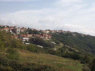
Megali Panagia is a big village in Chalkidiki peninsula. It is located in the east of Chalkidiki prefecture, 80 kilometres from Thessaloniki and 12 from Arnaia, built at 440 meters height, in the slopes of the hill named Chtikela. Until 2011 it was the seat of local municipality. Today it is included in Aristotelis municipality.
Felli is a village and a community of the Grevena municipality. Before the 2011 local government reform, it was a part of the municipality of Grevena, of which it was a municipal district. The 2021 census recorded 799 residents in the community. The community of Felli covers an area of 57.857 km2.
Magoula is a village and a community of the Elassona municipality. Before the 2011 local government reform it was a part of the municipality of Potamia, of which it was a municipal district. The community of Magoula covers an area of 7.803 km2.

Kladorrachi is a village in the Florina regional unit, West Macedonia, Greece. It has also been known as Kladorrachi, Kladorobi, Kladorahi, Kladorohi, Kladorabi and Kladoraki. Since the 2011 local government reform it is part of the municipality of Florina. It was previously part of the municipality of Kato Kleines. It is located 5 km (3.1 mi) north of the city of Florina.