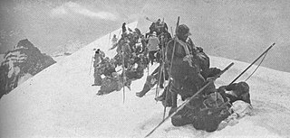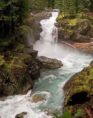
Mount Rainier National Park is a national park of the United States located in southeast Pierce County and northeast Lewis County in Washington state. The park was established on March 2, 1899, as the fourth national park in the United States, preserving 236,381 acres including all of Mount Rainier, a 14,410-foot (4,390 m) stratovolcano. The mountain rises abruptly from the surrounding land with elevations in the park ranging from 1,600 feet to over 14,000 feet (490–4,300 m). The highest point in the Cascade Range, Mount Rainier is surrounded by valleys, waterfalls, subalpine meadows, and 91,000 acres of old-growth forest. More than 25 glaciers descend the flanks of the volcano, which is often shrouded in clouds that dump enormous amounts of rain and snow.

The Wonderland Trail is an approximately 93-mile (150 km) hiking trail that circumnavigates Mount Rainier in Mount Rainier National Park, Washington, United States. The trail goes over many ridges of Mount Rainier for a cumulative 22,000 feet (6,700 m) of elevation gain. The trail was built in 1915. In 1981, it was designated a National Recreation Trail. An estimated 200 to 250 people a year complete the entire trail with several thousand others doing shorter sections of it. The average time taken to complete the entire trip is 10 to 14 days.

Goat Rocks is an extinct stratovolcano in the Cascade Range, located between Mount Rainier and Mount Adams in southern Washington, in the United States. Part of the Cascade Volcanoes, it was formed by the subduction of the Juan de Fuca Plate under the western edge of the North American Plate. The volcano was active from 3.2 million years ago until eruptions ceased between 1 and 0.5 million years ago. Throughout its complex eruptive history, volcanism shifted from silicic explosive eruptions to voluminous, mafic activity.

The Mountaineers is an alpine club in the US state of Washington. Founded in 1906, it is organized as an outdoor recreation, education, and conservation 501(c)(3) nonprofit organization, and is based in Seattle, Washington. The club hosts a wide range of outdoor activities, primarily alpine mountain climbing and hikes. The club also hosts classes, training courses, and social events.

Larch Mountain is an extinct volcano near Portland, Oregon. The name is misleading, as no western larch can be found there. It received that name when early lumbermen sold the noble fir wood as larch. The peak can be reached between May and November on paved Larch Mountain Road, 16 mi (26 km) east of Corbett, Oregon, although the road is closed during the winter and spring months. The road leading to Larch Mountain from the Historic Columbia River Highway is 14 miles long, which closed at milepost 10 from Nov. through late May or early June due to snow.

The Weminuche Wilderness is a wilderness area in southwest Colorado managed by the United States Forest Service as part of the San Juan National Forest on the west side of the Continental Divide and the Rio Grande National Forest on the east side of the divide. The Weminuche Wilderness was designated by Congress in 1975, and expanded by the Colorado Wilderness Acts of 1980 and 1993. It is located 4 miles (6.4 km) southeast of the town of Silverton, 17 miles (27 km) northeast of Durango, and 8 miles (13 km) west of South Fork. At 499,771 acres (2,022.50 km2), it is the largest wilderness area in the state of Colorado. Elevation in the wilderness ranges from 7,700 feet (2,300 m) along the Animas River to 14,093 feet (4,296 m) at the summit of Windom Peak.

Mount Scott is a small stratovolcano and a so-called parasitic cone on the southeast flank of Crater Lake in southern Oregon. It is approximately 420,000 years old. Its summit is the highest point within Crater Lake National Park, and the tenth highest peak in the Oregon Cascades. A small fire lookout tower stands on the summit, at the end of a trail that zigzags approximately 1,500 feet up the mountain. The mountain is named for Oregon pioneer Levi Scott, founder of Scottsburg, Oregon.

Glacier View Wilderness is a 3,073-acre (1,244 ha) wilderness adjacent to the west side of Mount Rainier National Park in Washington state. It was designated as wilderness in 1984. Glacier View Wilderness has views of the glaciated slopes of Mount Rainier which lies to the east. This includes viewing points from Mt. Belijica and Glacier View Point. Glacier View Point is the former site of a fire lookout built in 1934. The wilderness is administered by the Gifford Pinchot National Forest through the Cowlitz Valley Ranger district with headquarters located in Randle, Washington.

Horse Camp is a property on Mount Shasta owned by the nonprofit Sierra Club Foundation. It is a 720-acre (2.9 km2) enclave within the Mount Shasta Wilderness of the Shasta-Trinity National Forest in California, United States. It is located at approximately 7,950 feet (2,420 m) elevation at the lower end of Avalanche Gulch, the most popular climbing route on the mountain.
The Silver Knapsack Trail is a 36.2-mile (58.3 km) trail in the Sierra Nevada, near Johnsondale, Springville, and Three Rivers, California. It is located in Sequoia National Forest and the southernmost part of Sequoia National Park. Much of the trail lies within the Golden Trout Wilderness.

The Ohanapecosh River is a 16-mile (26 km) river in the U.S. state of Washington.

The List of Mount Rainier National Park references identifies English language historic, scientific, ecological, cultural, tourism, social, and advocacy books, journals and studies on the subject of Mount Rainier National Park topics published since 1899 and documented in Mount Rainier related bibliographies and other related references.
Sawtooth Mountain is a shield volcano, and part of the polygenetic Indian Heaven Volcanic Field in Washington, United States. It is located midway between Mount St. Helens and Mount Adams, and dates from the Pleistocene and Holocene. Sawtooth Mountain is the third highest point at 5,354 feet (1,632 m)in this region. The mountain forms a series of welded volcanic rock spires, an eroded remnant of an ancient shield volcano. Sawtooth Mountain is the third highest point in the Indian Heaven Wilderness Area. While Sawtooth Mountain is not the highest, its craggy appearance makes it one of the most namesake peaks in the Indian Heaven Volcanic Field.

Rachel Lake is located on the eastern side of Rampart Ridge in Kittitas County, Washington. The lake is a popular area for hiking, swimming, and fishing cutthroat trout.

Banshee Peak is a 7,420-foot (2,262-metre) mountain summit located in Mount Rainier National Park in Pierce County of Washington state, US. As part of the Cascade Range, Banshee Peak is situated west of the Cowlitz Chimneys and east of Panhandle Gap, with the Sarvant Glacier set below its north cliff. Precipitation runoff from Banshee Peak drains into tributaries of the White River and the Cowlitz River. Banshee Peak is a high remnant of bedded Ohanapecosh Formation lava flows. Access is from Panhandle Gap via the Wonderland Trail. The broad summit has alpine tundra similar to that found on Burroughs Mountain. The Sunrise Historic District provides a viewpoint from which to see Banshee Peak when weather permits. The road to Sunrise is only open seasonally in the summer due to closure from winter snowpack.

Double Peak is a 6,199-foot (1,889 m) double summit mountain located in Mount Rainier National Park in Pierce County of Washington state. Part of the Cascade Range, it is situated northwest of Shriner Peak, south of Governors Ridge, and southeast of the Cowlitz Chimneys. Precipitation runoff from Double Peak drains into the Ohanapecosh River which is a tributary of the Cowlitz River. Topographic relief is significant as the summit rises 3,400 feet above the Ohanapecosh in one mile (1.6 km). The mountain's descriptive toponym was officially adopted in 1932 by the United States Board on Geographic Names.

Goat Island Mountain is a 7,288-foot (2,221 m) ridge-like mountain located in Mount Rainier National Park, in Pierce County of Washington state. It is part of the Cascade Range, and lies 5.76 mi (9.27 km) east-northeast of the summit of Mount Rainier. This mountain is quite visible from the Sunrise Historic District and the many trails surrounding the Sunrise area. The Wonderland Trail provides an approach to this mountain, and the summit offers views of Cowlitz Chimneys, Fryingpan Glacier, and Mount Rainier. Burroughs Mountain is its nearest higher neighbor, 2.51 mi (4.04 km) to the northwest. Precipitation runoff from Goat Island Mountain drains into the White River. The mountain's descriptive name derives from mountain goats that were often seen on the peak. The toponym was officially adopted in 1932 by the United States Board on Geographic Names.
Lake Augusta is a freshwater lake located on the southwest skirt of Big Jim Mountain, East of Icicle Ridge, in Chelan County, Washington. Because of its close proximity to Icicle Ridge Trail, the lake is a popular area for hiking, swimming, and fishing cutthroat trout. Smaller Lake Ida is a short distance on the opposite side of Icicle Ridge and Big Jim Mountain Lakes or on the northeast slope of the mountain. Lake Augusta is located approximately 15 miles west of the city of Leavenworth. Self-issued Alpine Lake Wilderness permit required for transit within the Lake Augusta area.

Lake Edna is a freshwater lake located along Icicle Ridge, approximately 10 miles west of the city of Leavenworth in Chelan County, Washington. Because of its close proximity to Icicle Ridge Trail, the lake is a popular area for hiking, swimming, and fishing. Lake Alice is a short distance in a prominent cirque on the opposite side of Icicle Ridge.
Magee Peak is a stratovolcano in the Cascade Volcanic Arc north of Lassen Peak in Shasta County, California, United States. It was last active 1 to 2 million years ago.


