Panola, Oklahoma | |
|---|---|
 Panola  Panola | |
| Coordinates: 34°55′43″N95°12′48″W / 34.92861°N 95.21333°W | |
| Country | United States |
| State | Oklahoma |
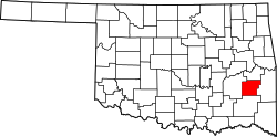
| County | Latimer |
| Area | |
• Total | 1.13 sq mi (2.92 km2) |
| • Land | 1.12 sq mi (2.90 km2) |
| • Water | 0.01 sq mi (0.02 km2) |
| Elevation | 642 ft (196 m) |
| Population (2020) | |
• Total | 73 |
| • Density | 65.12/sq mi (25.13/km2) |
| Time zone | UTC-6 (Central (CST)) |
| • Summer (DST) | UTC-5 (CDT) |
| FIPS code | 40-56950 |
| GNIS feature ID | 1096396 |
Panola is a small unincorporated community and census-designated place in Latimer County, Oklahoma, United States. The post office was established March 18, 1911. Panola is the Choctaw name for cotton. The high school and gymnasium are on the National Register of Historic Places. The population was 73 at the time of the 2020 Census. [2]