Fanshawe, Oklahoma

Last updated

Fanshawe, Oklahoma
OKMap-doton-Fanshawe.PNG
Location of Fanshawe, Oklahoma
Coordinates: 34°58′25″N94°49′19″W / 34.97361°N 94.82194°W / 34.97361; -94.82194
Country United States
State Oklahoma
Counties Latimer, Le Flore
Area
[1]
  Total23.07 sq mi (59.74 km2)
  Land22.97 sq mi (59.49 km2)
  Water0.10 sq mi (0.25 km2)
Elevation
[2]
732 ft (223 m)
Population
 (2020)
  Total317
  Density13.80/sq mi (5.33/km2)
Time zone UTC-6 (Central (CST))
  Summer (DST) UTC-5 (CDT)
ZIP code
74935
Area code(s) 539/918
FIPS code 40-25400 [3]
GNIS feature ID2412620 [2]

Fanshawe is a town in Latimer and Le Flore counties in the U.S. state of Oklahoma. As of the 2020 Census, the town had a total population of 317. [4] The Le Flore County portion of Fanshawe is part of the Fort Smith, Arkansas-Oklahoma Metropolitan Statistical Area.

Contents

History

A post office was established at Fanshawe, Indian Territory on March 31, 1891. [5] The town was named after John R. Fanshawe, an employee of the Choctaw, Oklahoma and Gulf Railroad, which built through the area in 1889–90; however, the town had no role in choosing the name. Railroad executives and investors made an inspection trip on the newly built line; at each designated station a name was drawn from a hat, and that name was used to designate the new town. [6] At the time of its founding, Fanshawe was located in the Moshulatubbee District of the Choctaw Nation. [7]

Geography

According to the United States Census Bureau, the town has a total area of 22.7 square miles (58.8 km2), of which 22.6 square miles (58.5 km2) is land and 0.1 square mile (0.3 km2) (0.57%) is water.

Demographics

Historical population
CensusPop.Note
1970 199
1980 416109.0%
1990 331−20.4%
2000 38416.0%
2010 4199.1%
2020 317−24.3%
U.S. Decennial Census [8] [4]

As of the census [3] of 2000, there were 384 people, 146 households, and 102 families residing in the town. The population density was 17.0 inhabitants per square mile (6.6/km2). There were 168 housing units at an average density of 7.4 per square mile (2.9/km2). The racial makeup of the town was 78.65% White, 17.97% Native American, 0.78% Asian, and 2.60% from two or more races. Hispanic or Latino of any race were 1.82% of the population.

There were 146 households, out of which 35.6% had children under the age of 18 living with them, 63.0% were married couples living together, 3.4% had a female householder with no husband present, and 30.1% were non-families. 28.1% of all households were made up of individuals, and 17.1% had someone living alone who was 65 years of age or older. The average household size was 2.63 and the average family size was 3.23.

In the town, the population was spread out, with 28.4% under the age of 18, 6.5% from 18 to 24, 26.6% from 25 to 44, 24.7% from 45 to 64, and 13.8% who were 65 years of age or older. The median age was 37 years. For every 100 females, there were 107.6 males. For every 100 females age 18 and over, there were 108.3 males.

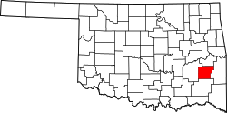
The median income for a household in the town was $21,875, and the median income for a family was $30,000. Males had a median income of $29,286 versus $23,125 for females. The per capita income for the town was $20,583. About 26.3% of families and 29.2% of the population were below the poverty line, including 34.6% of those under age 18 and 16.2% of those age 65 or over.

Related Research Articles

<span class="mw-page-title-main">LeFlore County, Oklahoma</span> County in Oklahoma, United States

Le Flore County is a county along the eastern border of the U.S state of Oklahoma. As of the 2020 census, the population was 48,129. Its county seat is Poteau. The county is part of the Fort Smith metropolitan area and the name honors a Choctaw family named LeFlore. The United States District Court for the Eastern District of Oklahoma is the federal district court with jurisdiction in LeFlore County.

<span class="mw-page-title-main">Bokchito, Oklahoma</span> Town in Oklahoma, United States

Bokchito is a town in Bryan County, Oklahoma, United States. The population was 632 at the 2010 census, an increase of 12.1 percent over the figure of 564 recorded in 2000. In the Choctaw language, "bok" means river, and "chito" means big or large, literally translating into "big creek".

<span class="mw-page-title-main">Boswell, Oklahoma</span> Town in Oklahoma, United States

Boswell is a town in Choctaw County, Oklahoma, United States. The population was 709 at the 2010 census.

<span class="mw-page-title-main">Fort Towson, Oklahoma</span> Town in Oklahoma, United States

Fort Towson is a town in Choctaw County, Oklahoma, United States. The population was 510 at the 2010 census, a 15.1 percent decline from the figure of 611 recorded in 2000. It was named for nearby Fort Towson, which had been established in May 1824 and named for General Nathan Towson, a hero of the War of 1812. The town of Fort Towson was established in 1902, after the Arkansas and Choctaw Railway reached eastern Choctaw County.

<span class="mw-page-title-main">Sawyer, Oklahoma</span> Town in Oklahoma, United States

Sawyer is a town in Choctaw County, Oklahoma, United States. The population was 321 at the 2010 census.

<span class="mw-page-title-main">Arkoma, Oklahoma</span> Town in Oklahoma, United States

Arkoma is a town in Le Flore County, Oklahoma, United States. It is part of the Fort Smith, Arkansas-Oklahoma Metropolitan Statistical Area. The population was 1,989 at the 2010 census, a decline from 2,180 in 2000. The name of the town is a portmanteau of Arkansas and Oklahoma. Throughout its history, Arkoma has served as a "bedroom community" because many residents commuted to work in Fort Smith.

<span class="mw-page-title-main">Bokoshe, Oklahoma</span> Town in Oklahoma, United States

Bokoshe is a town in Le Flore County, Oklahoma, United States. It is part of the Fort Smith, Arkansas-Oklahoma metropolitan statistical area. Bokoshe is a Choctaw word meaning "little creek". The population was 396 at the 2020 census, a 22.3% decrease over the figure of 510 recorded in 2010.

<span class="mw-page-title-main">Cameron, Oklahoma</span> Town in Oklahoma, United States

Cameron is a town in Le Flore County, Oklahoma, United States. It is part of the Fort Smith, Arkansas-Oklahoma Metropolitan Statistical Area. The population was 302 at the 2010 census, a decline of 3.2 percent from the figure of 312 recorded in 2000.

<span class="mw-page-title-main">Cowlington, Oklahoma</span> Town in Oklahoma, United States

Cowlington is a town in LeFlore County, Oklahoma. It is part of the Fort Smith metropolitan area. The population was 155 at the time of the 2010 census, a gain of 16.5 percent over the figure of 133 recorded in 2000.

<span class="mw-page-title-main">Fort Coffee, Oklahoma</span> Town in Oklahoma, United States

Fort Coffee is a town in Le Flore County, Oklahoma, United States. Originally constructed as a U. S. Army fort in 1834, it was named for U. S. General John Coffee, a veteran of the Seminole Wars. It is part of the Fort Smith, Arkansas-Oklahoma Metropolitan Statistical Area. The population was 424 at the 2010 census, a gain of 2.9 percent over the figure of 412 in 2000.

<span class="mw-page-title-main">Howe, Oklahoma</span> Town in Oklahoma, United States

Howe is a town in Le Flore County, Oklahoma, United States. It is part of the Fort Smith, Arkansas-Oklahoma Metropolitan Statistical Area. The population was 802 at the 2010 census, a gain of 15.1 percent over the figure of 697 recorded in 2000. The town was once noted for producing coal and coke, but today is chiefly supported by agriculture.

<span class="mw-page-title-main">LeFlore, Oklahoma</span> Town in Oklahoma, United States

LeFlore is a town in LeFlore County, Oklahoma, United States. It is part of the Fort Smith, Arkansas-Oklahoma Metropolitan Statistical Area. The population was 198 at the 2010 census, an increase of 13.1 percent over the figure of 168 in 2000. Although the legal town name is spelled in the two-word form, the official federal name for the place and the postal name used is Leflore.

<span class="mw-page-title-main">Pocola, Oklahoma</span> Town in Oklahoma, United States

Pocola is a town in Le Flore County, Oklahoma, United States. It is part of the Fort Smith, Arkansas-Oklahoma metropolitan area. The population was 4,056 in 2010, a gain of 1.6 percent over the figure of 3,994 recorded in 2000. Pocola is a Choctaw word meaning "ten", the approximate distance in miles from Fort Smith, Arkansas.

<span class="mw-page-title-main">Rock Island, Oklahoma</span> Town in Oklahoma, United States

Rock Island is a town in Le Flore County, Oklahoma, United States. It is part of the Fort Smith, Arkansas-Oklahoma Metropolitan Statistical Area. The population was 646 at the 2010 census, a decline of 8.9 percent from the figure of 709 recorded in 2000.

<span class="mw-page-title-main">Shady Point, Oklahoma</span> Town in Oklahoma, United States

Shady Point, sometimes referred to as Shadypoint, is a town in Le Flore County, Oklahoma, United States. It is part of the Fort Smith, Arkansas-Oklahoma Metropolitan Statistical Area. The population was 1,026 at the 2010 census, a 21.0 percent increase over the figure of 848 recorded in 2000.

<span class="mw-page-title-main">Talihina, Oklahoma</span> Town in Oklahoma, United States

Talihina is a town in LeFlore County, Oklahoma, United States, its name originating from two Choctaw words, tully and hena, meaning "iron road," a reference to the railroad around which the town was built. It is part of the Fort Smith, Arkansas–Oklahoma Metropolitan Statistical Area. The population was 925 at the time of the 2020 Census.

<span class="mw-page-title-main">Wister, Oklahoma</span> Town in Oklahoma, United States

Wister is a town in Le Flore County, Oklahoma, United States. It is part of the Fort Smith metropolitan area. The population was 1,102 at the 2010 census. Wister is named for Gutman G. Wister, an official with the Choctaw, Oklahoma and Gulf Railroad.

<span class="mw-page-title-main">Alderson, Oklahoma</span> Town in Oklahoma, United States

Alderson is a town in Pittsburg County, Oklahoma, United States. The population was 304 at the 2010 census.

<span class="mw-page-title-main">Crowder, Oklahoma</span> Town in Oklahoma, United States

Crowder is a town in Pittsburg County, Oklahoma, United States. The population was 430 at the 2010 census.

<span class="mw-page-title-main">Quinton, Oklahoma</span> Town in Oklahoma, United States

Quinton is a town in Pittsburg County, Oklahoma, United States. The population was 1,051 at the 2010 census. The town was named for Elizabeth Quinton, who lived to be 116 years old. Her family still resides in and around the town of Quinton. Web address https://townofquinton.com/

References

  1. "ArcGIS REST Services Directory". United States Census Bureau. Retrieved September 20, 2022.
  2. 1 2 U.S. Geological Survey Geographic Names Information System: Fanshawe, Oklahoma
  3. 1 2 "U.S. Census website". United States Census Bureau . Retrieved January 31, 2008.
  4. 1 2 "Fanshawe (town), Oklahoma". United States Census Bureau. Retrieved June 13, 2023.
  5. Shirk, George H. Oklahoma Place Names (Norman: University of Oklahoma Press, 1965), p. 77.
  6. "Fanshawe". Greg McGowen, Oklahoma Historical Society. Retrieved August 12, 2020.
  7. Morris, John W. Historical Atlas of Oklahoma (Norman: University of Oklahoma Press, 1986), plate 38.
  8. "Census of Population and Housing". Census.gov. Retrieved June 4, 2015.