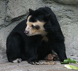
The spectacled bear, also known as the South American bear, Andean bear, Andean short-faced bear or mountain bear and locally as jukumari, ukumari (Quechua) or ukuku, is a species of bear native to the Andes Mountains in northern and western South America. It is the only living species of bear native to South America, and the last remaining short-faced bear. Its closest relatives are the extinct Tremarctos floridanus, and the giant short-faced bears, which became extinct at the end of the Pleistocene around 12,000 years ago. Unlike other omnivorous bears, the diet of the spectacled bear is mostly herbivorous. The species is classified as Vulnerable by the IUCN because of habitat loss.

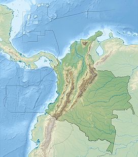
The Sierra Nevada de Santa Marta is an isolated mountain range in northern Colombia, separate from the Andes range that runs through the north of the country. Reaching an elevation of 5,700 m (18,700 ft) just 42 km (26 mi) from the Caribbean coast, the Sierra Nevada is the highest coastal range in the tropics, and one of the highest coastal ranges in the world, being 250 metres (820 ft) shorter than the Saint Elias Mountains in Canada. The Sierra Nevada encompasses about 17,000 km2 (6,600 sq mi) and serves as the source of 36 rivers. The range is in the Departments of Magdalena, Cesar and La Guajira.

Niels Kaare Krabbe is a Danish ornithologist and bird conservationist for many years based at the Vertebrate Department of the Zoological Museum, University of Copenhagen and tutored by Jon Fjeldså. His research interests include various aspects of ornithology, especially bioacoustics, conservation, and systematics and altitudinal replacements of Scytalopus tapaculos. He has worked extensively in the Andes, especially Ecuador, and wrote the passerine section of Birds of the High Andes (1990) and the accounts of most Andean species in Threatened Birds of the Americas (1992). He has helped build up a large tissue collection in the Zoological Museum and has authored or coauthored several bioacoustic publications and peer-reviewed papers in scientific journals.

The Cordillera Occidental is the lowest in elevation of the three branches of the Colombian Andes. The average altitude is 2,000 m (6,600 ft) and the highest peak is Cerro Tatamá at 4,100 m (13,500 ft). The range extends from south to north dividing from the Colombian Massif in Nariño Department, passes north through Cauca, Valle del Cauca, Risaralda, Chocó, and Caldas Departments to the Paramillo Massif in Antioquia and Córdoba Departments. The cordillera is paralleled on the east by the Cauca river. From this massif the range divides further to form the Serranías de Ayapel, San Jerónimo and Abibe. Only to recede into the Caribbean plain and the Sinú River valley.

The Yariguies brush finch is a subspecies of the yellow-breasted brush finch, discovered in 2004 in Colombia.

Scytalopus is a genus of small suboscine passerine birds belonging to the tapaculo family Rhinocryptidae. They are found in South and Central America from Tierra del Fuego to Costa Rica, but are absent from the Amazon Basin. They inhabit dense vegetation at or near ground-level and are mainly found in mountainous regions, particularly the Andes. They can be very difficult to see as they run through the undergrowth in a mouse-like fashion.

The chestnut-bellied flowerpiercer is a species of bird in the family Thraupidae. It is endemic to Colombia.
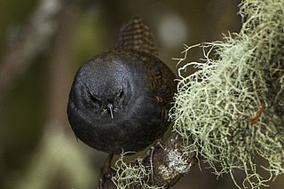
The Paramo tapaculo is a species of bird in the family Rhinocryptidae. It is found in the Andes of Ecuador and southern Colombia.
Serranía de Los Churumbelos Auka-Wasi National Natural Park was declared on 30 August 2007 by the Colombian government. It is located in the Bota Caucana of southern Colombia. Three biological expeditions conducted rapid biodiversity surveys and conservation assessments in Serranía de los Churumbelos from 1998 to 2000. The results from the expeditions were published by Fundacion ProAves in Conservacion Colombiana in 2007. These studies raised interest in the region and laid the justification for the protection of this spectacular mountain range.

The San Jorge River is a river in Colombia that begins in National Park Paramillo and that runs between the mountains of San Geronimo and Ayapel before flowing into the River Cauca in Sucre Department.
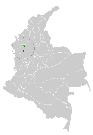
The Paramillo tapaculo is a species of bird in the family Rhinocryptidae.
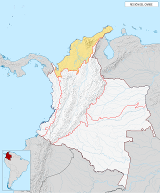
The Caribbean region is mostly lowland plains extending from the northern reaches of the Colombian Andes to the Caribbean Sea that are characterized by a variety of ecosystems including: humid forests, dry forests, savannas, wetlands and desert. The Sierra Nevada de Santa Marta rise from the plains to snow-capped peaks, separated from the Andes as an isolated area of high biodiversity and endemism. It contains one of the largest marshes in Colombia, the Ciénaga Grande de Santa Marta. The main river is the Magdalena which is fully navigable in the region and a major path for the flow of shipments to and from inland Colombia.
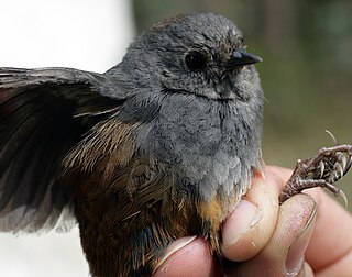
The Perijá tapaculo is a species of passerine bird in the family Rhinocryptidae (tapaculos). Endemic to the Serranía del Perijá mountain range on the Colombia–Venezuela border, the Perijá tapaculo is found at altitudes of 1,600–3,225 metres. Its body is 10 to 12 centimetres long and its tail is about 4 cm (1.6 in) long. Specimens have long been stored in museums, but the species was described only in 2015 based on sixteen specimens found between July 2008 and February 2009. It is considered vulnerable to extinction.
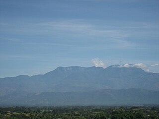
Sierra de Perijá National Park, also known as Perijá National Park is a protected area in western Venezuela, in the Serranía de Perijá mountains, on the border with Colombia. The national park, located southwest of Zulia state and Lake Maracaibo, was established in 1978 with the objective of protecting the biodiversity of the hilly regions.

The Cordillera Oriental montane forests (NT0118) is an ecoregion in Venezuela and Colombia along the east slopes of the eastern cordillera of the Andes. The extensive region of submontane and montane forests includes distinctive flora and fauna in the north, center and southern sections. The ecoregion is home to numerous endemic species of fauna. Despite extensive changes due to logging, farming and ranching, large areas of the original habitat remain intact, and the ecoregion has rich biodiversity.

The Magdalena–Urabá moist forests (NT0137) is an ecoregion in the north of Colombia. The terrain is largely flat or undulating, but includes mountainous areas in the south. It contains moist forests and large wetlands that are important to resident and migratory birds. The ecoregion forms a bridge between the Pacific coast ecoregions of Colombia and Central America, and the ecoregions of the Andes and Amazon. It is surrounded by the more populated parts of Colombia and is threatened by farming, ranching, logging, oil exploitation and water pollution in the main rivers.

The Eastern Panamanian montane forests (NT0122) is an ecoregion in the east of Panama and the extreme northwest of Colombia. It contains diverse flora and fauna, with considerable endemism. The ecoregion is largely intact due to its inaccessibility, although the opening of an extension of the Pan-American Highway has introduced threats from human activity.

The Magdalena Valley montane forests (NT0136) is an ecoregion in the Andes mountains of central Colombia.
The Tucurá Fault is a thrust fault in the departments of Córdoba and Antioquia in northern Colombia. The fault has a total length of 74.3 kilometres (46.2 mi) and runs along an average north-northwest to south-southeast strike of 356 ± 4 in the Sinú-San Jacinto Basin and the Central Ranges of the Colombian Andes. The fault is considered active because of three MW 5.7-6.7 earthquakes associated with the Tucurá Fault occurring in the twentieth century.

The Loja tapaculo is a species of bird in the family Rhinocryptidae that the South American Classification Committee of the American Ornithological Society (AOS) accepted as a new species in July 2020. It had been classified as a subspecies of paramo tapaculo. It is found in Ecuador and Peru.
