
Marramarra National Park is a protected national park that is located in the Hawkesbury region of northwestern Sydney, New South Wales, in eastern Australia. The 11,785-hectare (29,120-acre) national park is situated approximately 40 kilometres (25 mi) northwest of the Sydney central business district.

Berowra is an outer suburb of Northern Sydney located in the state of New South Wales, Australia 36 kilometres north of the Sydney central business district, in the local government area of Hornsby Shire. Berowra is south-east of the suburbs of Berowra Heights and east of Berowra Waters. The name Berowra means place of many shells, referring to the many shell middens on Berowra Creek.

Pittwater is a semi-mature tide dominated drowned valley estuary, located about 40 kilometres (25 mi) north of the Sydney central business district, New South Wales, Australia; being one of the bodies of water that separate greater Metropolitan Sydney from the Central Coast.

Mount Kuring-gai is an outer suburb of Northern Sydney, in the state of New South Wales, Australia. Mount Kuring-gai is located 31 kilometres north-west of the Sydney central business district, in the local government area of Hornsby Shire.
Berowra Heights is an outer suburb of Northern Sydney, in the state of New South Wales, Australia 39 kilometres north of the Sydney central business district, in the local government area of Hornsby Shire. Berowra Heights is north-west of the suburb of Berowra and east of Berowra Waters.
Berrilee is a semi-rural outer suburb of Sydney, in the state of New South Wales, Australia. Berrilee is located 38 kilometres north of the Sydney central business district, in the local government area of Hornsby Shire.

Berowra Waters is an outer suburb of Northern Sydney, in the state of New South Wales, Australia. Berowra is located 40 kilometres north of the Sydney central business district, in the local government area of Hornsby Shire. Berowra Waters is north-west of the suburbs of Berowra Heights and west of Berowra.
The Berowra Creek, a watercourse that is part of the Hawkesbury-Nepean catchment, is located to the north of the Sydney central business district in the Hornsby Shire of New South Wales, Australia.
The Berowra Valley Regional Park is in the Hornsby Shire in Sydney, Australia. Most of what was previously the regional park was placed in the Berowra Valley National Park in September 2012. Only a small portion remains as the regional park.

The Parish of Tarago is a parish of Argyle County. It does not actually contain the town of Tarago, which is located further to the south-east in the Parish of Mulwaree. The Parish was built by the Department of Lands in New South Wales.
The Parish of Wologorong is a parish of Argyle County, New South Wales, Australia.
The Parish of Goulburn is a parish of Argyle County which includes most of the city of Goulburn, New South Wales.

The Berowra Waters Ferry is a cable ferry across the Berowra Creek, a tributary of the Hawkesbury River, located in the Berowra Valley National Park, Sydney, Australia. The ferry operates from the community of Berowra Waters on the west bank of the creek, to a landing on the east bank, thus connecting with the road to Berowra Heights.

The Berowra Valley National Park is a protected national park that is located in northern Sydney, New South Wales, Australia. The 3,884-hectare (9,600-acre) national park is situated approximately 20 kilometres (12 mi) north-west of the Sydney central business district.

The Parish of Terrana is a parish of Argyle County, New South Wales, Australia.
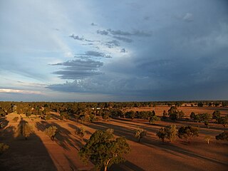
Peka, New South Wales located at 29°53'04.0"S 143°58'36.0"E is an uninhabited cadastral parish of Ularara County in north western New South Wales.
The Parish of Nocoleche is a cadastral parish of Ularara County in north western New South Wales.
Egelabra, New South Wales is a civil parish and rural locality of New South Wales located at 31°47′54″S 147°50′04″E.

The Parish of Cowan, is a civil parish of the County of Cumberland.
Coonong, New South Wales is a rural locality and civil parish of County of Landsborough located to the west of the town of Louth, New South Wales. The parish is in Bourke Shire.


