The Seat of Government Acceptance Act 1909 is an Australian Commonwealth Government act, that in conjunction with the Seat of Government Surrender Act 1909 transferred land from the state of New South Wales to the Commonwealth for the creation of the Federal Capital Territory.
Cowley County is one of the 141 Cadastral divisions of New South Wales. It contains the locality of Cavan. It was originally bordered on the north, east and part of the south by the Murrumbidgee River, and on the west by the Goodradigbee River. A large part of the county was transferred to the Commonwealth to make the Australian Capital Territory in 1909, with the remaining part the area to the north-west of the ACT as far north as the Burrinjuck Dam, and thin strips of land along the western, southern and south-eastern borders of the ACT.
Yarrolumla Parish is a former parish of Murray County, New South Wales, a cadastral unit for use on land titles. It was formed in the nineteenth century, and existed until 1 January 1911, when the Seat of Government (Administration) Act 1910 came into force, after the land was transferred to the Commonwealth government in 1909 to be used to form the Australian Capital Territory.

Tuggeranong Parish is a parish of Murray County, New South Wales, a cadastral unit for use on land titles. It is now about a third of the size it was in the nineteenth century, after most of the land in the parish was transferred to the Australian Capital Territory in 1911. It currently includes a small section of land in New South Wales between the ACT border and Jerrabomberra Creek, but once included most of what is now the Canberra town centre of Tuggeranong.

Weetangera Parish is a parish of Murray County, New South Wales, a cadastral unit for use on land titles. It is now very small, after most of the land in the parish was transferred to the Australian Capital Territory in 1911, but it once included the south-west part of what is now the Canberra town centre of Belconnen including the town centre. It currently includes a small section of land in New South Wales between the ACT border, Ginninderra Creek and the Murrumbidgee River.
Pialligo Parish is a parish of Murray County, New South Wales, a cadastral unit for use on land titles. It is now a very tiny piece of land to the north-east of the Australian Capital Territory after most of the land in the parish was transferred to the ACT in 1911. It once included the area to the east of Mount Ainslie and the north of the Molonglo River, including Mount Majura and what is now Canberra Airport, and the suburb of Pialligo.

Queanbeyan Parish is a parish of Murray County, New South Wales, a cadastral unit for use on land titles. It covers the city of Queanbeyan. It was originally bounded by the Molonglo River to the north, but is now bounded by the NSW-ACT border in the north and west. Parts of the western area of the parish were transferred to the Australian Capital Territory in 1909, including what are now the Canberra suburbs of Fyshwick, Narrabundah, Kingston, Oaks Estate, Harman and part of Hume.

Ginninderra Creek, a partly perennial stream of the Murrumbidgee catchment within the Murray-Darling basin, is located in the Capital Country region spanning both the Australian Capital Territory and New South Wales, Australia.
Naas Valley is an area south of Canberra, Australia in the Brindabella Ranges which was first settled by Europeans in 1834. The watershed of Naas Creek forms the southern and south-eastern boundary of the Australian Capital Territory, as specified in the Seat of Government Acceptance Act 1909.

Amungula Parish is a parish of Murray County, New South Wales, a cadastral unit for use on land titles. It is located in two non-contiguous sections, divided by the Australian Capital Territory, as most of the parish was transferred to the ACT in 1909 and now makes up much of the Kowen district. The northern section, the larger of the two, is located just to the south of Wamboin around 35°15′50″S149°17′29″E; the southern, a section of land between the Goulburn-Queanbeyan railway and the Molonglo River around 35°20′48″S149°19′49″E. Before 1909, the Molonglo River was the southern boundary of the parish. The Kings Highway passes through a small part of the southern remaining portion. It was formerly located in Yarrowlumla Shire, but is now located in Queanbeyan-Palerang Regional Council.

Majura Parish is a parish of Murray County, New South Wales, a cadastral unit for use on land titles. It is located to the east of the extreme eastern tip of the ACT. The Queanbeyan-Bungendore railway line and the Kings Highway pass through the parish. About a quarter of the original nineteenth-century parish was transferred to the ACT in 1909. The land transferred was the area between the railway line in the south and the watershed of the Molonglo River in the north. This cut off part of portion 210 of Majura Parish from the rest, giving the parish a small exclave.

Carwoola Parish is a parish of Murray County, a cadastral unit for use on land titles. It is located to the south of the Australian Capital Territory and to the south-east of Queanbeyan. The original northern and eastern boundary was the Molonglo River; this is still the boundary for most of the parish, except in the north, where the relatively small area north of the Queanbeyan-Goulburn railway line was transferred to the ACT in 1909. The south-western boundary is the Queanbeyan River. Captain's Flat Road is the major road running through the parish. The area also roughly aligns with the locality of Carwoola.
Gigerline Parish was a former parish of Murray County, New South Wales, a cadastral unit for use on land titles. It was formed in the nineteenth century, and existed until 1 January 1911, when the Seat of Government (Administration) Act 1910 came into force, after the land was transferred to the Commonwealth government in 1909 to be used to form the Australian Capital Territory.
Wallaroo Parish is one of the 54 parishes of Murray County, New South Wales, a cadastral unit for use on land titles. It is bounded by the Murrumbidgee River in the west, Ginninderra Creek in the south and Gooromon Ponds in the east. The Australian Capital Territory has also formed a small part of the boundary since 1909, after a small part of land in the parish at 35°11′54″S149°00′00″E was transferred to the Commonwealth. This area is just to the west of Dunlop. The Wallaroo road is the main road in the area, which comes off the Barton Highway. The parish is similar to the locality of Wallaroo.
The Parish of Wamboin is a parish of the County of Murray, a cadastral unit for use on land titles. It is located just to the north-east of the Australian Capital Territory and includes part of the town of Bungendore on the eastern edge and the rural community of Wamboin near the south-western edge.

The Parish of Bherwerre is a parish of the County of St Vincent in New South Wales which formerly included the area that is now the Jervis Bay Territory, which was transferred to the Commonwealth of Australia in 1915. Because of this, the parish is now less than half the size it was in the nineteenth century. The Jervis Bay Territory Acceptance Act of 1915 mentions that 18,000 acres (7,300 ha) of the parish were transferred to the Commonwealth. The Seat of Government Acceptance Act of 1909 mentions that three separate parcels in the parish were planned to be transferred to the Commonwealth from Bherwerre, along with land in other nearby parishes, although the actual land transfer in 1915 was only made up of land in the Parish of Bherwerre. The land mentioned in the 1909 act was a 2-square-mile (5.2 km2) portion, a 412-acre (167 ha) portion, and the 132 acres (53 ha) of Bowen Island. At the time, the parish was located in Clyde Shire.
Jerrabomberra Creek, a partly perennial stream of the Murrumbidgee catchment within the Murray-Darling basin, is located in the Capital Country region spanning both New South Wales and the Australian Capital Territory, Australia.

The Burra Creek, a mostly–perennial river that is part of the Murrumbidgee catchment within the Murray–Darling basin, is located in the Monaro and Southern Tablelands regions of New South Wales, Australia.
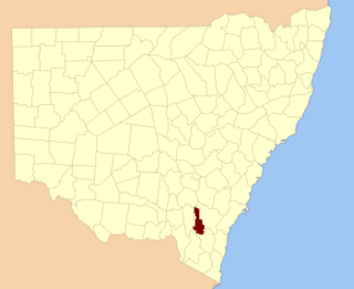
Monkellan Parish is a civil parish of Murray County, New South Wales.


