The German Federal Bureau of Aircraft Accident Investigation is the German federal agency responsible for air accident and incident investigation.

Alt-Mariendorf is a Berlin U-Bahn station located on the U 6 line. It serves as the current southern terminus of the line. It was opened in 1966. The architect of the station was R. G. Rümmler. The walls are covered with white tiles, and on the southern entrance, wood was used as a reference to the nearby church.

Kulata is a village in Petrich Municipality, Blagoevgrad Province, in southwestern Bulgaria. As of 2006 it has 892 inhabitants and the mayor is Dimitar Manolev. The village is a major border checkpoint on the border with Greece. The community of Promachonas in Serres regional unit lies across the border.

The Musée Valentin Haüy is a private museum dedicated to tools and education of the blind, and located in the building of the Valentin Haüy Association, in the 7th arrondissement of Paris at 5, rue Duroc, Paris, France. It is open Tuesday and Wednesday afternoons without charge.

Walentowo is a village in the administrative district of Gmina Lubień Kujawski, within Włocławek County, Kuyavian-Pomeranian Voivodeship, in north-central Poland. It lies approximately 3 kilometres (2 mi) south-west of Lubień Kujawski, 30 km (19 mi) south of Włocławek, and 81 km (50 mi) south-east of Toruń.
Stodolne is a village in the administrative district of Gmina Sokółka, within Sokółka County, Podlaskie Voivodeship, in north-eastern Poland, close to the border with Belarus.

Bronisławów is a village in the administrative district of Gmina Łanięta, within Kutno County, Łódź Voivodeship, in central Poland. It lies approximately 5 kilometres (3 mi) south of Łanięta, 12 km (7 mi) north-west of Kutno, and 61 km (38 mi) north of the regional capital Łódź.

Kuźnica Zagrzebska is a village in the administrative district of Gmina Klonowa, within Sieradz County, Łódź Voivodeship, in central Poland. It lies approximately 6 kilometres (4 mi) north of Klonowa, 30 km (19 mi) south-west of Sieradz, and 83 km (52 mi) south-west of the regional capital Łódź.

Okoń is a village in the administrative district of Gmina Galewice, within Wieruszów County, Łódź Voivodeship, in central Poland. It lies approximately 6 kilometres (4 mi) north of Galewice, 12 km (7 mi) north-east of Wieruszów, and 97 km (60 mi) south-west of the regional capital Łódź.

Przepiórów is a village in the administrative district of Gmina Iwaniska, within Opatów County, Świętokrzyskie Voivodeship, in south-central Poland. It lies approximately 9 kilometres (6 mi) east of Iwaniska, 12 km (7 mi) south of Opatów, and 58 km (36 mi) east of the regional capital Kielce.
Kobylany-Kozy is a village in the administrative district of Gmina Paprotnia, within Siedlce County, Masovian Voivodeship, in east-central Poland.

Ginterowo is a settlement in the administrative district of Gmina Trzcianka, within Czarnków-Trzcianka County, Greater Poland Voivodeship, in west-central Poland. It lies approximately 6 kilometres (4 mi) south-west of Trzcianka, 19 km (12 mi) north-west of Czarnków, and 79 km (49 mi) north-west of the regional capital Poznań.

Kolonia Nietoperek is a village in the administrative district of Gmina Międzyrzecz, within Międzyrzecz County, Lubusz Voivodeship, in western Poland. It lies approximately 8 kilometres (5 mi) south-west of Międzyrzecz, 44 km (27 mi) south-east of Gorzów Wielkopolski, and 50 km (31 mi) north of Zielona Góra.
Mnichus is a village in the administrative district of Gmina Ozimek, within Opole County, Opole Voivodeship, in south-western Poland.

Przyjezierze is a village in the administrative district of Gmina Moryń, within Gryfino County, West Pomeranian Voivodeship, in north-western Poland. It lies approximately 2 kilometres (1 mi) north of Moryń, 43 km (27 mi) south of Gryfino, and 62 km (39 mi) south of the regional capital Szczecin.

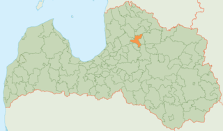
Priekuļi Municipality is a municipality in Vidzeme, Latvia. The municipality was formed in 2009 by merging Liepa parish, Mārsnēni parish, Priekuļi parish and Veselava parish the administrative centre being Priekuļi.
Qibin District is a district of the city of Hebi, Henan province, China.
Tchake is a village and rural commune in Niger.
Peshterica is a former village in Municipality of Prilep, Republic of Macedonia. Now submerged under Lake of Prilep.
The National Environment Management Authority of Uganda (NEMA), is a government agency responsible for the monitoring, coordinating, supervising and regulating the natural environment and the environmental policy of Uganda. NEMA advises the government of Uganda and spearheads the development of environmental policies, regulations, laws, guidelines and standards.


