Budziszewo is a village in the administrative district of Gmina Jabłonowo Pomorskie, within Brodnica County, Kuyavian-Pomeranian Voivodeship, in north-central Poland. It lies 5 kilometres (3 mi) south-west of Jabłonowo Pomorskie, 24 km (15 mi) north-west of Brodnica, and 50 km (31 mi) north-east of Toruń.

Kanibród is a village in the administrative district of Gmina Lubień Kujawski, within Włocławek County, Kuyavian-Pomeranian Voivodeship, in north-central Poland. It lies approximately 5 kilometres (3 mi) east of Lubień Kujawski, 29 km (18 mi) south-east of Włocławek, and 80 km (50 mi) south-east of Toruń.
Łętków is a village in the administrative district of Gmina Góra Świętej Małgorzaty, within Łęczyca County, Łódź Voivodeship, in central Poland.

Karaganly is a village in the Agsu Rayon of Azerbaijan.
Gomulin-Kolonia is a village in the administrative district of Gmina Wola Krzysztoporska, within Piotrków County, Łódź Voivodeship, in central Poland.
Niwa is a village in the administrative district of Gmina Złoczew, within Sieradz County, Łódź Voivodeship, in central Poland.

Ostrów is a village in the administrative district of Gmina Zgierz, within Zgierz County, Łódź Voivodeship, in central Poland. It lies approximately 11 kilometres (7 mi) north of Zgierz and 18 km (11 mi) north of the regional capital Łódź.

Mękarzowice is a village in the administrative district of Gmina Czarnocin, within Kazimierza County, Świętokrzyskie Voivodeship, in south-central Poland. It lies approximately 3 kilometres (2 mi) north of Czarnocin, 11 km (7 mi) north of Kazimierza Wielka, and 58 km (36 mi) south of the regional capital Kielce.

Modliszewice is a village in the administrative district of Gmina Końskie, within Końskie County, Świętokrzyskie Voivodeship, in south-central Poland. It lies approximately 4 kilometres (2 mi) west of Końskie and 40 km (25 mi) north-west of the regional capital Kielce.

Gojców is a village in the administrative district of Gmina Opatów, within Opatów County, Świętokrzyskie Voivodeship, in south-central Poland. It lies approximately 6 kilometres (4 mi) south of Opatów and 58 km (36 mi) east of the regional capital Kielce.
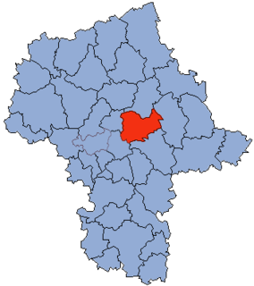
Kleniew is a village in the administrative district of Gmina Gostynin, within Gostynin County, Masovian Voivodeship, in east-central Poland.

Chmielew is a village in the administrative district of Gmina Sokołów Podlaski, within Sokołów County, Masovian Voivodeship, in east-central Poland. It lies approximately 7 kilometres (4 mi) west of Sokołów Podlaski and 82 km (51 mi) east of Warsaw.
Świdwowiec is a village in the administrative district of Gmina Trzciel, within Międzyrzecz County, Lubusz Voivodeship, in western Poland.

Kiełpinek is a village in the administrative district of Gmina Człuchów, within Człuchów County, Pomeranian Voivodeship, in northern Poland. It lies approximately 8 kilometres (5 mi) north of Człuchów and 110 km (68 mi) south-west of the regional capital Gdańsk.
Janisze is a village in the administrative district of Gmina Ełk, within Ełk County, Warmian-Masurian Voivodeship, in northern Poland.

Kwiatuszki Wielkie is a village in the administrative district of Gmina Rozogi, within Szczytno County, Warmian-Masurian Voivodeship, in northern Poland.

Mirowo is a village in the administrative district of Gmina Moryń, within Gryfino County, West Pomeranian Voivodeship, in north-western Poland. It lies approximately 5 kilometres (3 mi) north of Moryń, 40 km (25 mi) south of Gryfino, and 59 km (37 mi) south of the regional capital Szczecin.
Gonne Małe is a village in the administrative district of Gmina Barwice, within Szczecinek County, West Pomeranian Voivodeship, in north-western Poland.

The Amstelhof, was a retirement home that is the Hermitage Amsterdam museum. It was built near the Amstel river in 1682 by the diaconate of the Dutch Reformed Church after having received an inheritance of the rich merchant Barent Helleman. He died on 18 October 1680 and left approximately 90,000 guilders to the church. The city of Amsterdam donated the land on which it was built.

Gubavce is a village in the municipality of Medveđa, Serbia. According to the 2002 census, the village has a population of 36 people.


