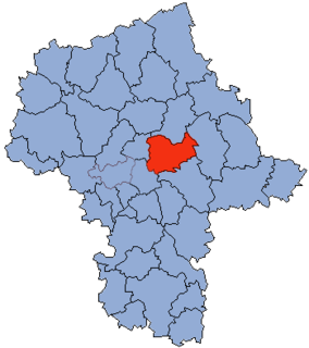
Gmina Poświętne is a rural gmina in Wołomin County, Masovian Voivodeship, in east-central Poland. Its seat is the village of Poświętne, which lies approximately 12 kilometres (7 mi) east of Wołomin and 30 km (18 mi) north-east of Warsaw.
Majdan is a village in the administrative district of Gmina Wołomin, within Wołomin County, Masovian Voivodeship, in east-central Poland. It lies approximately 5 kilometres (3 mi) east of Wołomin and 25 km (16 mi) north-east of Warsaw.
Lasków is a village in the administrative district of Gmina Dąbrówka, within Wołomin County, Masovian Voivodeship, in east-central Poland. It lies approximately 6 kilometres (4 mi) east of Dąbrówka, 18 km (11 mi) north-east of Wołomin, and 40 km (25 mi) north-east of Warsaw.
Małopole is a village in the administrative district of Gmina Dąbrówka, within Wołomin County, Masovian Voivodeship, in east-central Poland. It lies approximately 16 kilometres (10 mi) north of Wołomin and 36 km (22 mi) north-east of Warsaw.
Karolew is a village in the administrative district of Gmina Klembów, within Wołomin County, Masovian Voivodeship, in east-central Poland. It lies approximately 7 kilometres (4 mi) south-east of Klembów, 13 km (8 mi) east of Wołomin, and 33 km (21 mi) north-east of Warsaw.
Klembów is a village in Wołomin County, Masovian Voivodeship, in east-central Poland. It is the seat of the gmina called Gmina Klembów. It lies approximately 8 kilometres (5 mi) north-east of Wołomin and 30 km (19 mi) north-east of Warsaw.
Krusze is a village in the administrative district of Gmina Klembów, within Wołomin County, Masovian Voivodeship, in east-central Poland. It lies approximately 6 kilometres (4 mi) north-east of Klembów, 13 km (8 mi) north-east of Wołomin, and 35 km (22 mi) north-east of Warsaw.
Krzywica is a village in the administrative district of Gmina Klembów, within Wołomin County, Masovian Voivodeship, in east-central Poland. It lies approximately 3 kilometres (2 mi) south-east of Klembów, 9 km (6 mi) north-east of Wołomin, and 31 km (19 mi) north-east of Warsaw.
Lipka is a village in the administrative district of Gmina Klembów, within Wołomin County, Masovian Voivodeship, in east-central Poland. It lies approximately 3 kilometres (2 mi) south-east of Klembów, 9 km (6 mi) north-east of Wołomin, and 31 km (19 mi) north-east of Warsaw.
Michałów is a village in the administrative district of Gmina Klembów, within Wołomin County, Masovian Voivodeship, in east-central Poland. It lies approximately 2 kilometres (1 mi) north of Klembów, 10 km (6 mi) north-east of Wołomin, and 31 km (19 mi) north-east of Warsaw.
Ostrówek is a village in the administrative district of Gmina Klembów, within Wołomin County, Masovian Voivodeship, in east-central Poland. It lies approximately 4 kilometres (2 mi) south-east of Klembów, 10 km (6 mi) east of Wołomin, and 32 km (20 mi) north-east of Warsaw.
Rasztów is a village in the administrative district of Gmina Klembów, within Wołomin County, Masovian Voivodeship, in east-central Poland. It lies approximately 5 kilometres (3 mi) west of Klembów, 8 km (5 mi) north of Wołomin, and 29 km (18 mi) north-east of Warsaw.
Roszczep is a village in the administrative district of Gmina Klembów, within Wołomin County, Masovian Voivodeship, in east-central Poland. It lies approximately 5 kilometres (3 mi) north of Klembów, 13 km (8 mi) north-east of Wołomin, and 34 km (21 mi) north-east of Warsaw.
Tuł is a village in the administrative district of Gmina Klembów, within Wołomin County, Masovian Voivodeship, in east-central Poland. It lies approximately 6 kilometres (4 mi) south-east of Klembów, 12 km (7 mi) east of Wołomin, and 33 km (21 mi) north-east of Warsaw.
Wola Rasztowska is a village in the administrative district of Gmina Klembów, within Wołomin County, Masovian Voivodeship, in east-central Poland. It lies approximately 6 kilometres (4 mi) north-west of Klembów, 12 km (7 mi) north of Wołomin, and 33 km (21 mi) north-east of Warsaw.
Borucza is a village in the administrative district of Gmina Strachówka, within Wołomin County, Masovian Voivodeship, in east-central Poland. It lies approximately 9 kilometres (6 mi) south-west of Strachówka, 22 km (14 mi) east of Wołomin, and 42 km (26 mi) north-east of Warsaw.
Franciszków is a village in the administrative district of Gmina Tłuszcz, within Wołomin County, Masovian Voivodeship, in east-central Poland. It lies approximately 6 kilometres (4 mi) south of Tłuszcz, 17 km (11 mi) east of Wołomin, and 37 km (23 mi) north-east of Warsaw.
Szczepanek is a village in the administrative district of Gmina Tłuszcz, within Wołomin County, Masovian Voivodeship, in east-central Poland. It lies approximately 6 kilometres (4 mi) south of Tłuszcz, 15 km (9 mi) east of Wołomin, and 35 km (22 mi) north-east of Warsaw.
Leśnictwo is a village in the administrative district of Gmina Ślesin, within Konin County, Greater Poland Voivodeship, in west-central Poland. It lies approximately 6 kilometres (4 mi) east of Ślesin, 21 km (13 mi) north-east of Konin, and 100 km (62 mi) east of the regional capital Poznań.