The Tarkani or Tarkalani are a Pashtun tribe mainly settled in Bajaur District, Lower Dir district, Barawal upper dir and in Kabal and Matta tehsil of district Swat Pakistan but originally hailed from the Laghman province of modern-day Afghanistan.
The Salarzai are one of the four Tarkani clans. They inhabit what is now Bajaur District in Khyber Pakhtunkhwa, Pakistan. In 2014, they may have been the majority tribe among the area's 600,000 population. In common with some other tribes of the area, it has been reported that they have formed militias to oppose the Taliban.

Bajaur District is a district in the Malakand Division of Khyber Pakhtunkhwa province of Pakistan. Until 2018, it was an agency of the Federally Administered Tribal Areas. in 2018, it was merged with Khyber Pakhtunkhwa, after the announcement of annexing FATA with KPK. According to the 2017 census report, the population of the district was 1,093,684. It shares a 52 km border with Afghanistan's Kunar Province. The town of Khar is its district headquarter.

The Battle of Bajaur, also known as Operation Sherdil, was a military campaign in the Bajaur region of Pakistan. It was conducted on 7 August 2008 by the Frontier Corps and Infantry Brigade of Pakistan army. The operation was primarily launched to end the political movement of the Tehrik-e-Taliban Pakistan. Bajaur area was administered by Tehrik-e-Taliban Pakistan until 2007, and it remained Al-Qaeda's central command and control for carrying out activities in Northeast Afghanistan and Kunar province. Recent reports indicate that ongoing conflict has newly displaced an estimate of 7,000 people between 3 and 4 March in Nurgal district.
Inayat Killi is a town in Khar Bajaur Tehsil, Bajaur Agency, Federally Administered Tribal Areas, Pakistan. The population is 10,717 according to the 2017 census.
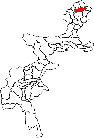
Salarzai Tehsil is a subdivision located in Bajaur District, Khyber Pakhtunkhwa, Pakistan. The population is 268,517 according to the 2017 census.

Bar Chamer Kand Tehsil is a subdivision located in Bajaur District, Khyber Pakhtunkhwa, Pakistan.
Barang Tehsil is a subdivision located in Bajaur District, Khyber Pakhtunkhwa, Pakistan.

Mamund Tehsil is a subdivision located in Bajaur District, Khyber Pakhtunkhwa, Pakistan. Mamund is the largest tehsil of district Bajaur.
Utman Khel Subdivision is a subdivision located in Bajaur District, Khyber Pakhtunkhwa, Pakistan. The population is 107,356 according to the 2017 census.
Khar Bajaur Tehsil is a subdivision located in Bajaur District, Khyber Pakhtunkhwa, Pakistan. It starts in Jar to Zorbandar (east–west) and Tangai to Inzari (northwest–southwest) and A Inayat kali to Mandalu (northeast–southeast).
Kitkot or Katkot is a village located in Mamund Tehsil, Bajaur District, Khyber Pakhtunkhwa, Pakistan. The population is 7,398 according to the 2017 census.
Bar Kamar is an area of Mamund Tehsil, Bajaur Agency, Federally Administered Tribal Areas, Pakistan. The population is 1,787 according to the 2017 census.
Chachagai is a village in Salarzai Tehsil, Bajaur Agency, Federally Administered Tribal Areas, Pakistan. The population is 956 according to the 2017 census.
Batwar is an area of Salarzai Tehsil, in Bajaur District, Khyber Pakhtunkhwa province, Pakistan. The population is 5,267 according to the 2017 census.
Begal is an area within the Salarzai Tehsil of the Bajaur District in Khyber Pakhtunkhwa, Pakistan. The population was 1,314 in the 2017 national census.
Lora Miana, or Lwara Myana is an area of Mula Gori Tehsil, Khyber Agency, Federally Administered Tribal Areas, Pakistan. The population is 7,466 according to the 2017 census.
Maimoola or Memola is an area serving as the headquarters of Barang Tehsil, Bajaur Agency, Federally Administered Tribal Areas, Pakistan. As of 2017, the population is 530.
Lagharai is a town in Mamund Tehsil, Bajaur Agency, Federally Administered Tribal Areas, Pakistan. The population is 592 according to the 2017 census.
Utmankhel Tehsil is a subdivision located in Bajaur District, Khyber Pakhtunkhwa, Pakistan. The population is 107,356 according to the 2017 census.
