Péribonka is a municipality in the Canadian province of Quebec, located in the Maria-Chapdelaine Regional County Municipality. It is situated at the mouth of the Peribonka River where it forms a bay on the north shore of Lac Saint-Jean.

Rivière-Héva is a municipality in northwestern Quebec, Canada in the La Vallée-de-l'Or Regional County Municipality. It is named after the Héva River that flows through the municipality.

Lac-Chicobi is an unorganized territory in the Canadian province of Quebec, located within the Abitibi Regional County Municipality. The area consists of two non-contiguous portions on either side of the incorporated municipality of Berry.
Dépôt-Échouani is an unorganized territory in the Outaouais region of Quebec, Canada. It is the smallest and northernmost of the five unorganized territories in the La Vallée-de-la-Gatineau Regional County Municipality. Its territory surrounds Échouani Lake and stretches along the western banks of the upper Gatineau River.

Lac-Masketsi is an unorganized territory in the Mauricie region of province of Quebec, Canada, part of the Mékinac Regional County Municipality. Most of its area is part of the Zec Tawachiche. The discharge of Masketsi Lake at the south-east flows in the Little Lake Masketsi, which empties into the Tawachiche West River.

Lake Lapeyrère is a municipal unorganized territory, part of Portneuf in Quebec, (Canada). The RCM is included in the administrative region of the Capitale-Nationale. This area of the north shore of St. Lawrence river and the west bank of the Batiscan River is located about 75 kilometers northeast of Shawinigan, Quebec. The unorganized territory Lac-Lapeyrère includes Lapeyrère Township, which was established in 1907. The canton is one sector of Portneuf Wildlife Reserve and Zec Tawachiche. Territory Lac-Lapeyrère has several major water bodies including lakes Garneau, Travers, Robinson, Casgrain, Tage and Lapeyrère, and is drained to the east by the Batiscan River.

Linton is an unorganized territory in the Capitale-Nationale region of Quebec, Canada, in the north of the Portneuf Regional County Municipality. It is named after the hamlet of Linton that is located along the Canadian National Railway and the Batiscan River.

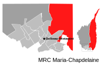
Lac-Ashuapmushuan is an unorganized territory in the Canadian province of Quebec, Canada, located in the regional county municipality of Le Domaine-du-Roy. The region had a population of 140 as of the Canada 2021 Census, and covered a land area of 14,684.28 km2. It is home to the Ashuapmushuan Wildlife Reserve.

Mont-Valin is an unorganized territory in the Canadian province of Quebec. It makes up over 87% of Le Fjord-du-Saguenay Regional County Municipality and is the largest subdivision of the Saguenay–Lac-Saint-Jean region. The territory, named after Mount Valin, had a population of 10 as of the Canada 2021 Census, and covered a land area of 33,540.39 km2.
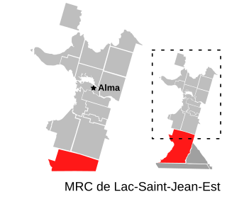
Belle-Rivière is an unorganized territory in the Canadian province of Quebec, located in the regional county municipality of Lac-Saint-Jean-Est. It had a population of 10 in the Canada 2021 Census, and covered a land area of 608.47 km2. The Métabetchouane River forms its western boundary.

Mont-Apica is an unorganized territory in the Canadian province of Quebec, located in the regional county municipality of Lac-Saint-Jean-Est. It had a population of 0 in the Canada 2011 Census, and covered a land area of 12.68 km2, entirely within the Laurentides Wildlife Reserve.

Lac-Jacques-Cartier is a large unorganized territory in the Capitale-Nationale region of Quebec, Canada, in the La Côte-de-Beaupré Regional County Municipality, making up more than 85% of this regional county. It is unpopulated and undeveloped, almost entirely part of the Jacques-Cartier National Park and the Laurentides Wildlife Reserve.

Lac-Pikauba is an unorganized territory in the Capitale-Nationale region of Quebec, Canada. It is a large, unpopulated, undeveloped territory that makes up two-thirds of the Charlevoix Regional County Municipality.

Lac-Walker is an unorganized territory in the Côte-Nord region of Quebec, Canada. It makes up more than half of the Sept-Rivières Regional County Municipality.
Rivière-Nipissis is an unorganized territory in the Côte-Nord region of Quebec, Canada, part of the Sept-Rivières Regional County Municipality.

Petit-Mécatina is an unorganized territory in the Côte-Nord region of Quebec, Canada, part of Le Golfe-du-Saint-Laurent Regional County Municipality. It was formerly part of the Minganie Regional County Municipality, but transferred to the current MRC in July 2010.
Rivière-Mouchalagane is an unorganized territory in the Côte-Nord region of Quebec, Canada, part of Caniapiscau Regional County Municipality.
Rivière-Vaseuse is an unorganized territory in the Bas-Saint-Laurent region of Quebec, Canada.

Rivière-Patapédia-Est is an unorganized territory in the Bas-Saint-Laurent region of Quebec, Canada.
The Rivière de la Grande Loutre is a tributary of the Péribonka River, flowing in the unorganized territory of Passes-Dangereuses, in the Maria-Chapdelaine Regional County Municipality, in the administrative region of Saguenay–Lac-Saint-Jean, in the province of Quebec, in Canada.