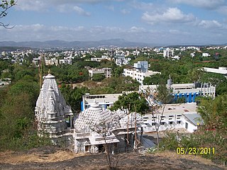
Patilpada is a village in the Palghar district of Maharashtra, India. It is located in the Talasari taluka.
Patilpada is a village in the Palghar district of Maharashtra, India. It is located in the Talasari taluka.
Patilpada is a village in the Palghar district of Maharashtra, India. It is located in the Talasari taluka.
Khunavade is a village in the Palghar district of Maharashtra, India. It is located in the Dahanu taluka.

Kosbad is a village in the Palghar district of Maharashtra, India. It is located in the Dahanu taluka.
Dehane is a village in the Palghar district of Maharashtra, India. It is located in the Dahanu taluka.
Rampur is a village in the Palghar district of Maharashtra, India. It is located in the Dahanu taluka. It lies along the Maharashtra State Highway 73.
Patilpada is a village in the Palghar district of Maharashtra, India. It is located in the Dahanu taluka.
Varkhande is a village in the Palghar district of Maharashtra, India. It is located in the Dahanu taluka.
Ghadane is a village in the Palghar district of Maharashtra, India. It is located in the Dahanu taluka.
Bodgaon is a village in the Palghar district of Maharashtra, India. It is located in the Dahanu taluka.
Dharampur is a village in the Palghar district of Maharashtra, India. It is in the Dahanu taluka.
Naruli is a village in the Palghar district of Maharashtra, India. It is located in the Dahanu taluka.
Tadiyale is a village in the Palghar district of Maharashtra, India. It is located in the Dahanu taluka, on the shore of Arabian Sea.
Peth is a village in the Palghar district of Maharashtra, India. It is located in the Dahanu taluka.
Vaghadi is a village in the Palghar district of Maharashtra, India. It is located in the Dahanu taluka.
Dhumket is a village in the Palghar district of Maharashtra, India. It is located in the Dahanu taluka.
Chandranagar is a village in the Palghar district of Maharashtra, India. It is located in the Dahanu taluka.
Kosesari is a village in the Palghar district of Maharashtra, India. It is located in the Dahanu taluka. It is in rural part of Palghar, and it is one of the 173 villages of Dahanu Block of Palghar district.
Vittalnagar is a village in the Palghar district of Maharashtra, India. It is located in the Vikramgad taluka.


