
The Deschutes River in central Oregon is a major tributary of the Columbia River. The river provides much of the drainage on the eastern side of the Cascade Range in Oregon, gathering many of the tributaries that descend from the drier, eastern flank of the mountains. The Deschutes provided an important route to and from the Columbia for Native Americans for thousands of years, and then in the 19th century for pioneers on the Oregon Trail. The river flows mostly through rugged and arid country, and its valley provides a cultural heart for central Oregon. Today the river supplies water for irrigation and is popular in the summer for whitewater rafting and fishing.

The Catawba River originates in Western North Carolina and flows into South Carolina, where it is known as the Wateree River. The river is approximately 220 miles (350 km) long. It rises in the Appalachian Mountains and drains into the Piedmont, where it has been impounded through a series of reservoirs for flood control and generation of hydroelectricity. The river is named after the Catawba tribe of Native Americans, which lives on its banks. In their language, they call themselves "yeh is-WAH h’reh", meaning "people of the river."
The Menominee River is a river in northwestern Michigan and northeastern Wisconsin in the United States. It is approximately 116 miles (187 km) long, draining a rural forested area of northern Wisconsin and the Upper Peninsula of Michigan into Lake Michigan. Its entire course, with that of its tributary, the Brule River, forms part of the boundary between the two states.

The Wolf River is a 225 mi (362 km) long tributary of the Fox River in northeastern Wisconsin in the Great Lakes region of the United States. The river is one of the two National Scenic Rivers in Wisconsin, along with the St. Croix River. The scenic portion is 24 miles (39 km) long. The river and its parent the Fox River and associated lakes are known for their sturgeon which spawn every spring upstream on the lower river until blocked by the Shawano Dam. The river flows through mostly undeveloped forestland southerly from central Forest County in the north to Lake Poygan in the south. The lake is part of the Winnebago Pool of lakes fed by both the Fox and Wolf Rivers. The Fox-Wolf basin is usually considered to be a single unified basin and the rivers themselves may be referred to as the Fox-Wolf River system.
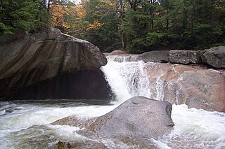
The Pemigewasset River, known locally as "The Pemi", is a river in the state of New Hampshire, the United States. It is 65.0 miles (104.6 km) in length and drains approximately 1,021 square miles (2,644 km2). The name "Pemigewasset" comes from the Abenaki word bemijijoasek [bəmidzidzoasək], meaning "where side (entering) current is".

The Flint River is a 78.3-mile-long (126.0 km) river in the Flint/Tri-Cities region of Michigan in the United States. The river's headwaters are in Columbiaville in Lapeer County and flows through the counties of Lapeer, Genesee, and Saginaw. The cities of Lapeer, Flint, Flushing, and Montrose are along its course.
The Ware River is a 35.4-mile-long (57.0 km) river in central Massachusetts. It has two forks, the both of which begin in Hubbardston, Massachusetts. The Ware River flows southwest through the middle of the state, joins the Quaboag River at Three Rivers, Massachusetts, to form the Chicopee River on its way to the Connecticut River.
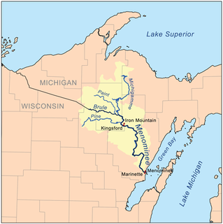
The Michigamme River is a 67.0-mile-long (107.8 km) tributary of the Menominee River on the Upper Peninsula of Michigan in the United States. Via the Menominee River, its water flows to Lake Michigan.
Boyne River is a stream in Northern Michigan, named for the River Boyne in Leinster, Ireland. Together with the north and south branches, the river system has approximately 22 miles (35 km) of mainstream and the water basin drains 40,320 acres (163.2 km2). Boyne River is Lake Charlevoix's second-largest tributary, after the Jordan River.

Harris Station Dam is a hydroelectric dam in Northeast Somerset, Somerset County, Maine. Also known as the Indian Pond Project, the dam was built from 1952 to 1954 as the largest hydroelectric dam in the state of Maine. It impounds the Kennebec River at the southern end of the natural Indian Pond, about 12 miles downstream from Moosehead Lake.

The Upper Twin Falls Bridge is a bridge that spans the Menominee River linking Breitung Township, Michigan, to Florence County, Wisconsin. Completed in 1910, construction was prompted by the erection of a dam downstream. The bridge was closed to automobile traffic in 1971. It was listed on the National Register of Historic Places in December 2012.

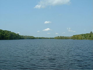
This page is about the Croton River watershed, a hydrological feature. For the component of the New York City water supply system with a similar name, see Croton Watershed

The Flat Rock Dam is a decommissioned hydroelectric gravity dam crossing the Huron River. It is located in the city of Flat Rock in Wayne County in the U.S. state of Michigan. The dam was built by the Ford Motor Company in 1924 for hydroelectricity for the nearby Ford Motor Company Lamp Factory, which remained in operation until 1950.

The Argo Dam is a decommissioned hydroelectric barrage dam crossing the Huron River. It is located in the city of Ann Arbor in Washtenaw County in the U.S. state of Michigan. It was built by the Detroit Edison Company in 1920 for hydroelectricity before being decommissioned in 1959 and sold to the city of Ann Arbor in 1963. The surrounding area is used for recreational purposes, including Argo Nature Area and Bandemer Park.

