Peel Sound

Last updated
Peel Sound
Canada Nunavut location map-lambert proj3.svg
Red pog.svg
Peel Sound
Coordinates 73°00′N096°30′W / 73.000°N 96.500°W / 73.000; -96.500 (Peel Sound) Coordinates: 73°00′N096°30′W / 73.000°N 96.500°W / 73.000; -96.500 (Peel Sound)
Basin  countries Canada
SettlementsUninhabited
Peel Sound is the next inlet west of Prince Regent Inlet Map indicating Prince Regent Inlet, Nunavut, Canada.png
Peel Sound is the next inlet west of Prince Regent Inlet

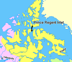
Peel Sound [1] is an Arctic waterway in the Qikiqtaaluk, Nunavut, Canada. It separates Somerset Island on the east from Prince of Wales Island on the west. To the north it opens onto Parry Channel while its southern end merges with Franklin Strait.

There are several named islands within the sound, including: Lock, Vivian, Prescott, Pandora, Otrick, Barth, De la Roquette, and Gibson.

Sir John Franklin passed through the strait in 1846 during an unseasonably warm summer,[ citation needed ] since typically Peel Sound is frozen. Its east side was traced by James Clark Ross in 1849.[ citation needed ] In 1858 Francis Leopold McClintock tried to penetrate it and was blocked by ice.[ citation needed ]

Related Research Articles

<span class="mw-page-title-main">Northwest Passage</span> Sea route north of North America

The Northwest Passage (NWP) is the sea route between the Atlantic and Pacific oceans through the Arctic Ocean, along the northern coast of North America via waterways through the Canadian Arctic Archipelago. The eastern route along the Arctic coasts of Norway and Siberia is accordingly called the Northeast Passage (NEP). The various islands of the archipelago are separated from one another and from Mainland Canada by a series of Arctic waterways collectively known as the Northwest Passages, Northwestern Passages or the Canadian Internal Waters.

<span class="mw-page-title-main">Taiwan Strait</span> Strait between Mainland China and Taiwan

The Taiwan Strait is a 180-kilometer -wide strait separating the island of Taiwan and continental Asia. The strait is part of the South China Sea and connects to the East China Sea to the north. The narrowest part is 130 km wide.

<span class="mw-page-title-main">John Rae (explorer)</span> Scottish explorer

John Rae was a Scottish surgeon who explored parts of northern Canada.

<span class="mw-page-title-main">Strait of Georgia</span> Waterway between Vancouver Island and mainland North America

The Strait of Georgia or the Georgia Strait is an arm of the Salish Sea between Vancouver Island and the extreme southwestern mainland coast of British Columbia, Canada and the extreme northwestern mainland coast of Washington, United States. It is approximately 240 kilometres (150 mi) long and varies in width from 20 to 58 kilometres. Along with the Strait of Juan de Fuca and Puget Sound, it is a constituent part of the Salish Sea.

<span class="mw-page-title-main">Torres Strait Islands</span> Group of islands in the Torres Strait between Australia and New Guinea

The Torres Strait Islands are a group of at least 274 small islands in the Torres Strait, a waterway separating far northern continental Australia's Cape York Peninsula and the island of New Guinea. They span an area of 48,000 km2 (19,000 sq mi), but their total land area is 566 km2 (219 sq mi).

<span class="mw-page-title-main">Davis Strait</span> Northern arm of the Arctic Ocean that lies between mid-western Greenland and Canadas Baffin Island

Davis Strait is a northern arm of the Atlantic Ocean that lies north of the Labrador Sea. It lies between mid-western Greenland and Baffin Island in Nunavut, Canada. To the north is Baffin Bay. The strait was named for the English explorer John Davis (1550–1605), who explored the area while seeking a Northwest Passage. By the 1650s it was used for whale hunting.

<span class="mw-page-title-main">King William Island</span> Island in Nunavut, Canada

King William Island is an island in the Kitikmeot Region of Nunavut, which is part of the Arctic Archipelago. In area it is between 12,516 km2 (4,832 sq mi) and 13,111 km2 (5,062 sq mi) making it the 61st-largest island in the world and Canada's 15th-largest island. Its population, as of the 2021 census, was 1,349, all of whom live in the island's only community, Gjoa Haven.

<span class="mw-page-title-main">Henry Larsen (explorer)</span> 20th-century Canadian Arctic explorer

Henry Asbjørn Larsen was a Norwegian-Canadian Arctic explorer. Larsen was born on a small island, Herføl, south of Fredrikstad in Norway. Like his hero, Roald Amundsen, he became a seaman. Larsen immigrated to Canada, and became a British subject in 1927. In 1928, he joined the Royal Canadian Mounted Police (RCMP).

<span class="mw-page-title-main">Leopold McClintock</span> Irish explorer in the British Royal Navy

Sir Francis Leopold McClintock was an Irish explorer in the British Royal Navy, known for his discoveries in the Canadian Arctic Archipelago. He confirmed explorer John Rae's controversial report gathered from Inuit sources on the fate of Franklin's lost expedition, the ill-fated Royal Navy undertaking commanded by Sir John Franklin in 1845 attempting to be the first to traverse the Northwest Passage.

<span class="mw-page-title-main">Joseph René Bellot</span> French polar explorer

Joseph-René Bellot was a French naval officer and Arctic explorer.

<span class="mw-page-title-main">Peel Island</span> Suburb of City of Redland, Queensland, Australia

Peel Island is a small heritage-listed island located in Moreton Bay, east of Brisbane, in South East Queensland, Australia. The island is a locality within the local government area of Redland City and a national park. In the 2016 census, Peel Island had a population of 0 people.

<span class="mw-page-title-main">Viscount Melville Sound</span> Waterway in the Northwest Territories and Nunavut, Canada

Viscount Melville Sound is an arm of the Arctic Ocean in the Kitikmeot Region, Nunavut and the Inuvik Region, Northwest Territories, Canada. Forming part of the Parry Channel, it separates Victoria Island and Prince of Wales Island from the Queen Elizabeth Islands. East of the sound, via Barrow Strait, lies Lancaster Sound, leading into Baffin Bay; westward lies the M'Clure Strait and the Arctic Ocean/Beaufort Sea. The sound is a part of the Northwest Passage.

<span class="mw-page-title-main">Bellot Strait</span> Body of water

Bellot Strait is a strait in Nunavut that separates Somerset Island to its north from the Murchison Promontory of Boothia Peninsula to its south, which is the northernmost part of the mainland of the Americas. The two-kilometre-wide (1.2 mi) and 25-kilometre-long (16 mi) strait connects the Gulf of Boothia, Prince Regent Inlet, and Brentford Bay to its east with Peel Sound and Franklin Strait to its west.

<span class="mw-page-title-main">James Clark Ross</span> British explorer and naval officer (1800–1862)

Sir James Clark Ross was a British Royal Navy officer and polar explorer known for his explorations of the Arctic, participating in two expeditions led by his uncle John Ross, and four led by William Edward Parry, and, in particular, for his own Antarctic expedition from 1839 to 1843.

<span class="mw-page-title-main">Franklin's lost expedition</span> British expedition of Arctic exploration

Franklin's lost expedition was a failed British voyage of Arctic exploration led by Captain Sir John Franklin that departed England in 1845 aboard two ships, HMS Erebus and HMS Terror, and was assigned to traverse the last unnavigated sections of the Northwest Passage in the Canadian Arctic and to record magnetic data to help determine whether a better understanding could aid navigation. The expedition met with disaster after both ships and their crews, a total of 129 officers and men, became icebound in Victoria Strait near King William Island in what is today the Canadian territory of Nunavut. After being icebound for more than a year Erebus and Terror were abandoned in April 1848, by which point Franklin and nearly two dozen others had died. The survivors, now led by Franklin's second-in-command, Francis Crozier, and Erebus's captain, James Fitzjames, set out for the Canadian mainland and disappeared, presumably having perished.

<span class="mw-page-title-main">Parry Channel</span> Natural waterway through the central Canadian Arctic Archipelago

The Parry Channel is a natural waterway through the central Canadian Arctic Archipelago. Its eastern two-thirds lie in the territory of Nunavut, while its western third lies in the Northwest Territories. It runs east to west, connecting Baffin Bay in the east with the Beaufort Sea in the west. Its eastern end is the only practical entrance to the Northwest Passage. Its western end would be a natural exit from the archipelago were it not filled with ice. The channel separates the Queen Elizabeth Islands to the north from the rest of Nunavut.

<span class="mw-page-title-main">Franklin Strait</span>

The Franklin Strait is an Arctic waterway in Northern Canada's territory of Nunavut. It is located between southeastern Prince of Wales Island and the Boothia Peninsula. It is on the south end of Peel Sound.

Nimigen Island is an uninhabited Baffin Island offshore island located in the Arctic Archipelago in Nunavut's Qikiqtaaluk Region. It lies in Cumberland Sound, approximately 10.5 km (6.5 mi) east of Robert Peel Inlet To its east is Utsusivik Island; south is Chidliak Bay.

Larsen Sound is an Arctic waterway in the Kitikmeot Region, Nunavut, Canada.

<span class="mw-page-title-main">McClintock Arctic expedition</span> British expedition of Arctic exploration

The McClintock Arctic expedition of 1857 was a British effort to locate the last remains of Franklin's lost expedition. Led by Francis Leopold McClintock, RN aboard the steam yacht Fox, the expedition spent two years in the region and ultimately returned with the only written message recovered from the doomed expedition. McClintock and crew were awarded the Arctic medal in recognition of their achievements.

References

  1. "Peel sound". tageo.com. Retrieved 2008-07-06.