
Snowdon or Yr Wyddfa is the highest mountain in Wales, at an elevation of 1,085 metres (3,560 ft) above sea level, and the highest point in the British Isles outside the Scottish Highlands. It is located in Snowdonia National Park in Gwynedd.
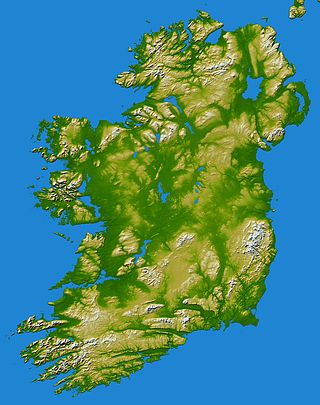
In these lists of mountains in Ireland, those within Northern Ireland, or on the Republic of Ireland – United Kingdom border, are marked with an asterisk, while the rest are within the Republic of Ireland. Where mountains are ranked by height, the definition of the topographical prominence used to classify the mountain, is noted. In British definitions, a height of 600 metres (1,969 ft) is required for a mountain, whereas in Ireland, a lower threshold of 500 metres (1,640 ft) is sometimes advocated.

Pen y Fan is the highest peak in South Wales, situated in Brecon Beacons National Park. At 886 metres (2,907 ft) above sea-level, it is also the highest British peak south of Cadair Idris in Snowdonia. It is the highest point of the historic county of Brecknockshire. The twin summits of Pen y Fan and Corn Du at 873 metres (2,864 ft) were formerly referred to as Cadair Arthur or 'Arthur's Seat'.

Aran Fawddwy is a mountain in southern Snowdonia, Wales, United Kingdom. It is the highest point of the historic county of Merionethshire. It is the highest peak in the Aran mountain range, the only peak in Wales outside North Snowdonia above 900m, and higher than anywhere in the United Kingdom outside Northern Snowdonia, the Scottish Highlands and the Lake District. The nearest urban centres to the mountain are Dinas Mawddwy to the south, Llanymawddwy to the southeast, Llanuwchllyn on the shores of Bala Lake to the north, and Rhydymain to the west. The nearest settlements with around 2,000 people are Bala and Dolgellau. On the eastern slopes of Aran Fawddwy is the small lake named Creiglyn Dyfi, the source of the River Dyfi. Its sister peak is Aran Benllyn at 885 metres (2,904 ft). There is also a middle peak- Erw y Ddafad-ddu.

Moel Hebog is a mountain in Snowdonia, north Wales which dominates the view west from the village of Beddgelert. It gives name to a whole range of peaks in the north-western corner of Snowdonia, which include the Nantlle Ridge and Mynydd Mawr.

Cadair Berwyn or Cader Berwyn is a mountain summit in north-east Wales with a height of 832 metres (2,730 ft) above sea level. It is the highest point in the Berwyn range, the highest in North East Wales and the highest significant summit in Wales outside the National Parks. Cadair Berwyn and Foel Cedig to the west are the two Marilyns that form the Berwyn range. The undulating plateau of the range also includes a large number of other summits above 2,000 feet (610 m), including satellite summits of Cadair Berwyn and many which are classed as Nuttalls.

The Black Mountains are a group of hills spread across parts of Powys and Monmouthshire in southeast Wales, and extending across the England–Wales border into Herefordshire. They are the easternmost of the four ranges of hills that comprise the Bannau Brycheiniog National Park, and are frequently confused with the westernmost, which is known as the Black Mountain. The Black Mountains may be roughly defined as those hills contained within a triangle defined by the towns of Abergavenny in the southeast, Hay-on-Wye in the north and the village of Llangors in the west. Other gateway towns to the Black Mountains include Talgarth and Crickhowell. The range of hills is well known to walkers and ramblers for the ease of access and views from the many ridge trails, such as that on the Black Hill (Herefordshire) at the eastern edge of the massif. The range includes the highest public road in Wales at Gospel Pass, and the highest point in southern England at Black Mountain.

Foel-fras (944 m) is a mountain in the Carneddau range, about 10 km east of Bethesda in Wales. It lies on the border between the counties of Gwynedd and Conwy. With a summit elevation of 944 m it is officially the eleventh-highest summit in Wales. Foel-fras is located at the northern end of the main ridge of the Carneddau, between Drum to the north and Foel Grach to the south, with the subsidiary summit of Garnedd Uchaf (925 m) between it and Foel Grach. Due south and 400 m below lies the reservoir of Llyn Dulyn, while the smaller reservoir of Llyn Anafon lies to the north.

The mountains and hills of the British Isles are categorised into various lists based on different combinations of elevation, prominence, and other criteria such as isolation. These lists are used for peak bagging, whereby hillwalkers attempt to reach all the summits on a given list, the oldest being the 282 Munros in Scotland, created in 1891.
Fan y Big is a subsidiary summit of Waun Rydd in the Brecon Beacons National Park, in southern Powys, Wales. It is 716.6 m (2,351 ft) high and is often hiked as part of the Horseshoe Walk, a traverse of the four main peaks in the Brecon Beacons.
Pen Pumlumon Llygad-bychan is a subsidiary summit of Pen Pumlumon Fawr and the third highest summit on the Plynlimon massif, a part of the Cambrian Mountains in the county of Ceredigion, Wales. It is not named on Ordnance Survey walking maps.
Pen Pumlumon Arwystli is the second highest summit on the Plynlimon massif, a part of the Cambrian Mountains in the county of Ceredigion, Wales.

Gwaun y Llwyni is a subsidiary summit of Aran Fawddwy in southern Snowdonia, Wales. It forms a part of the Aran mountain range.

Aran Benllyn is a subsidiary summit of Aran Fawddwy in southern Snowdonia, North Wales, Wales, United Kingdom. It is the second highest peak in the Aran mountain range.

Waun Camddwr is a top of Aran Fawddwy in the south of the Snowdonia National Park in Gwynedd, Wales. It is the highest point on a wide boggy area between the summits of Aran Fawddwy and Glasgwm. It was surveyed after the first Nuttall list was compiled, and found to have just enough prominence to be included. The summit is a rocky outcrop amid an area of heather, long grass and peat bog. Gwaun y Llwyni rises to the south of the summit.

Glasgwm is a mountain in Gwynedd, Wales forming part of the Aran range in southern Snowdonia. It is one of the three Marilyns that make up the range, the others being Aran Fawddwy and Esgeiriau Gwynion. To the west is Maesglase and the Dyfi hills, while to the south-west lies Cadair Idris. To the south lies the Plynlimon range. It is 779 metres (2,556 ft) high.

Foel Goch is a subsidiary summit of Esgeiriau Gwynion, and is included in a group of hills known as the Hirnantau. These hills rise from the south east shores of Bala Lake.

Esgeiriau Gwynion is a mountain in north Wales. It is the smallest of the three Marilyns that form the Aran range, the others being Aran Fawddwy and Glasgwm.

Pen yr Allt Uchaf is a subsidiary summit of Aran Fawddwy in the south of the Snowdonia National Park in Gwynedd, Wales. The summit is the highest point on a ridge branching off to the west of Aran Fawddwy's south ridge.
