Pendleton District, South Carolina

Last updated
Farmers' Hall, whose construction was begun for the second Pendleton District court house. Farmers' Hall, Pendleton, South Carolina.jpg
Farmers' Hall, whose construction was begun for the second Pendleton District court house.

Pendleton District, named after US Judge Henry Pendleton, is a former judicial district in South Carolina. It existed as a county or a district from 7 March 1789 to 20 December 1826.

South Carolina State of the United States of America

South Carolina is a state in the Southeastern United States and the easternmost of the Deep South. It is bordered to the north by North Carolina, to the southeast by the Atlantic Ocean, and to the southwest by Georgia across the Savannah River.

In the colonial period, the land around the coast was divided into parishes corresponding to the parishes of the Church of England. There were also several counties that had judicial and electoral functions. As people settled the backcountry, judicial districts and additional counties were formed. This structure continued and grew after the Revolutionary War. In 1800, all counties were renamed as districts. In 1868, the districts were converted back to counties. [1] The South Carolina Department of Archives and History has maps that show the boundaries of counties, districts, and parishes starting in 1682. [2]

Church of England Anglican state church of England

The Church of England is the established church of England. The Archbishop of Canterbury is the most senior cleric, although the monarch is the supreme governor. The Church of England is also the mother church of the international Anglican Communion. It traces its history to the Christian church recorded as existing in the Roman province of Britain by the third century, and to the 6th-century Gregorian mission to Kent led by Augustine of Canterbury.

American Revolutionary War War between Great Britain and the Thirteen Colonies, which won independence as the United States of America

The American Revolutionary War (1775–1783), also known as the American War of Independence, was an 18th-century war between Great Britain and its Thirteen Colonies which declared independence as the United States of America.

Pendleton County was created on 7 March 1789 in the former Indian lands. It included the current Anderson and Pickens counties and all but about 70 square miles (180 km2) along the Chattooga River of Oconee County. The land along the Chattooga belonged the Cherokee and Creek peoples. Pendleton County was attached to Abbeville.

Anderson County, South Carolina County in the United States

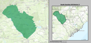
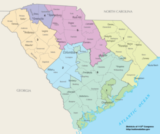
Anderson County is a county located in the U.S. state of South Carolina. As of the 2010 census, its population was 187,126. Its county seat is Anderson. Named for Revolutionary War leader Robert Anderson, the county is located in northwestern South Carolina, along the Georgia border.

Pickens County, South Carolina County in the United States

Pickens County is a county in the northwest part of the U.S. state of South Carolina. As of the 2010 census, its population was 119,224. Its county seat is Pickens. The county was created in 1826.

Chattooga River river in the United States of America

The Chattooga River is the main tributary of the Tugaloo River. Its headwaters are located southwest of Cashiers, North Carolina, and it stretches 57 miles (92 km) to where it has its confluence with the Tallulah River within Lake Tugalo, held back by the Tugalo Dam. The Chattooga and the Tallulah combine to make the Tugaloo River starting at the outlet of Lake Tugalo. The Chattooga begins in southern Jackson County, North Carolina, then flows southwestward between northwestern Oconee County, South Carolina, and eastern Rabun County, Georgia. The "Chattooga" spelling was approved by the US Board on Geographic Names in 1897.

On 19 February 1791, Pendleton County became part of the new Washington District, which also included most of Greenville County. On 1 January 1800, Washington District was disbanded. Pendleton County and Greenville County were renamed as districts.

Washington District is a former judicial district in South Carolina. It existed as a district from 19 February 1791 to 1 January 1800. The court house and jail for Washington District were in Pickensville, South Carolina.

Greenville County, South Carolina County in the United States

Greenville County is a county located in the state of South Carolina, in the United States. As of the 2010 census, the population was 451,225, making it the most populous county in the state. In 2017, the estimated population of the county was 506,837. Its county seat is Greenville. The county is also home to the Greenville County School District, the largest school system in South Carolina. County government is headquartered at Greenville County Square.

On 19 December 1816, Pendleton District gained the Indian lands along the Chattooga. Finally, on 20 December 1826, the Pendleton District was abolished and replaced by Anderson and Pickens Districts. Pickens District incorporated both the current Pickens and Oconee Counties. [3]

Oconee County, South Carolina County in the United States

Oconee County is the westernmost county in the U.S. state of South Carolina. As of the 2010 census, the population was 74,273. Its county seat is Walhalla.

The court house and jail for Pendleton District were in Pendleton, South Carolina. As the time of the dissolution of the district, its second court house was under construction. This was completed by the Pendleton Farmers' Society. It is still standing in on the Pendleton Square and is part of the Pendleton Historic District. [4]

Pendleton, South Carolina Town in South Carolina, United States

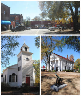
Pendleton is a town in Anderson County, South Carolina, United States. The population was 2,964 at the 2010 census. It is a sister city of Stornoway in the Outer Hebrides of Scotland.

Pendleton Historic District (Pendleton, South Carolina)

Pendleton Historic District in Pendleton, South Carolina is a historic district which is located mostly in Anderson County, South Carolina and partly in Pickens County, South Carolina. The district was listed on the National Register of Historic Places in 1970. The historic district includes the town of Pendleton and its immediate surroundings plus a large tract west towards Lake Hartwell to include the Hopewell Keowee Monument and the Treaty Oak Monument. The entire historic district covers an area of over 6,300 acres (25 km2).

Related Research Articles

Anderson, South Carolina City in South Carolina, United States

Anderson is a city in and the county seat of Anderson County, South Carolina, United States. The population was 26,686 at the 2010 census, and the city was the center of an urbanized area of 75,702. It is one of the principal cities in the Greenville-Anderson--Mauldin Metropolitan Statistical Area, which had a population of 824,112 at the 2010 census. It is further included in the larger Greenville-Spartanburg-Anderson, South Carolina Combined Statistical Area, with a total population of 1,266,995, at the 2010 census. Anderson is just off Interstate 85 and is 120 miles (190 km) from Atlanta and 140 miles (230 km) from Charlotte.

Easley, South Carolina City in South Carolina, United States

Easley is a city in Pickens County in the State of South Carolina. It is a principal city of the Greenville–Mauldin–Easley Metropolitan Statistical Area. Most of the city lies in Pickens County, with only a very small portion of the city in Anderson County.

Liberty, South Carolina City in South Carolina, United States

Liberty is a city in Pickens County, South Carolina, United States. It is part of the Greenville–Mauldin–Easley Metropolitan Statistical Area. The city was chartered on March 2, 1876.

Pickens, South Carolina City in South Carolina, United States

Pickens, formerly called Pickens Courthouse, is a city in Pickens County, South Carolina, United States. The population was 3,126 at the 2010 census. Pickens changed its classification from a town to a city in 1998, but it was not reported to the Census Bureau until 2001. It is the county seat of Pickens County. It was named after Andrew Pickens (1739–1817), an American revolutionary soldier and US Congressman for South Carolina.

U.S. Route 123 is a spur of US 23 in the U.S. states of Georgia and South Carolina. The U.S. Highway runs 75.12 miles (120.89 km) from US 23, US 441, and SR 365 near Clarkesville, Georgia, north and east to Interstate 385 Business in Greenville, South Carolina. US 123 parallels I-85 to the north as it connects the Northeast Georgia cities of Clarkesville and Toccoa with the western Upstate South Carolina communities of Westminster, Seneca, Clemson, Easley, and Greenville.

Upstate South Carolina CSA in South Carolina, United States

The Upstate is the region in the westernmost part of South Carolina, United States, also known as the Upcountry, which is the historical term. Although loosely defined among locals, the general definition includes the ten counties of the commerce-rich I-85 corridor in the northwest corner of South Carolina. This definition coincides with the Greenville–Spartanburg–Anderson, SC Combined Statistical Area, as first defined by the Office of Management and Budget in 2015, and maintained as of 2017. The region's population was 1,347,112 as of 2016. Situated between Atlanta and Charlotte, the Upstate is the fastest-growing region of South Carolina, and is the geographical center of the Charlanta mega-region. After BMW's initial investment, foreign companies, including others from Germany, have a substantial presence in the Upstate; several large corporations have established regional, national, or continental headquarters in the area. Greenville is the largest city in the region with a population of 67,453 and an urban-area population of 400,492, and it is the base of most commercial activity. Spartanburg and Anderson are next in population.

South Carolinas 3rd congressional district

The 3rd Congressional District of South Carolina is a congressional district in western South Carolina bordering both Georgia and North Carolina. It includes all of Abbeville, Anderson, Edgefield, Greenwood, Laurens, McCormick, Oconee, Pickens and Saluda counties and portions of Greenville and Newberry counties. The district is mostly rural, but much of the economy revolves around the manufacturing centers of Anderson and Greenwood.

South Carolinas congressional districts

There are currently seven United States congressional districts in South Carolina. There have been as few as four and as many as nine congressional districts in South Carolina. The 9th district and the 8th district were lost after the 1840 Census. Because the state exceeded the nation's average population growth in the 2010 Census, South Carolina regained its 7th district, which had remained unused since the Civil War.

Area code 864

Area code 864 is an area code in the U.S. state of South Carolina that covers Greenville, Spartanburg, Anderson and the other parts of upstate South Carolina. It was split from area code 803 on December 3, 1995.

Sumter National Forest

The Sumter National Forest is one of two forests in South Carolina that are managed together by the United States Forest Service, the other being the Francis Marion National Forest. The Sumter National Forest consists of 370,442 acres (1,499.13 km2) which are divided into several non-contiguous sections in western South Carolina. Overall, in descending order of land area the forest is located in parts of Oconee, Union, Newberry, McCormick, Edgefield, Abbeville, Laurens, Chester, Fairfield, Greenwood, and Saluda counties. Forest headquarters of both South Carolina forests are located together in the state's capital city of Columbia.

Robert Anderson (Revolutionary War) American politician, militia officer, and surveyor

Robert Anderson was a politician, militia officer, and surveyor from South Carolina. He was a lifelong friend of General Andrew Pickens. Anderson, South Carolina, Anderson County, South Carolina, and the ghost town of Andersonville are named for him.

Old Stone Church and Cemetery historic church in Clemson, South Carolina

Old Stone Church is a church building built in 1802. When it was constructed, it was in the Pendleton District, South Carolina. When Pendleton District was divided in 1826, the church was in Pickens District. When Pickens District was split in 1868, it was in Oconee County, South Carolina. In 1968, this section of Oconee County was annexed back to Pickens County. The church is about midway between the centers of Pendleton and Clemson. It is now in the city limits of Clemson.

Ninety-Six District is a former judicial district in the U.S. state of South Carolina. It existed as a district from 29 July 1769 to 31 December 1799. The court house and jail for Ninety-Six District were in Ninety Six, South Carolina.

Northeast Georgia

Northeast Georgia is a region of Georgia in the United States. The northern part is also in the north Georgia mountains, while the southern part is still hilly but much flatter in topography. Northeast Georgia is also served by the Asheville/Spartanburg/Greenville/Anderson market.

References

  1. Edgar, Walter, ed. The South Carolina Encyclopedia, University of South Carolina Press, 2006, pp. 230-234, ISBN   1-57003-598-9
  2. South Carolina Department of Archives and History maps Archived 2007-08-19 at the Wayback Machine ..
  3. DenBoer, Gordon, and Thorne, Kathryn Ford, South Carolina Atlas of Historical County Boundaries, Charles Scribner's Sons, New York, 1997, p. 168, ISBN   0-13-366360-4.
  4. Simpson, R. W., History of Old Pendleton District, Oulla Printing and Binding Co., Anderson, South Carolina, 1913.

Coordinates: 34°35′N82°46′W / 34.59°N 82.77°W / 34.59; -82.77