Related Research Articles
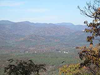
Pickens County is located in the northwest part of the U.S. state of South Carolina. As of the 2020 census, its population was 131,404. Its county seat is Pickens. The county was created in 1826. It is part of the Greenville-Anderson-Greer, SC Metropolitan Statistical Area.

Oconee County is the westernmost county in the U.S. state of South Carolina. As of the 2020 census, the population was 78,607. Its county seat is Walhalla and its largest community is Seneca. Oconee County is included in the Seneca, SC Micropolitan Statistical Area, which is also included in the Greenville-Spartanburg-Anderson, SC Combined Statistical Area. South Carolina Highway 11, the Cherokee Foothills National Scenic Highway, begins in southern Oconee County at Interstate Highway 85 at the Georgia state line.

Greenville County is located in the U.S. state of South Carolina. As of the 2020 census, the population was 525,534, making it the most populous county in the state. Its county seat is Greenville. The county is also home to the Greenville County School District, the largest school system in South Carolina. County government is headquartered at Greenville County Square.

Anderson County is a county located in the U.S. state of South Carolina. As of the 2020 census, its population was 203,718. Its county seat is Anderson. Named for Revolutionary War leader Robert Anderson, the county is located in northwestern South Carolina, along the state line of Georgia. Anderson County is included in the Greenville-Anderson-Greer, SC Metropolitan Statistical Area. Anderson County contains 55,950-acre (22,640 ha) Lake Hartwell, a U.S. Army Corps of Engineers lake with nearly 1,000 miles (1,600 km) of shoreline for residential and recreational use. The area is a growing industrial, commercial and tourist center. It is the home of Anderson University, a private, selective comprehensive university of approximately 4,000 undergraduate and graduate students.
Scouting in South Carolina has a long history, from the 1910s to the present day, serving thousands of youth in programs that suit the environment in which they live.
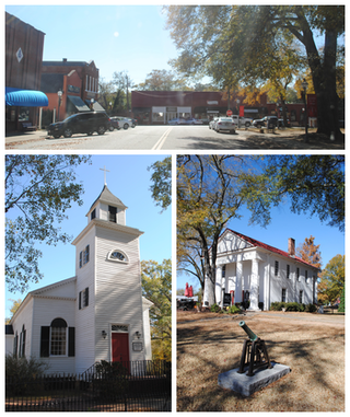
Pendleton is a town in Anderson County, South Carolina, United States. The population was 3,489 at the 2020 census. It is a sister city of Stornoway in the Outer Hebrides of Scotland.

Easley is a city in Pickens County in the U.S. state of South Carolina. Most of the city lies in Pickens County, with a small portion of the city in Anderson County.

Liberty is a city in Pickens County, South Carolina, United States. It is part of the Greenville–Mauldin–Easley Metropolitan Statistical Area. The city was chartered on March 2, 1876.

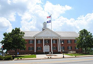
Pickens, formerly called Pickens Courthouse, is a city in and the county seat of Pickens County, South Carolina, United States. The population was 3,126 at the 2010 census. Pickens changed its classification from a town to a city in 1998, but it was not reported to the Census Bureau until 2001. It was named after Andrew Pickens (1739–1817), an American revolutionary soldier and US Congressman for South Carolina.
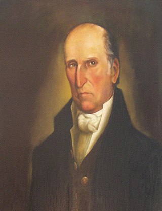
Andrew Pickens was a militia leader in the American Revolution. A planter and slaveowner, he developed his Hopewell plantation on the east side of the Keowee River across from the Cherokee town of Isunigu (Seneca) in western South Carolina. He was elected as a member of the United States House of Representatives from western South Carolina. Several treaties with the Cherokee were negotiated and signed at his plantation of Hopewell.

This is a list of the properties and historic districts in each of the 46 counties of South Carolina that are designated National Register of Historic Places.

There are currently seven United States congressional districts in South Carolina. There have been as few as four and as many as nine congressional districts in South Carolina. The 9th district and the 8th district were lost after the 1840 census. The 5th district and the 6th district were also briefly lost after the Civil War, but both had been regained by the 1880 census. Because of the state population growth in the 2010 census, South Carolina regained its 7th district, which had remained unused since the Civil War.

Robert Anderson was a politician, militia officer, and surveyor from South Carolina. He was a lifelong friend of General Andrew Pickens. Anderson, South Carolina, Anderson County, South Carolina, and the ghost town of Andersonville are named for him.

Pendleton District, named after US Judge Henry Pendleton, is a former judicial district in South Carolina. It existed as a county or a district from 7 March 1789 to 20 December 1826.
Ninety-Six District is a former judicial district in the U.S. state of South Carolina. It existed as a district from July 29, 1769 to December 31, 1799. The court house and jail for Ninety-Six District were in Ninety Six, South Carolina.

The 2008 South Carolina Senate elections were held on Tuesday, November 4, 2008. The primary elections were held on June 10 and the runoff elections were held two weeks later on June 24. The current composition of the state delegation is 27 Republicans and 19 Democrats. Senators are elected for four-year terms, all in the same year.
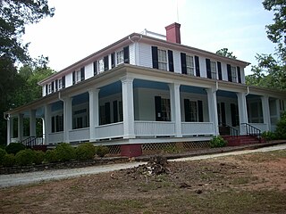
Ashtabula is a plantation house at 2725 Old Greenville Highway near Pendleton in Anderson County, South Carolina, USA. It has been also known as the Gibbes-Broyles-Latta-Pelzer House or some combination of one or more of these names. It was named in the National Register of Historic Places as a historic district on March 23, 1972. It is considered a significant example of a Lowcountry style plantation house built for a Charleston family in the Upstate in the early 19th century. It also is part of the Pendleton Historic District.
Tamassee is an unincorporated community and census-designated place (CDP) located in northwestern Oconee County, South Carolina, United States. It was first listed as a CDP in the 2020 census with a population of 60.
References
- ↑ Edgar, Walter, ed. The South Carolina Encyclopedia, University of South Carolina Press, 2006, pp. 230-234, ISBN 1-57003-598-9
- ↑ South Carolina Department of Archives and History maps.
- ↑ DenBoer, Gordon, and Thorne, Kathryn Ford, South Carolina Atlas of Historical County Boundaries, Charles Scribner's Sons, New York, 1997, pp. 249-250, ISBN 0-13-366360-4.
- ↑ McFall, Pearl Smith, It Happened in Pickens County, Sentinel Press, Pickens, SC, 1959, pp. 41-48.
- ↑ Aheron, Piper Peters, Images of America: Pickens County, Arcadia Publishing, Charleston, SC, 2000, p. 12, ISBN 0-7385-0606-0.