Penna San Giovanni | ||
---|---|---|
Comune | ||
Comune di Penna San Giovanni | ||
| ||
Coordinates: 43°3′N13°26′E / 43.050°N 13.433°E | ||
Country | Italy | |
Region | Marche | |
Province | Macerata (MC) | |
Government | ||
• Mayor | Emanuele Crisostomi | |
Area | ||
• Total | 28 km2 (11 sq mi) | |
Elevation | 630 m (2,070 ft) | |
Population (31 December 2010) [1] | ||
• Total | 1,176 | |
• Density | 42/km2 (110/sq mi) | |
Demonym(s) | Pennesi | |
Time zone | CET (UTC+1) | |
• Summer (DST) | CEST (UTC+2) | |
Postal code | 62020 | |
Dialing code | 0733 | |
Patron saint | St. John the Baptist | |
Saint day | 29 August - 24 June | |
Website | Official website |
Penna San Giovanni is a comune (municipality) in the Province of Macerata in the Italian region Marche, located about 60 kilometres (37 mi) south of Ancona and about 30 kilometres (19 mi) south of Macerata.
The comune is a basic administrative division in Italy, roughly equivalent to a township or municipality.
The province of Macerata is a province in the Marche region of Italy. Its capital is the city of Macerata. The province includes 55 comunes in the province, see Comunes of the Province of Macerata. Located between the rivers Potenza (Flosis) and Chienti, both of which originate in the province, the city of Macerata is located on a hill.
Italy, officially the Italian Republic, is a European country consisting of a peninsula delimited by the Italian Alps and surrounded by several islands. Located in the middle of the Mediterranean sea and traversed along its length by the Apennines, Italy has a largely temperate seasonal climate. The country covers an area of 301,340 km2 (116,350 sq mi) and shares open land borders with France, Slovenia, Austria, Switzerland and the enclaved microstates of Vatican City and San Marino. Italy has a territorial exclave in Switzerland (Campione) and a maritime exclave in the Tunisian sea (Lampedusa). With around 60 million inhabitants, Italy is the fourth-most populous member state of the European Union.
Penna San Giovanni borders the following municipalities: Amandola, Falerone, Gualdo, Monte San Martino, Sant'Angelo in Pontano, Servigliano.
Amandola is a comune (municipality) in the Province of Fermo in the Italian region Marche, located about 70 kilometres (43 mi) south of Ancona, about 25 kilometres (16 mi) northwest of Ascoli Piceno and about 35 kilometres (22 mi) west of Fermo. The city was founded in 1248 by the union of the castles of Agello Leone and Marrubbione, which formed a free municipality.
Falerone is a town and comune in province of Fermo, in the Italian region of the Marche, southeast of Urbisaglia.
Monte San Martino is a comune (municipality) in the Province of Macerata in the Italian region Marche, located about 70 kilometres (43 mi) south of Ancona and about 30 kilometres (19 mi) south of Macerata. There are 808 people in the village.
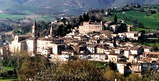
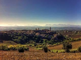
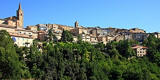
Penna is an ancient hill top town. There are half a dozen churches and a small early 18th-century theatre, Teatro Flora. At the very top of the town are the remains of the ancient fort with a panoramic view up to the mountains and looking out at the surrounding hilltop towns. In the summer the municipality organizes events on numerous evenings, including the Festa della Polenta and Otto Giorni Di Un Linguaggio Volgare.
The Flora Theater is a small 18th-century performing arts theater located in the Palazzo dei Priori in center of the town of Penna San Giovanni, province of Macerata, region of Marche, Italy.
Appignano is a comune (municipality) in the Province of Macerata in the Italian region Marche, located about 35 kilometres (22 mi) southwest of Ancona and about 20 kilometres (12 mi) northwest of Macerata.
Belforte del Chienti is a comune (municipality) in the province of Macerata in the Italian region Marche, located about 80 kilometres (50 mi) south of Ancona and about 50 kilometres (31 mi) southeast of Macerata.
Bolognola is a comune (municipality) in the Province of Macerata in the Italian region Marche, located about 70 kilometres (43 mi) southwest of Ancona and about 40 kilometres (25 mi) southwest of Macerata.
Caldarola is a comune (municipality) in the Province of Macerata in the Italian region Marche, located about 60 kilometres (37 mi) southwest of Ancona and about 25 kilometres (16 mi) southwest of Macerata.
Camporotondo di Fiastrone is a comune (municipality) of about 580 inhabitants in the Province of Macerata in the Italian region Marche, located about 60 kilometres (37 mi) southwest of Ancona and about 25 kilometres (16 mi) southwest of Macerata.
Cessapalombo is a comune (municipality) in the Province of Macerata in the Italian region Marche, located about 60 kilometres (37 mi) southwest of Ancona and about 25 kilometres (16 mi) southwest of Macerata.
Corridonia is a comune (municipality) in the Province of Macerata in the Italian region Marche, located about 40 kilometres (25 mi) south of Ancona and about 8 kilometres (5 mi) southeast of Macerata.
Fiuminata is a comune (municipality) in the Province of Macerata in the Italian region Marche, located about 70 kilometres (43 mi) southwest of Ancona and about 45 kilometres (28 mi) southwest of Macerata. The municipal seat is in the frazione of Massa.
Gagliole is a comune (municipality) in the Province of Macerata in the Italian region Marche, located about 60 kilometres (37 mi) southwest of Ancona and about 30 kilometres (19 mi) west of Macerata.
Gualdo is a comune (municipality) in the Province of Macerata in the Italian region Marche, located about 90 kilometres (56 mi) southwest of Ancona and about 50 kilometres (31 mi) southwest of Macerata. As of 31 December 2004, it had a population of 924 and an area of 22.1 square kilometres (8.5 sq mi).
Loro Piceno is a comune (municipality) in the Province of Macerata in the Italian region Marche, located about 50 kilometres (31 mi) south of Ancona and about 15 kilometres (9 mi) south of Macerata on a hill near the Fiastra stream.
Montecassiano is a comune (municipality) in the Province of Macerata in the Italian region Marche, located about 30 kilometres (19 mi) south of Ancona and about 8 kilometres (5 mi) north of Macerata.
Monte San Giusto is a comune (municipality) in the Province of Macerata in the Italian region Marche, located about 45 kilometres (28 mi) south of Ancona and about 14 kilometres (9 mi) southeast of Macerata.
Morrovalle is a comune (municipality) in the Province of Macerata in the Italian region Marche, located about 35 kilometres (22 mi) south of Ancona and about 11 kilometres (7 mi) east of Macerata.
Pollenza is a comune (municipality) in the Province of Macerata in the Italian region Marche, located about 40 kilometres (25 mi) southwest of Ancona and about 9 kilometres (6 mi) southwest of Macerata. As of 31 December 2004, it had a population of 6,086 and an area of 39.5 square kilometres (15.3 sq mi).
Ripe San Ginesio is a comune (municipality) in the Province of Macerata in the Italian region Marche, located about 50 kilometres (31 mi) south of Ancona and about 20 kilometres (12 mi) southwest of Macerata.
San Ginesio is a comune (municipality) in the Province of Macerata in the Italian region Marche, located about 60 kilometres (37 mi) southwest of Ancona and about 25 kilometres (16 mi) southwest of Macerata. As of 31 December 2004, it had a population of 3,872 and an area of 77.7 square kilometres (30.0 sq mi).
Serravalle di Chienti is a comune (municipality) in the Province of Macerata in the Italian region Marche, located about 80 kilometres (50 mi) southwest of Ancona and about 50 kilometres (31 mi) southwest of Macerata. It is crossed by the Chienti river. The communal territory is largely mountainous with numerous woods and pastures.
Servigliano is a comune (municipality) in the Province of Fermo in the Italian region Marche, located about 60 kilometres (37 mi) south of Ancona and about 25 kilometres (16 mi) north of Ascoli Piceno. As of 31 December 2004, it had a population of 2,349 and an area of 18.5 square kilometres (7.1 sq mi).
This Marche location article is a stub. You can help Wikipedia by expanding it. |