
Galzignano Terme is a comune (municipality) in the Province of Padua in the Italian region Veneto, located about 50 kilometres (31 mi) southwest of Venice and about 15 kilometres (9 mi) southwest of Padua.

Piandimeleto is a comune (municipality) in the Province of Pesaro e Urbino in the Italian region Marche, located about 90 kilometres (56 mi) west of Ancona and about 45 kilometres (28 mi) southwest of Pesaro.
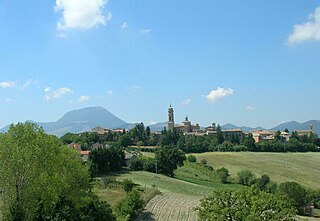
Apiro is a comune (municipality) in the Province of Macerata in the Italian region Marche, located about 40 kilometres (25 mi) southwest of Ancona and about 25 kilometres (16 mi) northwest of Macerata.

Bolognola is a comune (municipality) in the Province of Macerata in the Italian region Marche, located about 70 kilometres (43 mi) southwest of Ancona and about 40 kilometres (25 mi) southwest of Macerata.
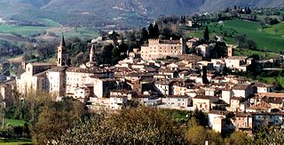
Caldarola is a comune (municipality) in the Province of Macerata in the Italian region Marche, located about 60 kilometres (37 mi) southwest of Ancona and about 25 kilometres (16 mi) southwest of Macerata.

Castelraimondo is a comune (municipality) in the Province of Macerata in the Italian region Marche, located about 60 kilometres (37 mi) southwest of Ancona and about 35 kilometres (22 mi) southwest of Macerata.

Fiuminata is a comune (municipality) in the Province of Macerata in the Italian region Marche, located about 70 kilometres (43 mi) southwest of Ancona and about 45 kilometres (28 mi) southwest of Macerata. The municipal seat is in the frazione of Massa.

Loro Piceno is a comune (municipality) in the Province of Macerata in the Italian region Marche, located about 50 kilometres (31 mi) south of Ancona and about 15 kilometres (9 mi) south of Macerata on a hill near the Fiastra stream.

Montecassiano is a comune (municipality) in the Province of Macerata in the Italian region Marche, located about 30 kilometres (19 mi) south of Ancona and about 8 kilometres (5 mi) north of Macerata.
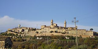
Montecosaro is a comune (municipality) in the Province of Macerata in the Italian region Marche, located about 35 kilometres (22 mi) southeast of Ancona and about 15 kilometres (9 mi) east of Macerata.

Montefano is a comune (municipality) in the Province of Macerata in the Italian region Marche, located about 25 kilometres (16 mi) southwest of Ancona and about 13 kilometres (8 mi) north of Macerata.
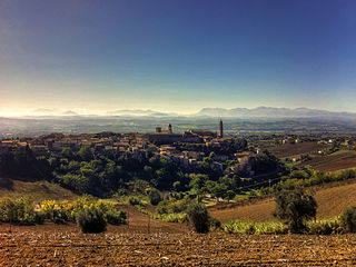
Morrovalle is a comune (municipality) in the Province of Macerata in the Italian region Marche, located about 35 kilometres (22 mi) south of Ancona and about 11 kilometres (7 mi) east of Macerata.

Pieve Torina is a comune (municipality) in the Province of Macerata in the Italian region Marche, located about 70 kilometres (43 mi) southwest of Ancona and about 45 kilometres (28 mi) southwest of Macerata.

Pollenza is a comune (municipality) in the Province of Macerata in the Italian region Marche, located about 40 kilometres (25 mi) southwest of Ancona and about 9 kilometres (6 mi) southwest of Macerata. As of 31 December 2004, it had a population of 6,086 and an area of 39.5 square kilometres (15.3 sq mi).
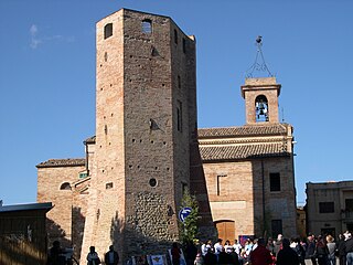
Ripe San Ginesio is a comune (municipality) in the Province of Macerata in the Italian region Marche, located about 50 kilometres (31 mi) south of Ancona and about 20 kilometres (12 mi) southwest of Macerata.

San Ginesio is a comune (municipality) in the Province of Macerata in the Italian region Marche, located about 60 kilometres (37 mi) southwest of Ancona and about 25 kilometres (16 mi) southwest of Macerata. As of 31 December 2004, it had a population of 3,872 and an area of 77.7 square kilometres (30.0 sq mi).

Sant'Angelo in Pontano is a comune (municipality) in the Province of Macerata in the Italian region Marche, located about 60 kilometres (37 mi) south of Ancona and about 25 kilometres (16 mi) south of Macerata. It stands in pleasant position with a panoramic view over the adjacent valleys of Ete Morto river and Tenna river.
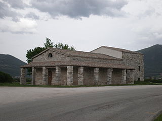
Serravalle di Chienti is a comune (municipality) in the Province of Macerata in the Italian region Marche, located about 80 kilometres (50 mi) southwest of Ancona and about 50 kilometres (31 mi) southwest of Macerata. It is crossed by the Chienti river. The communal territory is largely mountainous with numerous woods and pastures.
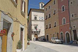
Visso is a comune (municipality) in the Province of Macerata in the Italian region Marche, located about 80 kilometres (50 mi) southwest of Ancona and about 50 kilometres (31 mi) southwest of Macerata. It houses the seat of Monti Sibillini National Park.

Buggiano is a comune (municipality) in the Province of Pistoia in the Italian region Tuscany, located about 45 kilometres (28 mi) northwest of Florence and about 15 kilometres (9 mi) southwest of Pistoia.


