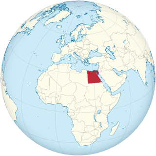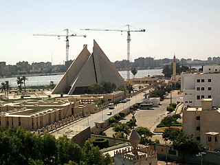
Thebes, known to the ancient Egyptians as Waset, was an ancient Egyptian city located along the Nile about 800 kilometers (500 mi) south of the Mediterranean. Its ruins lie within the modern Egyptian city of Luxor. Thebes was the main city of the fourth Upper Egyptian nome and was the capital of Egypt for long periods during the Middle Kingdom and New Kingdom eras. It was close to Nubia and the Eastern Desert, with its valuable mineral resources and trade routes. It was a religious center and the most venerated city during many periods of ancient Egyptian history. The site of Thebes includes areas on both the eastern bank of the Nile, where the temples of Karnak and Luxor stand and where the city was situated; and the western bank, where a necropolis of large private and royal cemeteries and funerary complexes can be found. In 1979, the ruins of ancient Thebes were classified by UNESCO as a World Heritage Site.

Articles related to Egypt include:

Lower Egypt is the northernmost region of Egypt, which consists of the fertile Nile Delta between Upper Egypt and the Mediterranean Sea, from El Aiyat, south of modern-day Cairo, and Dahshur. Historically, the Nile River split into seven branches of the delta in Lower Egypt.

Bubastis, also known in Arabic as Tell-Basta or in Egyptian as Per-Bast, was an ancient Egyptian city. Bubastis is often identified with the biblical Pi-Beseth. It was the capital of its own nome, located along the River Nile in the Delta region of Lower Egypt, and notable as a center of worship for the feline goddess Bastet, and therefore the principal depository in Egypt of mummies of cats.
A nome was a territorial division in ancient Egypt.

Edfu is an Egyptian city, located on the west bank of the Nile River between Esna and Aswan, with a population of approximately 60,000 people. Edfu is the site of the Ptolemaic Temple of Horus and an ancient settlement, Tell Edfu. About 5 km (3.1 mi) south of Edfu are remains of ancient pyramids.

Avaris was the Hyksos capital of Egypt located at the modern site of Tell el-Dab'a in the northeastern region of the Nile Delta. As the main course of the Nile migrated eastward, its position at the hub of Egypt's delta emporia made it a major capital suitable for trade. It was occupied from about the 18th century BC until its capture by Ahmose I.

Akhmim is a city in the Sohag Governorate of Upper Egypt. Referred to by the ancient Greeks as Khemmis or Chemmis and Panopolis, it is located on the east bank of the Nile, four miles (6.4 km) to the northeast of Sohag.

Heracleopolis Magna and Heracleopolis and Herakleoupolis (Ἡρακλεούπολις), is the Roman name of the capital of the 20th nome of ancient Upper Egypt, known in Ancient Egyptian as nn nswt. The site is located approximately 15 km (9.3 mi) west of the modern city of Beni Suef, in the Beni Suef Governorate of Egypt.
Pithom was an ancient city of Egypt. References in the Hebrew Bible and ancient Greek and Roman sources exist for this city, but its exact location remains somewhat uncertain. Some scholars identified it as the later archaeological site of Tell el-Maskhuta. Others identified it as the earlier archaeological site of Tell El Retabeh.
Qift is a city in the Qena Governorate of Egypt about 43 km (27 mi) north of Luxor, situated a little south of latitude 26° north, on the east bank of the Nile. In ancient times its proximity to the Red Sea made it an important trading emporium between India, Punt, Arabia Felix and the North. It was important for nearby gold and quartzite mines in the Eastern Desert, and as a starting point for expeditions to Punt.

In Egyptian mythology, Nemty was a god whose worship centered at Antaeopolis in the northern part of Upper Egypt.

Senakhtenre Ahmose, was a king of the Seventeenth Dynasty of Egypt during the Second Intermediate Period. Senakhtenre reigned for a short period over the Theban region in Upper Egypt at a time where the Hyksos 15th Dynasty ruled Lower Egypt. Senakhtenre died c.1560 or 1558 BC at the latest.
Pr is the hieroglyph for 'house', the floor-plan of a walled building with an open doorway.
Hebenu or Alabastron was a city in ancient Egypt. It was located in Middle Egypt, or the Heptanomy, and belonged to the Hare nome (𓉆. It was the early capital of the Oryx nome (𓉇. The modern village of Zawiyat al-Amwat is built on the site where the ancient city stood.

Minya is the capital of the Minya Governorate in Upper Egypt. It is located approximately 245 km (152 mi) south of Cairo on the western bank of the Nile River, which flows north through the city.

Elkab, also spelled El-Kab or El Kab, is an Upper Egyptian site on the east bank of the Nile at the mouth of the Wadi Hillal about 80 kilometres (50 mi) south of Luxor. Elkab was called Nekheb in the Egyptian language, a name that refers to Nekhbet, the goddess depicted as a white vulture. In Greek it was called Eileithyias polis, "city of the goddess Eileithyia".
This page list topics related to ancient Egypt.
Per-Wadjet was an Ancient Egyptian town in the 10th Upper Egyptian nome. The ancient town is identical with the modern village Kom Ishqau. Per-Wadjet is known from Egyptian sources since the New Kingdom. It was a cult place for Hathor, who was here identified with Wadjet. The Greeks identified Hathor with Aphrodite and called the town Aphroditopolis or Aphrodito. In Greek and Roman times the town was sometimes the nome capital. In Kom Ishqau were found the papyri of Dioscorus of Aphrodito, who lived there in the 6th century A.D. These papyri are an important source for life in Byzantine Egypt. A long-lost 2.200 year-old temple with words linked to Ptolemy IV Philopator was accidentally found during drilling work on a sewage project by the Egyptian archaeological mission in the village in early September 2019. Temple stones for installing the sewage pumps, limestone wall remnants and ground floor were also revealed during the excavation. Inscriptions described Hapi, the God of the Nile, presenting offerings of varied animal and birds in the walls of the temple.
Ihnasya is a historical city in the Beni Suef Governorate of Egypt. It is located on the left bank of the Nile, close to the Bahr Yussef canal. Ihnasya, also known as Heracleopolis, served as the capital of the Heracleopolite nome in Ancient Egyptian, Ptolemaic, and Roman periods. Its importance persisted after the Muslim conquest of Egypt, as it became the capital of kurah al-Ihnasiyya.


