Perth Hills

Last updated

Perth Hills
Western Australia
Perth Water and south perth foreshore.jpg
Perth Hills in context with Perth - the blue line on the horizon is the Darling Scarp which defines the western side of the Perth Hills area
LGA(s)

Perth Hills is a term used primarily for marketing purposes to identify the part of the Darling Scarp and hinterland east of the scarp that lies within the Shire of Mundaring, City of Swan, and the City of Kalamunda and as part of the constituent bodies belonging to the Eastern Metropolitan Regional Council of Perth , Western Australia.

Contents

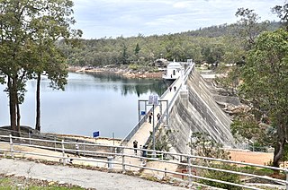
The term is most commonly found on tourist maps, and on the government Department of Environment and Conservation pamphlets and materials relating to the regional headquarters at Mundaring Weir – The Perth Hills National Parks Centre [1] [2] (formerly known as the Hills Forest Discovery Centre) and its "Nearer to Nature" programs and activities. It is also sometimes used in books and pamphlets. [3] [4]

In earlier usage of the term "The Hills" by people living in Perth, the identification of specific locations along the Darling Scarp (also called the Darling Range) found some places more commonly referred to than others.

Both Kalamunda and Darlington, as separate and specific areas, were frequently referred to specifically as "The Hills", due to their presence on the edge of the scarp.[ citation needed ]

Greenmount Hill is often considered the "entrance point to the Hills", because the main road – the Great Eastern Highway – passes through this location, adjacent to the route of the much earlier road, the York Road.

The "Swan Hills" is a name often given to a part of the range centred on Toodyay Road and its corridor through the north-eastern part of the City of Swan and Gidgegannup.[ citation needed ] However, the term "Swan Hills" is also used in other ways as well.[ how? ]

A "Welcome to Perth Hills" sign within 100 metres of Chippers Leap on Greenmount Hill is the entry point for that part of the hills in the Mundaring shire. [5]

Another "Welcome to Perth Hills" sign is on Kalamunda Road, before the road climbs to Kalamunda. [6] The area also includes the Bickley and Carmel Wine region.

The hills above Armadale and localities are quite separate from the other hills localities. [7]

Wine region

Perth Hills is also a wine region, with some 35 wineries. The climate of warmer days and cooler nights makes it a very different region to the neighbouring Swan Valley. Larger wineries in the region combine vineyards with popular restaurants. [8] [9]

The Australian Geographical Indication "Perth Hills" was entered in the Register of Protected Names on 25 March 1999. [10]

Bushfires

Bushfires in the area are often cited in news media as fires in the Perth Hills.

The serious bushfire in 2014 was frequently referred to as the Perth Hills bushfire, rather than the Parkerville bushfire, in reports and media. [11] [12]

A fire in February 2021 - the 2021 Wooroloo bushfires was reported as a fire in the Perth Hills. [13] [14] [15]

Related Research Articles

<span class="mw-page-title-main">Greenmount National Park</span> Protected area in Western Australia

Greenmount National Park is a national park in the locality of Greenmount, Western Australia, 22 km east of Perth.

<span class="mw-page-title-main">John Forrest National Park</span> Protected area in Western Australia

John Forrest National Park is a national park in the Darling Scarp, 24 km (15 mi) east of Perth, Western Australia. Proclaimed as a national park in November 1900, it was the first national park in Western Australia.

Kalamunda National Park is a national park in Western Australia, 23 kilometres (14 mi) east of Perth, near the town of Kalamunda.

<span class="mw-page-title-main">Darling Scarp</span> Scarp east of Perth, Western Australia

The Darling Scarp, also referred to as the Darling Range or Darling Ranges, is a low escarpment running north–south to the east of the Swan Coastal Plain and Perth, Western Australia. The escarpment extends generally north of Bindoon, to the south of Pemberton. The adjacent Darling Plateau goes easterly to include Mount Bakewell near York and Mount Saddleback near Boddington. It was named after the Governor of New South Wales, Lieutenant-General Ralph Darling.

<span class="mw-page-title-main">Kalamunda, Western Australia</span> Suburb of Perth, Western Australia

Kalamunda is a town and eastern suburb of Perth, Western Australia, located in the Darling Scarp at the eastern limits of the Perth metropolitan area.

<span class="mw-page-title-main">Mundaring, Western Australia</span> Suburb of Perth, Western Australia

Mundaring is a suburb located 34 km east of Perth, Western Australia on the Great Eastern Highway. The suburb is located within the Shire of Mundaring.

<span class="mw-page-title-main">Darlington, Western Australia</span> Suburb of Perth, Western Australia

Darlington, Western Australia, is a locality in the Shire of Mundaring on the Darling Scarp, bisected by Nyaania Creek and north of the Helena River.

<span class="mw-page-title-main">Bellevue, Western Australia</span> Suburb of Perth, Western Australia

Bellevue is an eastern suburb of Perth, Western Australia in the local government areas of the City of Swan and the Shire of Mundaring. It is at the foot of the slopes of Greenmount, a landmark on the Darling Scarp that is noted in the earliest of travel journals of the early Swan River Colony.

<span class="mw-page-title-main">Greenmount, Western Australia</span> Suburb of Perth, Western Australia

Greenmount is a locality and a geographical feature in the Shire of Mundaring, Western Australia, on the edge of the Darling Scarp. It is a vital point in the transport routes from the Swan Coastal Plain into the hinterland of Western Australia.

<span class="mw-page-title-main">Helena River</span> River in Western Australia

The Helena River is a tributary of the Swan River in Western Australia. The river rises in country east of Mount Dale and flows north-west to Mundaring Weir, where it is dammed. It then flows west until it reaches the Darling Scarp.

<span class="mw-page-title-main">Railway Reserves Heritage Trail</span> Trail in Shire of Mundaring, Western Australia

The Railway Reserves Heritage Trail – also on some maps as Rail Reserve Heritage Trail or Rail Reserves Historical Trail, and frequently referred to locally as the Bridle Trail or Bridle Track – is within the Shire of Mundaring in Western Australia.

The Mundaring Branch Railway is a historical section of the original Eastern Railway main line across the Darling Scarp in the Western Australian Government Railways (WAGR) system.

<span class="mw-page-title-main">Mundaring Weir</span> Reservoir in Mundaring, Western Australia

Mundaring Weir is a concrete gravity dam located 39 kilometres (24 mi) from Perth, Western Australia in the Darling Scarp. The dam and reservoir form the boundary between the suburbs of Reservoir and Sawyers Valley. The dam impounds the Helena River.

<span class="mw-page-title-main">Swan View, Western Australia</span> Suburb of Perth, Western Australia

Swan View is an eastern suburb of Perth, Western Australia. Its local government areas are the City of Swan and the Shire of Mundaring. It is 25 kilometres (16 mi) from Perth in the Perth Hills on the edge of the Darling Scarp, just to the west of the John Forrest National Park, east of Roe Highway and north of the Great Eastern Highway.

<span class="mw-page-title-main">Boya, Western Australia</span> Suburb of Perth, Western Australia

Boya is a locality on the Darling Scarp, in the Shire of Mundaring, Western Australia; it is on the south side of Greenmount Hill, and just west of Darlington.

<span class="mw-page-title-main">Helena Valley, Western Australia</span> Suburb of Perth, Western Australia

Helena Valley is the name of a river valley and a locality in the foothills of the Darling Scarp in Perth, Western Australia.

<span class="mw-page-title-main">Shire of Mundaring</span> Local government area in Perth, Western Australia

The Shire of Mundaring is a local government area in eastern metropolitan Perth, the capital of Western Australia. The Shire covers an area of 645 square kilometres (249 sq mi) and had a population of approximately 38,000 as at the 2016 Census.

<span class="mw-page-title-main">Mundaring Weir Road</span> Road in Perth, Western Australia

Mundaring Weir Road is a road in the outer eastern suburbs of Perth, Western Australia that links Mundaring and Kalamunda.

<span class="mw-page-title-main">Statham's Quarry</span> Quarry in Perth, Western Australia

Statham's Quarry is the site of a quarry on the Darling Scarp on the southern side of the entrance of the Helena River valley on to the Swan Coastal Plain in Perth, Western Australia. It is located in Gooseberry Hill and is within the bounds of the Gooseberry Hill National Park.

References

  1. "Perth Hills Discovery Centre: visitor information and national park camping". Department of Environment and Conservation . Government of Western Australia. 2011. Retrieved 23 October 2016 via Trove, National Library of Australia.
  2. "New interpretation centre for Perth hills parks". Department of Environment and Conservation (Press release). Government of Western Australia. May 2006. Archived from the original on 13 August 2008.
  3. Scott, Don (2006). "A guide to the Perth hills". Department of Environment and Conservation . Government of Western Australia. Retrieved 23 October 2016 via Trove, National Library of Australia.
  4. Bell, Una (2004). Guide to native grasses in the Perth Hills (2nd ed.). U. Bell. ISBN   978-0-646-38142-8.
  5. http://www.perthhills.com.au Mundaring Visitor Centre
  6. http://www.kalamunda.wa.gov.au Kalamunda shire website
  7. www.perthhillsarmadale.com.au Perth Hills Armadale Visitor Centre
  8. Perth Hills Wine (Promotional website)
  9. Perth Hills wine press: newsletter of the Perth Hills Vignerons' Association (Inc.), Perth Hills Vignerons' Association, 1900, retrieved 3 July 2018 via Trove, National Library of Australia
  10. https://www.wineaustralia.com/labelling/geographical-indicators/labelling-gi-perth-hills Perth Hills
  11. Keelty, Mick (2011). A shared responsibility: the report of the Perth Hills Bushfire February 2011 Review. Government of Western Australia. ISBN   978-0-7307-0248-1.
  12. Submissions to the Perth Hills Bushfire February 2011 Review. 2011. Retrieved 23 October 2016 via Trove, National Library of Australia.{{cite book}}: |work= ignored (help)
  13. "Perth bushfire destroys homes residents evacuated". Australian Broadcasting Corporation .
  14. "ash and burnt leaves from Perth Hills bushfire seen some 50km away".
  15. "Western Australia Perth Hills bushfire emergency destroys homes and threatens lives".