Petroleum, Indiana

Last updated

Petroleum, Indiana
Petroleum, Indiana.jpg
Unused buildings in Petroleum
Map of Indiana highlighting Wells County.svg
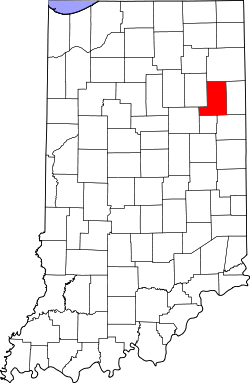
Wells County's location in Indiana
Location map of Wells County, Indiana.svg
Red pog.svg
Petroleum
Location of Petroleum in Wells County
Coordinates: 40°36′45″N85°09′08″W / 40.61250°N 85.15222°W / 40.61250; -85.15222
Country United States
State Indiana
County Wells
Township Nottingham
Elevation
[1]
860 ft (260 m)
Time zone UTC-5 (Eastern (EST))
  Summer (DST) UTC-4 (EDT)
ZIP code
46778
Area code 260
FIPS code 18-59418 [2]
GNIS feature ID2830582 [1]

Petroleum is an unincorporated community in Nottingham Township, Wells County, in the U.S. state of Indiana. [1] Petroleum has a population of 106. [3]

Contents

History

Petroleum was platted in 1894, and is so named because it was laid out in an oil field. [4] The post office at Petroleum has been in operation since 1894. [5]

Demographics

The United States Census Bureau designated Petroleum as a census designated place in the 2022 American Community Survey. [6]

References

  1. 1 2 3 U.S. Geological Survey Geographic Names Information System: Petroleum, Indiana
  2. "U.S. Census website". United States Census Bureau . Retrieved January 31, 2008.
  3. "Petroleum". worldpopulationreview.com/. Retrieved August 27, 2025.
  4. Baker, Ronald L. (October 1995). From Needmore to Prosperity: Hoosier Place Names in Folklore and History . Indiana University Press. p.  261. ISBN   978-0-253-32866-3. This village was laid out in June 1894 in the midst of an oil field, for which it was named...
  5. "Wells County". Jim Forte Postal History. Retrieved July 7, 2016.
  6. "2022 Geography Changes". United States Census Bureau.