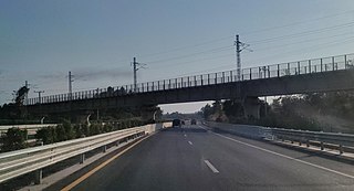
This article concerns the systems of transportation in Laos. Laos is a country in Asia, which possesses a number of modern transportation systems, including several highways and a number of airports. As a landlocked country, Laos possesses no ports or harbours on the sea, and the difficulty of navigation on the Mekong means that this is also not a significant transport route.
Nam Et-Phou Louey National Park is a protected area in northern Laos, covering 4,107.1 km2 (1,585.8 sq mi) in three provinces: Houaphan, Luang Prabang, and Xieng Khouang. It was designated a national park in 2019, and was previously designated a national protected area. The protected area included a 3,000 km2 (1,200 sq mi) core area where human access and wildlife harvest is prohibited and a 2,950 km2 buffer area where pre-existing villages are allocated land for subsistence living.

Pha Taem National Park (Thai:อุทยานแห่งชาติผาแต้ม) is a national park on the Mekong River in Ubon Ratchathani Province, northeast Thailand. Phou Xieng Thong National Protected Area in Laos is on the opposite side of the river.

Attapeu is a province of Laos in the southeast of the country. It has five districts: Samakkixay, Xaysetha, Sanamxay, Sanxay, and Phouvong, covering an area of 10,320 square kilometres (3,980 sq mi) with a population of 127,285. Its capital city lies at Attapeu.

Bolikhamsai is a province of Laos. Pakxan, Thaphabat, Pakkading, Borikhane, Viengthong, and Khamkeut are its districts and Pakxan is its capital city. The province is the site of the Nam Theun 2 Dam, the country's largest hydroelectric project.
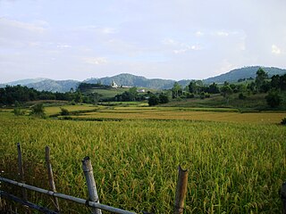
Xiangkhouang is a province of Laos on the Xiangkhoang Plateau, in the nation's northeast. The province has the distinction of being the most heavily-bombed place on Earth.
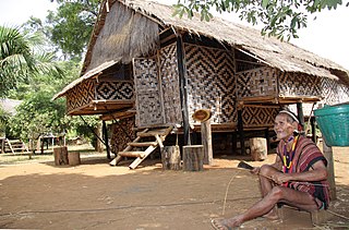
Sekong is a province of Laos in the southeast of the country.
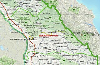
Khammouane province (Khammouan) is a province in the center of Laos. Its capital lies at Thakhek.

Salavan is a province of Laos, located in the south of the country. Its earlier name was Saravan which was changed by the Thais to Salavan in 1828. It was part of the Champasak Kingdom in an area known as Muang Mang inhabited by minorities of Mon-Khmer groups.
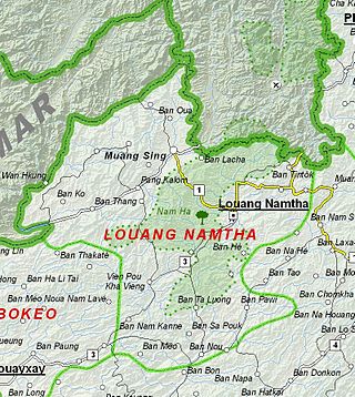
Luang Namtha is a province of Laos in the country's north. From 1966 to 1976 it formed, together with Bokeo, the province of Houakhong. Luang Namtha province covers an area of 9,325 square kilometres (3,600 sq mi). Its provincial capital is Luang Namtha. The province borders Yunnan, China to the north, Oudomxai province to the east and southeast, Bokeo province to the southwest, and Shan State, Myanmar to the northwest.

Sainyabuli province is a province in northwest Laos. The capital of the province is the town of Saiyabuli. Saiyabuli is the only Lao province that is completely west of the Mekong River.

Luang Prabang is a province in northern Laos. Its capital of the same name, Luang Prabang, was the capital of the Lan Xang Kingdom during the 13th to 16th centuries. It is listed since 1995 by UNESCO as a World Heritage Site for unique architectural, religious and cultural heritage, a blend of the rural and urban developments over several centuries, including the French colonial influences during the 19th and 20th centuries. The province has 12 districts. The Royal Palace, the national museum in the capital city, and the Phou Loei Protected Reserve are important sites. Notable temples in the province are the Wat Xieng Thong, Wat Wisunarat, Wat Sen, Wat Xieng Muan, and Wat Manorom. The Lao New Year is celebrated in April as The Bun Pi Mai.

Champasak is a province in southwestern Laos, near the borders with Thailand and Cambodia. It is one of the three principalities that succeeded the Lao kingdom of Lan Xang. As of the 2015 census, it had a population of 694,023. The capital is Pakse, but the province takes its name from Champasak, the former capital of the Kingdom of Champasak.
Xe Pian National Park is a national park in Champasak and Attapeu provinces in southern Laos. This forested, hilly park is home to significant wetlands and a great diversity of animal, bird and fish species. It is an ecotourism destination.
Dong Hua Sao National Protected Area is a national park in Champasak Province in southern Laos. This forested park rises from the Mekong river lowlands eastwards into the Bolaven Plateau. It is an ecotourism destination.
Phou Xang He National Protected Area is a national protected area in Savannakhet Province in central Laos. This mostly pristine forested park is home to a large variety of important animal and bird species. The park is home to the Phu Tai and Katang ethnic groups and is an ecotourism destination.

Protected areas in Laos include:
Dong Phou Vieng National Protected Area is a national protected area in Savannakhet Province in central Laos. This mostly forested park is home to large variety of animal species and contains part of the former Ho Chi Minh trail. The park is home to the Katang ethnic group and is an ecotourism destination.
Nam Kading National Protected Area is a national protected area in Bolikhamsai Province in central Laos. This rugged and largely inaccessible park, cut through by its namesake Nam Kading river, is home to a wide variety of plant and animal species, some endangered. Due to its ruggedness, the park lacks any significant human settlement.

