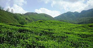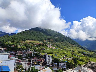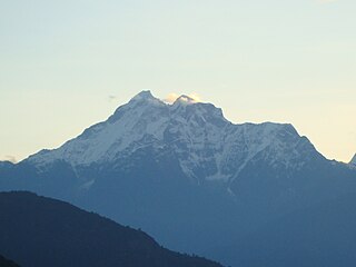
Sindhupalchowk District is a part of Bagmati Province and one of the seventy-seven districts of Nepal, with an area of 2,542 km2 (981 sq mi). The district's headquarters is in Chautara. In 2006, 336,478 people resided in 79 village development committees; in 2011 there were 287,798.

Solududhkunda (earlier:Dudhkunda) is the only municipality of Solukhumbu District. Located in Koshi Province of Nepal. The town of Salleri, which is located within the municipality is the headquarter of Solukhumbu District It was formed in 2014 by merging four VDCs: Salleri, Garma, Loding Tamakhani and Beni and was divided into 9 wards. Total area of the municipality had 254.3 square kilometres (98.2 sq mi) and population of municipality had 20,399 individuals living in 5,368 households.

Bahrabise is an urban municipality located in Sindhupalchok District of Bagmati Province of Nepal.

Bhotechaur is a village in Sindhupalchok District in the Bagmati Zone of central Nepal. At the time of the 1991 Nepal census it had a population of 4995 and had 870 houses in the village.
Listikot is a village in Sindhupalchok District in the Bagmati Zone of central Nepal. At the time of the 1991 Nepal census it had a population of 3664 and had 714 houses in the village.
Maneshwara is a village in Sindhupalchok District in the Bagmati Zone of central Nepal. At the time of the 1991 Nepal census, it had a population of 3,065, and had 642 houses in the village. By 2011 the population had become 3,393 in 789 households.
Pedku is a village in Sindhupalchok District in the Bagmati Zone of central Nepal. At the time of the 2013 Nepal census it had a population of 2284 and had 408 houses in the village. In 2011 the population was 1600 in 391 households.
Tatopani is a village in Sindhupalchok District in the Bagmati Zone of central Nepal. At the time of the 1991 Nepal census it had a population of 3102 and had 613 houses in the village. Majority people are of ethnic Sherpa and Tamang. Historically and today, it is a huge trading post between Nepal and China. People living here speak Nepali and Tibetan.There is a inactive volcano in there as well. Shrestha Bipin is mayor in Tatopani. The actual border crossing is at Kodari. The village was visited by and served as pitstop for famous indian scholar and travelogue Rahul Sankrityayan multiple times on his way to Tibet.

Tauthali is a village in Sindhupalchok District in Bagmati Province, central Nepal. Tauthali is 110 km away from Kathmandu.
Thokarpa is a village in Sindhupalchok District in the Bagmati Zone of central Nepal. At the time of the 2013 Nepal census it had a population of 6,243 and had 1,047 houses in it.
Dilasaini is a former village development committee that is now a Rural Municipality in Baitadi District in Sudurpashchim Province of western Nepal. At the time of the 1991 Nepal census it had a population of 4,828 and had 849 houses in the village. There is one plus two, two high schools and many primary schools in the VDC. This VDC is bordered by Mathairaj, Gokuleshwor, Rudreswor and Rim VDC and Darchula district in the northwest. This VDC is named after a local deity. The temple of this devi is located in Dhamigaun which is one of the wards of the VDC. This temple is famous in far-western Nepal for the sacrifice of huge number of bull buffaloes on occasion of Dashain.

Matatirtha is a village and former Village Development Committee that is now part of Chandragiri Municipality in Kathmandu District in Province No. 3 of central Nepal. At the time of the 1991 Nepal census it had a population of 2,799 living in 506 households. Its population has now grown to 5,982 spread over 1,314 households. Santosh Khadka was elected as Ward Chairman of Matatirtha through a local election.
Shankhupati chaur is a village development committee in Kavrepalanchok District in the Bagmati Zone of central Nepal. At the time of the 1991 Nepal census it had a population of 3,246 in 585 individual households.
Dhurkot Nayagaun is a town and municipality in Gulmi District in the Lumbini Zone of central Nepal. At the time of the 1991 Nepal census it had a population of 4692. This VDC is one of the most beautiful VDC of Gulmi and famous for Oranges. Literacy rate of this VDC is above 90%. Politically above 75% people support Nepali Congress in this village. This VDC is touched by Arghakhanchi district.
Lamatar is a village and former Village Development Committee that is now part of Mahalaxmi Municipality in Province No. 3 of central Nepal.
Ghyang Sukathokar is a village development committee (VDC) in Dolakha District in the Janakpur Zone of north-eastern Nepal. At the time of the 1991 Nepal census it had a population of 4,600.
Dhaulakot is a village development committee in Darchula District in the Mahakali Zone of western Nepal. At the time of the 1991 Nepal census it had a population of 2094 people living in 337 individual households.

Gaurishankar Conservation Area is a protected area in the Himalayas of Nepal that was established in January 2010, covering 2,179 km2 (841 sq mi) in the Ramechhap, Dolakha and Sindhupalchok districts and encompassing 22 Village Development Committees. It is contiguous with Tibet in the north and a part of the Sacred Himalayan Landscape. The protected area connects the Langtang and Sagarmatha National Parks. In 2010, the Government of Nepal handed over the management of Gaurishankar Conservation Area to National Trust for Nature Conservation for 20 years, which has been managing the area through its Gaurishankar Conservation Area Project.
Thangmi, also called Thāmī, Thangmi Kham, Thangmi Wakhe, and Thani, is a Sino-Tibetan language spoken in central-eastern Nepal and northeastern India by the Thami people. The Thami refer to their language as Thangmi Kham or Thangmi Wakhe while the rest of Nepal refers to it as Thāmī. The majority of these speakers, however, live in Nepal in their traditional homeland of Dolakhā District. In India, the Thami population is concentrated mostly in Darjeeling. The Thangmi language is written using the Devanagari script. Thangmi has been extensively documented by Mark Turin.
Thumpakhar is a village in Sindhupalchok District in the Bagmati Zone of central Nepal. In the 1991 Nepal census, it had a population of 5210, with 1023 houses.


