
Sindhupalchok District is a part of Bagmati Province and one of the seventy-seven districts of Nepal, with an area of 2,542 km2 (981 sq mi). The district's headquarters is in Chautara. In 2006, 336,478 people resided in 79 village development committees, in 2011 there were 287,798.
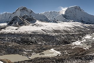
Solukhumbu District (Nepali: सोलुखुम्बु जिल्ला [solukʰumbu], Sherpa: ཤར་ཁུམ་བུ་རྫོང་ཁ།, Wylie: shar khum bu dzong kha) is one of 14 districts of Province No. 1 of eastern Nepal. As the name suggests, it consists of the subregions Solu and Khumbu.

A Village Development Committee (VDC) in Nepal was the lower administrative part of its Ministry of Federal Affairs and Local Development. Each district had several VDCs, similar to municipalities but with greater public-government interaction and administration. There were 3,157 village development committees in Nepal. Each VDC was further divided into several wards depending on the population of the district, the average being nine wards.

Srikot is a village development committee in Baitadi District in the Mahakali Zone of western Nepal. At the time of the 1991 Nepal census it had a population of 3,076 and had 498 houses in the village.
Dhapasi is a residentially preferred village and former Village Development Committee that is now part of Tokha Municipality, just outside the Kathmandu Ring Road, in Kathmandu District in Province No. 3 of central Nepal. At the time of the 2011 Nepal census it had a population of 31,406 and had 8,202 households in it.
Makaising is a village development committee in Gorkha District in the Gandaki Zone of northern-central Nepal. At the time of the 1991 Nepal census it had a population of 2,231 and had 416 houses in the village.
Saurpani is Ward no.4 Sulikot Gaupalika in Gorkha District in the Gandaki Zone of northern-central Nepal. At the time of the 2011 Nepal census it had a population of 5,958 and had 1,325 houses in the town.
Dhanushadham is a municipality in Danusha District in Province No. 2 of south-eastern Nepal. The municipality was established on 18 May 2014 by merging the existing Govindapur, Umprempur, Yagyabhumi, Dhanushadham village development committees (VDCs). It is a religious place of Hindu worship in Nepal. It is believed that a part of Shiva Dhanusha that was broken by Rama during Sita's swayamvara, is housed. Now there is temple around the remaining of bow and visited by Hindu devotees from all over the world. That's why it is named Dhanushadham.
Ravi Opi is a village development committee in Kabhrepalanchok District in the Bagmati Zone of central Nepal. At the time of the 2011 Nepal census it had a population of 4315 in 923 individual households. the VDC office was located at the middle of village named "dudamukh"
Lalmatiya is a town and Village Development Committee in Dang District in Province No. 5 of south-western Nepal. At the time of the 1991 Nepal census it had a population of 12,048 persons living in 1900 individual households.
Dhikurpokhari is a suburb and former Village Development Committee in Kaski District in the Gandaki Province of northern-central Nepal. At the time of the 1991 Nepal census it had a population of 7,392 persons living in 1,427 individual households.
Kakani is a Gaunpalika and former village development committee in Nuwakot District in Bagmati Pradesh of central Nepal. At the time of the 1991 Nepal census, the Kakani village development committee administered a population of 7816 living in 1343 individual households.
Lunkhu Deurali is a Village Development Committee in Parbat District in the Dhawalagiri Zone of central Nepal. At the time of the 2011 Nepal census it had a population of 2546 people living in 503 individual households.
Pakhapani is a Village Development Committee in Parbat District in the Dhawalagiri Zone of central Nepal. At the time of the 1991 Nepal census it had a population of 2969 people residing in 556 individual households. This village has three high schools located at; Pakhapani, Simley and Lamtun. It has nine wards and has a health post centre in each ward. The majority of the people have gone abroad for employment and remittance from them represents the economy. There are also numerous people who work in the British Army and Indian Army. Now this village has roads connecting all localities. Major village inside it are Kokhe(Chhetri community), Simle and Sarthan and Lamtun and many smaller villages.
Pasgaun is a village development committee in Lamjung District in the Gandaki Zone of northern-central Nepal. At the time of the 1991 Nepal census it had a population of 1856. It is one of the emerging tourist destination of Nepal providing 'Home Stay' services to the visitors. It is a predominantly Gurung village. Gurung is a word used to describe a certain ethnic tribe of Nepal in the Nepali language, where as in their own language they call themselves "Tamu", which translates as people of the highlands. Pasgaun also has besides Gurungs, people of other castes such as kami and Damain.
Manthali is a municipality and the headquarters of Ramechhap District in Bagmati Pradesh, Nepal that was established on 2 December 2014 by merging the former village development committees Old-Manthali, Bhatauli, Chisapani, Kathjor, Bhaluwajor, Salupati and Sunarpani. It was declared the headquarters of the district on 9 March 1989. It lies on the bank of the Tamakoshi River. At the time of the 2011 Nepal census it had a population of 45,416 people living in 10,099 individual households.
Ghodagaun is a village development committee in Rolpa District in the Rapti Zone of north-eastern Nepal. At the time of the 1991 Nepal census it had a population of 241 people living in 476 individual households. Ghodagaun has now changed in Sunilsmritee Rural Municipalities 1 Number ward. linkage of road and communication is well. Shree Rameshwari Higher Secondary School is the main educational institute of Ghodagaun.

Phidim Municipality is the headquarters of the Panchthar District in the Mechi Zone of eastern Nepal. Phidim was upgraded to a 'municipality' from a 'village', when a development committee merged with other VDCs - including the Phidim, Chokmagu and Siwa villages - on May 18, 2014. It offers a route for trekkers and locals, who travel to and from the Taplejung district bordering with the Tibetan Autonomous Region of China. It is also a commercial hub for the rural surroundings.

Labani is a village development committee in Kapilvastu District in the Lumbini Zone of southern Nepal. It is located on Taulihawa Road, 7 kilometres (4.3 mi) west of Lumbini. At the time of the 1991 Nepal census it had a population of 5110 people living in 858 individual households.
Sunkoshi Rural Municipality is a rural municipality in Sindhupalchowk District of Bagmati Pradesh in Nepal. According to the 2011 Nepal census, the total population of the municipality is 16713 and total area of the municipality is 72.84 square kilometres (28.12 sq mi) The Rural municipality is divided into 7 wards and the headquarter of the municipality is located at Pangretar.

