
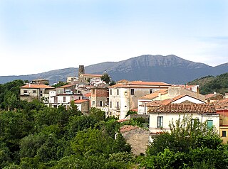
Aquara is a town and comune in the province of Salerno in the Campania region of south-western Italy.
Gioi is a town and comune in the province of Salerno in the Campania region of south-western Italy. As of 2011, its population was 1,339.

Magliano Vetere is a town and comune in the province of Salerno in the Campania region of south-western Italy. As of 2011 its population was 739.
Moio della Civitella is a town and comune in the province of Salerno in the Campania region of south-western Italy.

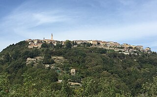
Monteforte Cilento is a town and comune of the province of Salerno in the Campania region of south-west Italy.

Orria is a town and comune in the province of Salerno in the Campania region of South-western Italy. As of 2011, its population was of 1161.
Perito is a town and comune in the province of Salerno in the Campania region of south-western Italy. As of 2011 its population was of 1,007.

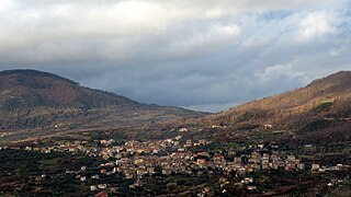
Pertosa is a village and comune of the province of Salerno in the Campania region of south-west Italy. In 2010 its population was 714.

Stio is a town and comune in the province of Salerno in the Campania region of south-western Italy. As of 2016, its population was 872.

Agnone Cilento, also shortened as Agnone, is an Italian hamlet (frazione), the greatest one in the municipality of Montecorice in the province of Salerno, Campania region.

Pioppi is an Italian hamlet (frazione) in the municipality of Pollica, in Cilento, Campania region. Its name means 'poplars' in the Italian language.

Case del Conte, sometimes also spelled Casa del Conte, is a southern Italian village and hamlet (frazione) of Montecorice, a municipality in the province of Salerno, Campania. As of 2009 its population was of 235.

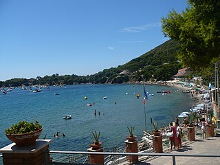
Marina di Casalvelino, also spelled Casalvelino Marina, is a southern Italian village and hamlet (frazione) of Casal Velino, a municipality in the province of Salerno, Campania. With a population of 1,263 (2009), it is the most populated hamlet of its municipality.

Abatemarco is a southern Italian village and hamlet (frazione) of Montano Antilia, a municipality in the province of Salerno, Campania. in 2011 it had a population of 309.

Massicelle is a southern Italian village and hamlet (frazione) of Montano Antilia, a municipality in the province of Salerno, Campania. in 2011 it had a population of 529.

Casalsottano, also spelled Casal Sottano, is a southern Italian village and hamlet (frazione) of San Mauro Cilento, a municipality in the Province of Salerno, Campania. In 2011 it had a population of 397.
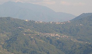
Cardile is a southern Italian village and the only hamlet (frazione) of Gioi, a municipality in the province of Salerno, Campania. As of 2009 its population was of 614.

Ostigliano is a southern Italian village and the only hamlet (frazione) of Perito, a municipality in the province of Salerno, Campania. As of 2011, its population was 431.
Ogliastro Marina, sometimes shortened as Ogliastro, is a southern Italian village and hamlet (frazione) of Castellabate, a municipality in the province of Salerno, Campania. As of 2009 its population was of 172.
Gorga, also known as Gorga Cilento, is a southern Italian village and the only hamlet (frazione) of Stio, a municipality in the province of Salerno, Campania. As of 2016, its population was 160.

