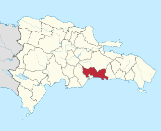
The Dominican Republic is divided into thirty–one provincias, while the national capital, Santo Domingo, is contained within its own Distrito Nacional.

Azua is a province which is collectively one of the thirty-two provinces of the Dominican Republic. It is divided into 10 municipalities and its capital city is Azua de Compostela. It is bordered by the provinces of La Vega to the north-east, San José de Ocoa and Peravia to the east, Barahona and Baoruco to the west and San Juan to the north-west. To the south, Azua has a significant coastline of the Caribbean Sea. Azua is known for its diverse geography and climate, with the southern part of the province having an arid climate that is not the typical tropical-like that is found in other parts of the Caribbean.

Baoruco, alternatively spelt Bahoruco, is a province of the Dominican Republic located in the southwest of the country, part of the Enriquillo Region, along with the provinces of Barahona, Independencia and Pedernales. Before 1952 it included what is now Independencia Province.

Barahona is a province of the Dominican Republic. The Barahona Coast is located on the southwestern part of the Dominican Republic approximately three hours drive from Santo Domingo the capital of the Dominican Republic. In 2019, volunteers from Amigos de las Americas visited to facilitate projects within the various municipalities of Barahona.

Puerto Plata is one of the northern provinces of the Dominican Republic. The area has become an increasingly popular tourist attraction since the late 1990s mainly due to its fine beaches. It borders the Septentrional mountain range to the north.

Valverde is a province of the Dominican Republic. It was split from Santiago Province in 1959. It is in the northwestern part of the country. Its capital city is Santa Cruz de Mao.

Santo Domingo is a province of the Dominican Republic. It was split from the Distrito Nacional on October 16, 2001.

Santo Domingo Este is a municipality and the provincial capital of the Santo Domingo province in the Dominican Republic. It has one municipal district, San Luis.
Santo Domingo Norte is a municipality of the Santo Domingo Province in the Dominican Republic. There is one municipal district within the municipality: La Victoria.

Dota is a canton in the San José province of Costa Rica. The head city of the canton is Santa María.

Osa is a canton in the Puntarenas province of Costa Rica. The head city is in Puerto Cortés district.
Central Santo Domingo or better known as Polígono Central is a term used to group several neighborhoods located in central Santo Domingo, Distrito Nacional, Dominican Republic defined as the area delineated by John F Kennedy Avenue on the north, on the west by Winston Churchill avenue, on the east by Maximo Gomez avenue, and on the south by 27 de Febrero avenue.
Hatillo is the tenth district of the San José canton, in the San José province of Costa Rica.
San Sebastián is the eleventh district of the San José canton, in the San José province of Costa Rica. An important residential district, San Sebastián is the third most populous and second most densely populated in the canton.

Los Cacicazgos is a district or neighborhood in the city of Santo Domingo, the capital of the Dominican Republic. It is one of the richest neighborhoods in Dominican Republic and the wealthiest in the city of Santo Domingo. The district is named after the Native Taino Chiefdoms of Hispaniola. Los Cacicazgos is in particular populated by individuals from the upper class.
San Vicente is a district of the Moravia canton, in the San José province of Costa Rica.
Los Guido is a district of the Desamparados canton, in the San José province of Costa Rica.
San Pablo is a district of the León Cortés Castro canton, in the San José province of Costa Rica.
Santa Isabel is a district of the Río Cuarto canton, in the Alajuela province of Costa Rica.


