Sarnia No. 221 is a rural municipality in south-central Saskatchewan, Canada located in Division 6.
Jiyyammavalasa is a village in Vizianagaram district of the Indian state of Andhra Pradesh.

Ostrówek is a village in Lubartów County, Lublin Voivodeship, in eastern Poland. It is the seat of the gmina called Gmina Ostrówek. It lies approximately 13 kilometres (8 mi) north of Lubartów and 37 km (23 mi) north of the regional capital Lublin.
Nowa Prawda is a village in the administrative district of Gmina Stoczek Łukowski, within Łuków County, Lublin Voivodeship, in eastern Poland.
Sędziejowice is a village in the administrative district of Gmina Chmielnik, within Kielce County, Świętokrzyskie Voivodeship, in south-central Poland. It lies approximately 8 kilometres (5 mi) south-west of Chmielnik and 34 km (21 mi) south of the regional capital Kielce.
Tumlin-Wykień is a village in the administrative district of Gmina Miedziana Góra, within Kielce County, Świętokrzyskie Voivodeship, in south-central Poland. It lies approximately 4 kilometres (2 mi) north of Miedziana Góra and 9 km (6 mi) north of the regional capital Kielce.
Czarna Glina is a village in the administrative district of Gmina Ćmielów, within Ostrowiec County, Świętokrzyskie Voivodeship, in south-central Poland. It lies approximately 6 kilometres (4 mi) north of Ćmielów, 8 km (5 mi) east of Ostrowiec Świętokrzyski, and 63 km (39 mi) east of the regional capital Kielce.
Górki is a village in the administrative district of Gmina Kije, within Pińczów County, Świętokrzyskie Voivodeship, in south-central Poland. It lies approximately 3 kilometres (2 mi) north of Kije, 11 km (7 mi) north of Pińczów, and 29 km (18 mi) south of the regional capital Kielce.
Ostra Górka is a village in the administrative district of Gmina Krasocin, within Włoszczowa County, Świętokrzyskie Voivodeship, in south-central Poland.
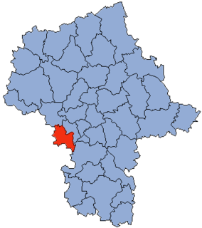
Kobylnica-Kolonia is a village in the administrative district of Gmina Maciejowice, within Garwolin County, Masovian Voivodeship, in east-central Poland.
Krzymów is a village in the administrative district of Gmina Szczawin Kościelny, within Gostynin County, Masovian Voivodeship, in east-central Poland.
Michrów-Stefów is a village in the administrative district of Gmina Pniewy, within Grójec County, Masovian Voivodeship, in east-central Poland.
Karczówka is a village in the administrative district of Gmina Zwoleń, within Zwoleń County, Masovian Voivodeship, in east-central Poland. It lies approximately 3 kilometres (2 mi) north of Zwoleń and 101 km (63 mi) south-east of Warsaw.
Płaczkowo is a village in the administrative district of Gmina Trzemeszno, within Gniezno County, Greater Poland Voivodeship, in west-central Poland.
Kościuszków is a village in the administrative district of Gmina Nowe Skalmierzyce, within Ostrów Wielkopolski County, Greater Poland Voivodeship, in west-central Poland. It lies approximately 5 kilometres (3 mi) west of Skalmierzyce, 19 km (12 mi) north-east of Ostrów Wielkopolski, and 103 km (64 mi) south-east of the regional capital Poznań.
Sikorzyn is a village in the administrative district of Gmina Rawicz, within Rawicz County, Greater Poland Voivodeship, in west-central Poland. It lies approximately 6 kilometres (4 mi) east of Rawicz and 89 km (55 mi) south of the regional capital Poznań.
Pieczyn is a village in the administrative district of Gmina Złotów, within Złotów County, Greater Poland Voivodeship, in west-central Poland. It lies approximately 8 km (5 mi) west of Złotów and 109 km (68 mi) north of the regional capital Poznań.
Żenichów is a village in the administrative district of Gmina Gubin, within Krosno Odrzańskie County, Lubusz Voivodeship, in western Poland, close to the German border.
Nowy Folwark is a settlement in the administrative district of Gmina Ostróda, within Ostróda County, Warmian-Masurian Voivodeship, in northern Poland.

Bohutín is a village and municipality in Příbram District in the Central Bohemian Region of the Czech Republic.